Lima in Allen County, Ohio — The American Midwest (Great Lakes)
Rotary Riverwalk & Ottawa River Bikeway
Photographed by Craig Doda, March 30, 2024
1. Rotary Riverwalk & Ottawa River Bikeway Marker
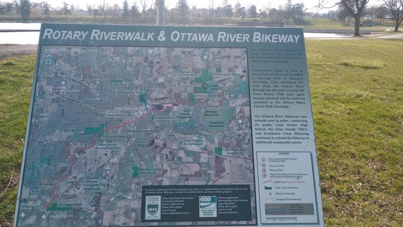
The Rotary Riverwalk/Ottawa River Bikeway has grown to become a vital link in the Lima-Allen County community.
Construction began in 1992 at Faurot Park in Lima and extended to Heritage Park in Shawnee Township. Lima continued the trail along the Ottawa River through the City and, in 2003, the Lima Rotary Club once again became involved and the trail was extended to the Ottawa Metro Park in Bath Township.
The Ottawa River Bikeway now extends over 13 miles, connecting six parks, Lima Senior High School, the Lima Family YMCA, and downtown Lima. Planning continues to extend the bikeway to additional community assets.
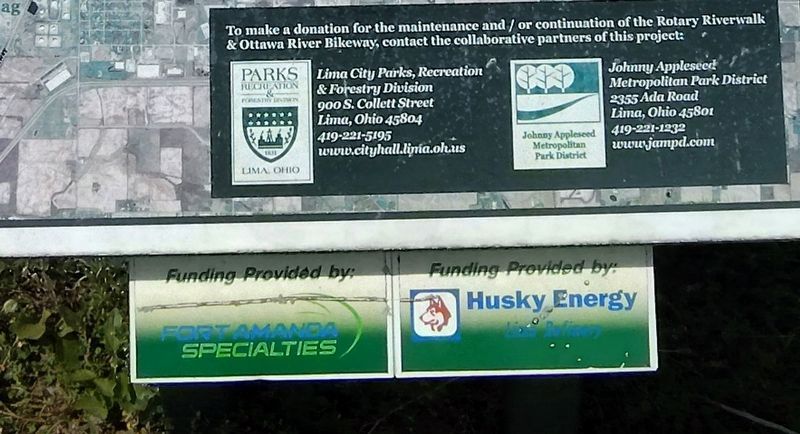
Erected by Lima City Parks, Recreation & Forestry Division - Johnny Appleseed Metropolitan Park District.
Topics. This historical marker is listed in these topic lists: Charity & Public Work • Parks & Recreational Areas • Roads & Vehicles • Waterways & Vessels. A significant historical year for this entry is 1992.
Location. 40° 45.049′ N, 84° 5.691′ W. Marker is in Lima, Ohio, in Allen County. It can be reached from Findlay Road (Ohio Route 81) 0.1 miles south of North McCullough Street,
this page online

Regionally, this marker is in Ohio’s Till Plains. It is also in the American Midwest and in the Corn Belt. Globally, it is in North America, the Western Hemisphere, the Western World, and the Anglosphere. Historically, it finds itself in what was once the Haudenosaunee (Iroquois) Confederacy, the territory of the Mississippian Culture, and the Northwest Territory.
Other nearby markers. At least 8 other markers are within walking distance of this marker: Faurot Oil Well (approx. 0.6 miles away); Servicemen's Free Canteen (approx. 0.6 miles away); First Oil Well (approx. 0.6 miles away); a different marker also named Servicemen's Free Canteen (approx. 0.6 miles away); Adam Welty Park (approx. 0.6 miles away); Site of Lima's First Cemetery (approx. 0.7 miles away); Site of Lima's First Cemetery and burial place of Pvt. Elijah Stites 1758-1843 (approx. 0.7 miles away); James Daniel's Cabin (approx. ¾ mile away). Touch for a list and map of all markers
Photographed by Craig Doda, March 30, 2024
2. Rotary Riverwalk & Ottawa River Bikeway Marker
Photographed by Craig Doda, March 30, 2024
3. Rotary Riverwalk & Ottawa River Bikeway Marker
Photographed by Craig Doda, July 18, 2026
4. Rotary Riverwalk & Ottawa River Bikeway Marker
Credits. This page was last revised on July 30, 2026. It was originally submitted on April 9, 2024, by Craig Doda of Napoleon, Ohio. This page has been viewed 466 times since then and 48 times this year. Photos: 1, 2, 3. submitted on April 9, 2024, by Craig Doda of Napoleon, Ohio. 4. submitted on July 22, 2026, by Craig Doda of Napoleon, Ohio. • Devry Becker Jones was the editor who published this page.
