Findlay in Hancock County, Ohio — The American Midwest (Great Lakes)
The Great Black Swamp

Photographed by Craig Doda, April 20, 2024
1. The Great Black Swamp Marker
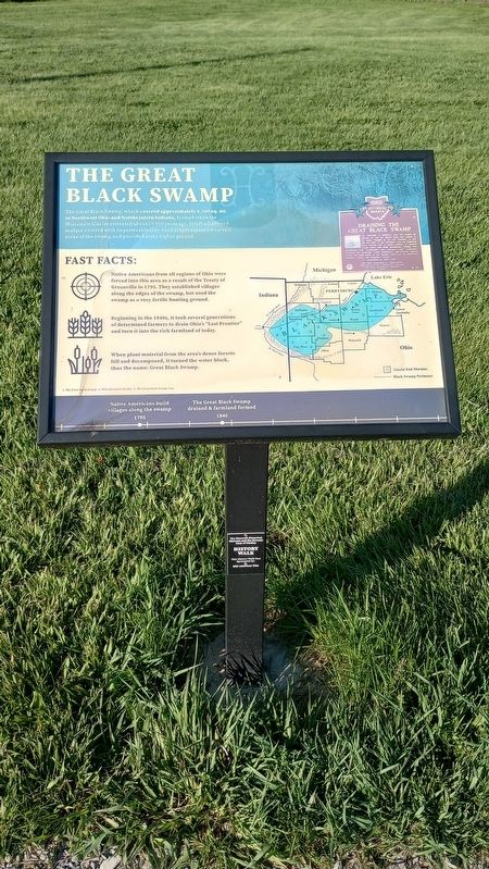
The Great Black Swamp, which covered approximately 1,500 sq. mi. in Northwest Ohio and Northeastern Indiana, formed when the Wisconsin Glacier retreated about 20,000 years ago. It left a flattened surface covered with impermeable clay. Sand ridges separated certain areas of the swamp and provided some higher ground.
Fast Facts:
Native Americans from all regions of Ohio were forced into this area as a result of the Treaty of Greenville in 1795. They established villages along the edges of the swamp, but used the swamp as a very fertile hunting ground.
Beginning in the 1840s, it took several generations of determined farmers to drain Ohio's "Last Frontier" and turn it into the rich farmland of today.
When plant material from the area's dense forests fell and decomposed, it turned the water black, thus the name: Great Black Swamp.
[Captions:]
1. The Great Black Swamp.2. Ohio Historical Marker. 3. The Great Black Swamp map.
Native Americans build villages along the swamp 1795
The Great Black Swamp drained & farmland formed 1840
Erected by Hancock Historical Museum.
Topics. This historical marker
this page online
Location. 41° 2.25′ N, 83° 35.613′ W. Marker is in Findlay, Ohio, in Hancock County. It is on County Route 236 0.2 miles north of Carey Road (Route 568), on the left when traveling north. Touch for map. Marker is at or near this postal address: 8884 Co Rd 236, Findlay OH 45840, United States of America. Touch for directions.

Regionally, this marker is in the Till Plains. It is also in the American Midwest and in the Corn Belt. Globally, it is in North America, the Western Hemisphere, the Western World, and the Anglosphere. Historically, it finds itself in what was once the Haudenosaunee (Iroquois) Confederacy, the territory of the Mississippian Culture, and the Northwest Territory.
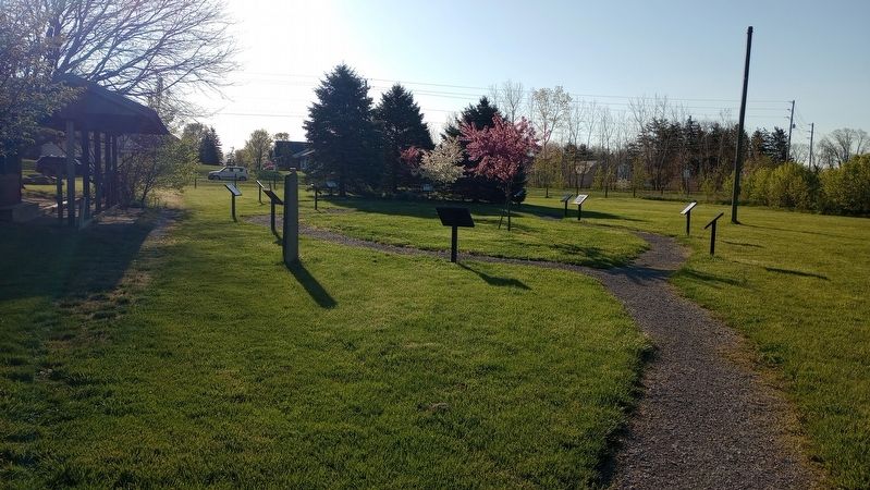
Other nearby markers. At least 8 other markers are within walking distance of this marker: The Swingin' Sixties (here, next to this marker); The Mighty Blanchard (here, next to this marker); Hancock County Joins World War II (a few steps from
Photographed by Craig Doda, April 20, 2024
2. The Great Black Swamp Marker

Photographed by Craig Doda, April 20, 2024
3. Draining The Great Black Swamp
The landscape of northwest Ohio was formed by melting ice and glacial lakes left behind in its wake. Because of the low gradient (3 feet fall per mile) to the northeast, the flat lacustrine plain evolved into a large swamp. A massive swamp forest with huge hardwoods, broken only sporadically with intermittent wet prairies and savannas, dominated the landscape. Both prehistoric and historic Indians farmed the flood plains of the Maumee River and its tributaries: Auglaize, Tiffin, and Blanchard rivers.
Photographed by Craig Doda, April 20, 2024
4. The Great Black Swamp Marker
Photographed by Craig Doda, April 20, 2024
5. The Great Black Swamp Marker
Credits. This page was last revised on April 24, 2024. It was originally submitted on April 24, 2024, by Craig Doda of Napoleon, Ohio. This page has been viewed 756 times since then and 155 times this year. Photos: 1, 2, 3, 4, 5. submitted on April 24, 2024, by Craig Doda of Napoleon, Ohio. • Devry Becker Jones was the editor who published this page.
