Near Fort Pierre in Stanley County, South Dakota — The American Midwest (Upper Plains)
Archeology in Oahe Downstream
May 3, 2024
1. Archeology in Oahe Downstream Marker
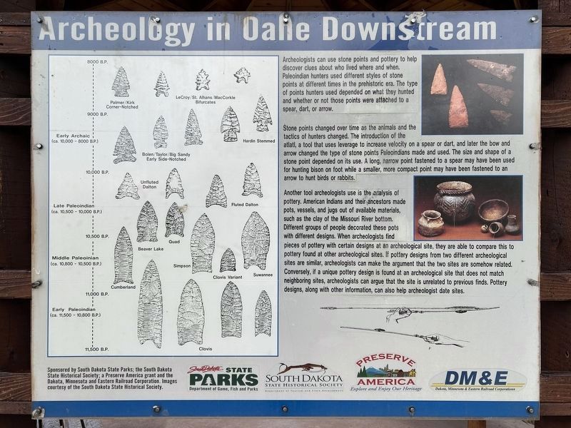
Archeologists can use stone points and pottery to help discover clues about who lived where and when Paleoindian hunters used different styles of stone points at different times in the prehistoric era. The type of points hunters used depended on what they hunted and whether or not those points were attached to a spear, dart, or arrow.
Stone points changed over time as the animals and the tactics of hunters changed. The introduction of the atlatl, a tool that uses leverage to increase velocity on a spear or dart, and later the bow and arrow changed the type of stone points Paleoindians made and used. The size and shape of a stone point depended on its use. A long, narrow point fastened to a spear may have been used for hunting bison on foot while a smaller, more compact point may have been fastened to an arrow to hunt birds or rabbits.
Another tool archeologists use is the analysis of pottery. American Indians and their ancestors made pots, vessels, and jugs out of available materials, such as the clay of the Missouri River bottom. Different groups of people decorated these pots with different designs. When archeologists
this page online
Early Archaic (ca. 10,000 - 8000 B.P.)
9000 B.P. - 8000 B.P.:
Palmer/Kirk Corner-Notched · LeCroy/St. Alhans/MacCorkle Bifurcates
10,000 B.P. - 9000 B.P.:
Bolen/Taylor/Big Sandy Early Side-Notched · Hardin Stemmed
Late Paleoindian (ca. 10,500 - 10,000 B.P.)
10,500 B.P. - 10,000 B.P.:
Unfluted Dalton · Fluted Dalton
Middle Paleoinian (ca. 10,800 - 10,500 B.P.)
11,000 B.P. - 10,500 B.P.:
Cumberland · Beaver Lake · Quad · Simpson · Clovis Variant · Suwannee
Early Paleoindian (ca. 11,500 - 10,800 B.P.)
11,500 B.P. - 11,000 B.P.:
Clovis
Erected by South
May 3, 2024
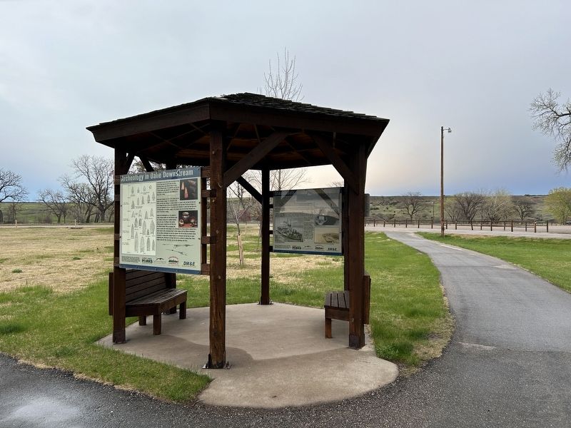
2. Archeology in Oahe Downstream Marker (left), from the west
Topics. This historical marker is listed in these topic lists: Anthropology & Archaeology • Indigenous Peoples and Communities • Waterways & Vessels.
Location. 44° 26.398′ N, 100° 23.568′ W. Marker is near Fort Pierre, South Dakota, in Stanley County. It can be reached from Marina Loop Road half a mile east of Power House Road, on the right when traveling west. Located in Oahe Downstream Recreation Area (fee area). Touch for map. Marker is at or near this postal address: 20439 Marina Loop Rd, Fort Pierre SD 57532, United States of America. Touch for directions.

Regionally, this marker is in the Crow Creek Sioux Tribe and in East River. It is also in the American Lewis & Clark Corridor, on the prairies, and on the Northern Plains. Globally, it is in North America, the Western Hemisphere, the Western World, and the Anglosphere. Historically, it finds itself in what was once Rupert’s Land and also the Louisiana Purchase.
Other nearby markers. At least 8 other markers are within walking distance of this marker: The Arikara / The Sioux (here, next to this marker); Steamboats (here, next to this marker); Honored Guests / Momentarily Adrift (approx. 0.8 miles away); Stilling Basin (approx. 0.9 miles away); The Lewis & Clark Expedition (approx. 0.9 miles away); A Tense Three Days (approx. 0.9 miles away); The Lewis and Clark Expedition (approx. 0.9 miles away); A Changing Landscape (approx. 0.9 miles away). Touch for a list and map of all markers in Fort Pierre.
Credits. This page was last revised on June 19, 2024. It was originally submitted on May 8, 2024. This page has been viewed 185 times since then and 19 times this year. Photos: 1, 2. submitted on May 8, 2024.
