Near Manassas in Prince William County, Virginia — The American South (Mid-Atlantic)
Peace Jubilee
Friendship and Reconciliation
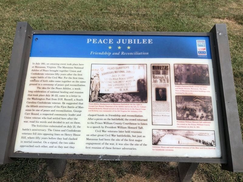
In July 1911, an amazing event took place here at Manassas, Virginia. The Manassas National Jubilee of Peace brought together Union and Confederate veterans fifty years after the first major battle of the Civil War. For the first time, veterans of both sides came together on the same ground in a ceremony of peace and reconciliation.
The idea for the Peace Jubilee, a week-long celebration of national healing and reunion that took place July 16-22, came in a letter to the Washington Post from D. H. Russell, a South Carolina Confederate veteran. He suggested that the fiftieth anniversary of the First Battle of Manassas be one of peace and reconciliation. George Carr Round, a respected community leader and Union veteran who had settled here after the war, read his words and decided to act on them.
The festivities culminated on July 21, the battle’s anniversary. The Union and Confederate veterans fell into opposing lines on Henry House Hill, where fifty years before they had clashed in mortal combat. On a signal, the two sides approached each other, and as they met they clasped hands in friendship and reconciliation.
this page online
Civil War veterans later held reunions on other great Civil War battlefields, but just as Manassas had been the site of the first major engagement of the war, it was also the site of the first reunion of these former adversaries.
[Captions:]
Peace Jubilee Headquarters at Manassas Battlefield. On the right is George Carr Round, Chairman of the Jubilee and on the left, Lt. Colonel Edmund Berkeley. Round served in the Union forces in the Signal Corps and Berkeley was commander of the 8th Virginia Vol. Infantry, CSA.
(banner) Head Quarters, Manassas National Jubilee, July 21, 1911. “Let Us Have Peace” –Grant. “Duty–the sublimest word in any language” –Lee. Ewell Camp, C.V. Manassas Picket Post, G.A.R.People’s National Bank, corner of Center and Battle Streets, Manassas. The then Town of Manassas decorated buildings with bunting for the event.
President William Howard Taft addresses the crowd at the Prince William County Courthouse on July 21, 1911.
Governor Mann and staff between veterans of the Blue and Grey lined up for handshake ceremony.
Erected by Virginia
Topics and series. This historical marker is listed in these topic lists: Notable Events • Peace • War, US Civil. In addition, it is included in the Former U.S. Presidents: #27 William Howard Taft, and the Virginia Civil War Trails series lists. A significant historical month for this entry is July 1911.
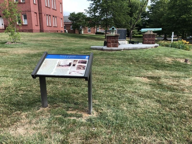
Location. This marker has been replaced by another marker nearby. It was located near 38° 45.131′ N, 77° 28.542′ W. Marker was near Manassas, Virginia, in Prince William County. It was at the intersection of Lee Avenue and Grant Avenue (Business Virginia Route 234), on the right when traveling west on Lee Avenue. Touch for map. Marker was in this post office area: Manassas VA 20110, United States of America. Touch for directions.

Regionally, this marker was in the Washington Metropolitan Area, in Northern Virginia, and in the Piedmont. It was also in the American South, specifically in the Upper South, in the Mid-Atlantic, and on the Eastern Seaboard. Globally, it was in the North Atlantic Region, North America, the Western Hemisphere, the Western World, and the Anglosphere. Historically, it found itself in what was once the territory of the Mississippian Culture, one of the original Thirteen Colonies, one of the Confederate States of America, and the Antebellum South.
Other nearby markers. At least 8 other markers are within walking distance of this location: A different marker also named Answering the Call to Service (here, next to this marker); a different marker also named Peace Jubilee (here, next to this marker); In Commemoration of the Manassas National Jubilee of Peace (a few steps from this marker); Fifth Prince William County Courthouse (within shouting distance of this marker); Prince William County World War I Memorial (within shouting distance of this marker); First Baptist Church (about 600 feet away, measured in a direct line); African American Entrepreneurs (about 700 feet away); Old Bennett School (about 700 feet away). Touch for a list and map of all markers in Manassas.
Another marker is no longer nearby. Answering the Call to Service (was here, next to this marker but has been replaced with another marker now near it).
Related markers. Click here for a list of markers that are related to this marker. To better understand the relationship, study each marker in the order shown.
Also see . . .
1. National Jubilee of Peace Monument. (Submitted on December 22, 2006, by Roger Dean Meyer of Yankton, South Dakota.)
2. Newspaper article from 1915 about the unveiling of the Peace Jubilee Marker. The Evening Star article from October 1, 1915 discusses the September 30, 1915 unveiling of the National Peace Jubilee marker in pictures 3 & 4. (Submitted on October 1, 2015.)
Additional commentary.
1. Location of the Marker
The marker lies in an exclave of Prince William County with county government offices that are completely surrounded by the City of Manassas.
— Submitted July 5, 2020, by Devry Becker Jones of Washington, District of Columbia.
Credits. This page was last revised on July 12, 2026. It was originally submitted on December 22, 2006, by Roger Dean Meyer of Yankton, South Dakota. This page has been viewed 4,754 times since then and 68 times this year. Last updated on September 12, 2007, by Craig Swain of Leesburg, Virginia. Photos: 1, 2. submitted on July 5, 2020, by Devry Becker Jones of Washington, District of Columbia. • J. J. Prats was the editor who published this page.
