Uptown Central in San Antonio in Bexar County, Texas — The American South (West South Central)
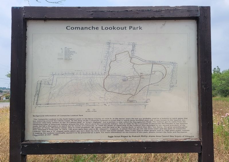
Comanche Lookout Park
Photographed by James Hulse, May 22, 2024
1. Comanche Lookout Park Marker
Background Information of Comanche Lookout Park
The Comanche Lookout is the forth highest point in the Bexar County of 1034 ft. In the earlier years the hill was probably used as a lookout to catch game that was watering around the Cibolo Creek. At the base of the Comanche Lookout is a trail that is nearly three hundred years old. It was known to the Spanish missionaries and early settlers as the "El Camino Real" or "King's Highway", but a portion is now called the Nacogdoches Road. The lookout got its name from the inhabiting tribe of American Indians around the hills, which were the Comanche Indians. Due to raids by the Comanche to passersby the Presidio in San Antonio made the hill a Divisadero to watch out for bands of Comanche. In 1848 the deeds of ownership of the Lookout then belonged to our second president of the Republic of Texas, Mirabeau Lamar. Due to some problems, Mr. Lamar sold the land to Mr. Gustav Rech, in which then Mrs. Van Autry, his great granddaughter then inherited it from him. In 1923, 100 acres were then sold to Mr. Edward C. Coppock, in which then we get the old stone tower and two walls at
this page online
Eagle Scout Project by Prakash Phillip-Alamo Area Council Boy Scouts of America
Erected by City of San Antonio Parks Department.
Topics. This historical marker is listed in these topic lists: Indigenous Peoples and Communities • Parks & Recreational Areas • Roads & Vehicles.
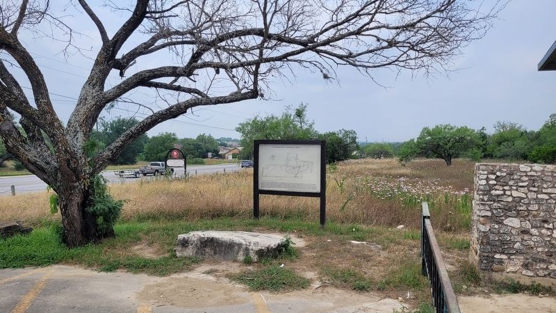
Location. 29° 34.96′ N, 98° 22.011′ W. Marker is in San Antonio, Texas, in Bexar County. It is in Uptown Central. It is on Nacogdoches Road (Farm to Market Road 2252) west of Toepperwein ROad, on the right when traveling west. The marker is located at the entrance to Comanche Lookout Park. Touch for map. Marker is at or near this postal address: 15551 Nacogdoches Rd, San Antonio TX 78247, United States of America. Touch for directions.

Regionally,
Photographed by James Hulse, May 22, 2024
2. The view of the Comanche Lookout Park Marker at the front of the park
Other nearby markers. At least 8 other markers are within 4 miles of this marker, measured as the crow flies: Comanche Lookout (here, next to this marker); Kings Highway Camino Real — Old San Antonio Road (approx. 2 miles away); Wetmore Community Cemetery (approx. 2.1 miles away); Georg Heinrich Buchsenschutz Family Cemetery (approx. 2.4 miles away); a different marker also named Kings Highway Camino Real — Old San Antonio Road (approx. 2.8 miles away); Davenport Cemetery (approx. 2.8 miles away); Historic Evans Road Trail (approx. 3.6 miles away); Harrison and McCulloch Stage Stop (approx. 3.7 miles away). Touch for a list and map of all markers in San Antonio.
Also see . . . Comanche Lookout Park. City of San Antonio
Comanche Lookout Park is a 96-acre public park owned by the City of San Antonio.(Submitted on May 28, 2024, by James Hulse of Medina, Texas.)The site includes the fourth highest point in Bexar County with an elevation of 1,340 feet. The Cibolo floodplain lies at the base of this escarpment between the Gulf Coastal Plain and the Edwards Plateau. Vegetation on the hill includes native ash juniper, Texas and Mexican buckeye, chinaberry, graneno, Lindheimer hackberry, honey mesquite and huisache.Photographed by James Hulse, May 22, 20243. The entrance to the Comanche Lookout Park

Credits. This page was last revised on May 28, 2024. It was originally submitted on May 27, 2024, by James Hulse of Medina, Texas. This page has been viewed 466 times since then and 55 times this year. Photos: 1, 2, 3. submitted on May 28, 2024, by James Hulse of Medina, Texas.
