Ogdensburg in St. Lawrence County, New York — The American Northeast (Mid-Atlantic)
Restoration of The St Lawrence Heritage Shoreline
Photographed by William Fischer, Jr., June 17, 2024
1. Restoration of The St Lawrence Heritage Shoreline Marker
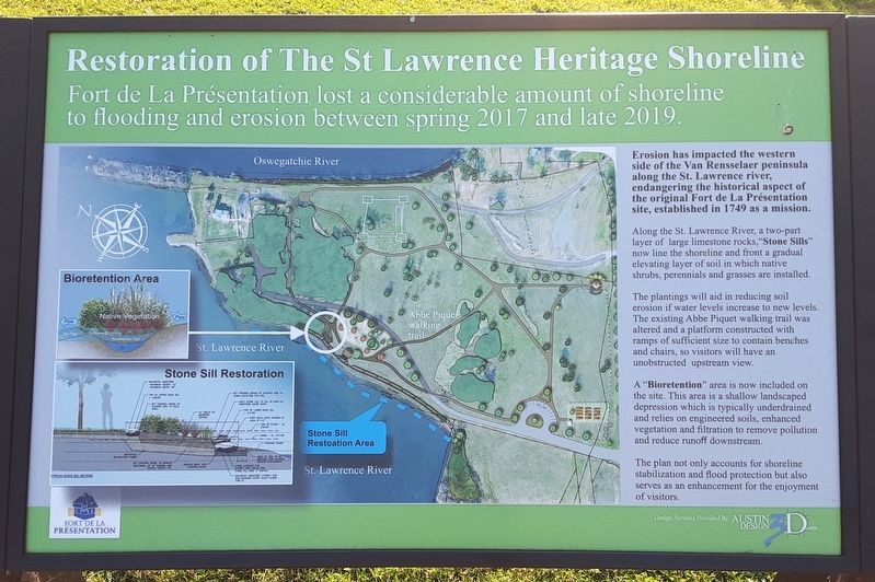
Fort de La Présentation lost a considerable amount of shoreline to flooding and erosion between spring 2017 and late 2019.
Erosion has impacted the western side of the Van Rensselaer peninsula along the St. Lawrence river, endangering the historical aspect of the original Fort de La Présentation site, established in 1749 as a mission.
Along the St. Lawrence River, a two-part layer of large limestone rocks, "Stone Sills" now line the shoreline and front a gradual elevating layer of soil in which native shrubs, perennials and grasses are installed.
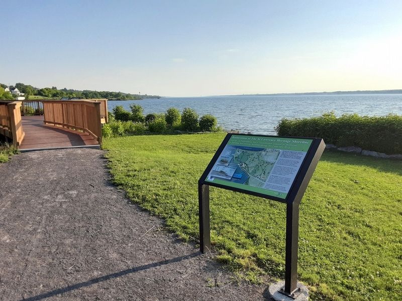
The plantings will aid in reducing soil erosion if water levels increase to new levels. The existing Abbe Piquet walking trail was altered and a platform constructed with ramps of sufficient size to contain benches and chairs, so visitors will have an unobstructed upstream view.
A "Bioretention" area is now included on the site. This area is a shallow landscaped depression which is typically underdrained and relies on engineered soils, enhanced vegetation and filtration to remove pollution and reduce runoff downstream.
The plan not only accounts for shoreline stabilization
this page online
Erected by Fort de la Présentation.
Topics. This historical marker is listed in these topic lists: Charity & Public Work • Environment • Parks & Recreational Areas • Waterways & Vessels. A significant historical year for this entry is 2017.
Location. 44° 41.773′ N, 75° 30.233′ W. Marker is in Ogdensburg, New York, in St. Lawrence County. It can be reached from Albany Avenue. Marker is along the Abbe Picquet Walking Trail at Fort de La Présentation, parking accessed along Albany Avenue north of New York Route 68. Touch for map. Marker is in this post office area: Ogdensburg NY 13669, United States of America. Touch for directions.

Regionally, this marker is in Upstate New York and in the Adirondacks & North Country. It is also in the American Northeast and in the Mid-Atlantic. Globally, it is in North America, the Western Hemisphere, the Western World, and the Anglosphere. Historically, it finds itself in what was once the Viceroyalty of New France, the Haudenosaunee (Iroquois) Confederacy, New Netherland, and one of
Photographed by William Fischer, Jr., June 17, 2024
2. Restoration of The St Lawrence Heritage Shoreline Marker
Other nearby markers. At least 8 other markers are within walking distance of this marker: America’s Fourth Coast (a few steps from this marker); An Armored Giant From Before the Dinosaurs (a few steps from this marker); Masonic Military Veterans (about 500 feet away, measured in a direct line); Railroads Come To The North Country (about 500 feet away); An Outdoor Geology Museum (about 600 feet away); Restoration of The Oswegatchie Heritage Shoreline (about 700 feet away); Abbe Picquet 1708-1781 (about 800 feet away); 300 Years of Artifacts, Refuse and Pollution (about 800 feet away). Touch for a list and map of all markers in Ogdensburg.
Related marker. Click here for another marker that is related to this marker.
Credits. This page was last revised on June 22, 2024. It was originally submitted on June 20, 2024, by William Fischer, Jr. of Reynoldsburg, Ohio. This page has been viewed 128 times since then and 13 times this year. Photos: 1, 2. submitted on June 20, 2024, by William Fischer, Jr. of Reynoldsburg, Ohio.
