Valkenburg in Valkenburg aan de Geul, Limburg, Netherlands — Northwestern Europe
De Via Belgica
Photographed by Andrew Ruppenstein, May 27, 2024
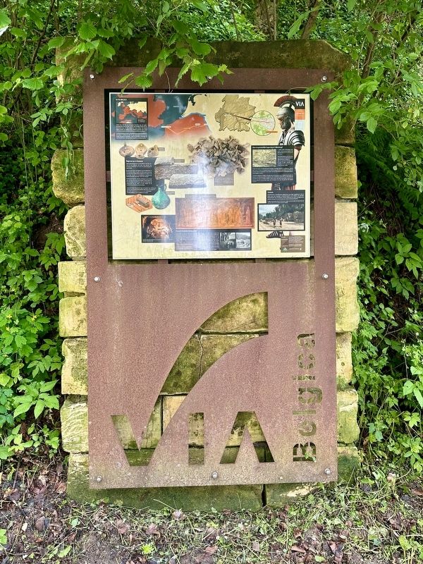
1. De Via Belgica Marker

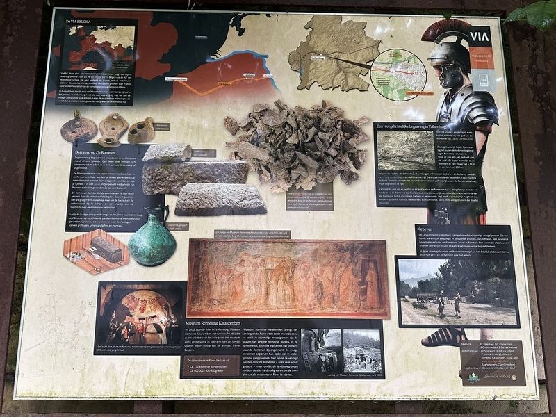
Vlakbij deze plek liep een belangrijke Romeinse weg, die tegenwoordig bekend staat als de Via Belgica. De Via Belgica was de 'A2' van Noordwest-Europa. De weg verbond de Franse zeekust met Keulen (Colonia Claudia Ara Agrippinensium), destijds de grootste stad in deze contreien én hoofdstad van de Romeinse provincie Germania Inferior.
In Zuid-Limburg lep de weg van Maastricht in het westen tot Landgraaf in het oosten. In Valkenburg heeft de weg waarschijnlijk niet ver van de huidige doorgaande weg gelegen. Langs de weg hebben archeologen op verschillende plekken resten gevonden van graven uit de Romeinse tijd.
Begraven op z'n Romeins
Tegenwoordig begraven we onze doden in een kist, een mand of een lijkwade. Ook laten veel mensen zich cremeren, waarna hun as in een urn wordt bewaard of uitgestrooid.
De Romeinse manier van begraven was veel beperkter: in de Romeinse cultuur werden de doden gecremeerd. De crematieresten werden daarna bijgezet in een kuil of-als je rijk was-in een askist. In Simpelveld en Bocholtz zijn Romeinse askisten gevonden. Ze zijn zeer bekend.
De Romeinen
this page online
Langs de huidige doorgaande weg van Houthem naar Valkenburg a/d Geul zijn op verschillende plekken Romeinse crematiegraven gevonden. Op de kaart bovenin zie je waar. Archeologen vonden grafkuilen, urnen, grafgiften en muntjes.
Museum Romeinse Katakomben
In 1910 opende hier in Valkenburg Museum Romeinse Katakomben, een toeristische attractie avant-la-lettre voor het hele gezin. Het museum werd gerealiseerd in opdracht van de familie Diepen, onder leiding van de architect Pierre Cuypers.
Museum Romeinse Katakomben brengt het ondergrondse Rome uit de derde en vierde eeuw in beeld. In voormalige mergelgroeven zijn de graven van gewone Romeinse burgers en de schitterende, kleurrijke grafkamers van vooraanstaande Romeinen bijeengebracht. De vroege christenen begroeven hun doden ook in ondergrondse gangenstelsels. Niet omdat ze vervolgd werden door de Romeinen zoals vaak wordt gedacht
Photographed by Andrew Ruppenstein, May 27, 2024
2. De Via Belgica Marker
De catacomben in Rome bestaan uit:
• Ca. 175 kilometer gangenstelsel
•Ca. 600.000 800.000 graven
Een vroegchristelijke begraving in Valkenburg?
In 1938 vonden archeologen even buiten Valkenburg een graf uit de Romeinse tijd. Op de klart bovenin zieje waar.
Zoals gebruikelijk bij de Romeinen lag het buiten de nederzetting éner lagen Romeinse vondsten in. Maar er was iets aan de hand met dit graf. Er lagen namelijk twee skeletten in: een vrouw van 1,70 m en een kind van 1,30m.
Volgens de vinders - de bekende Zuid-Limburgse archeologen Beckers sr en Beckers - was dit een vroeg-christelijk graf uit de Romeinse tijd. De vroege christenen geloofden in een leven na de dood. Daarom cremeerden ze hun doden niet zoals gebruikelijk was in de Romeinse cultuur, maar begroeven ze hen.
Vandaag de dag zijn er twijfels of dit graf wel uit de Romeinse bijd is. Mogelijk zijn moeder en kind pas na de Romeinse tyd hier begraven. Het is namelijk niet zeker dat er aan het einde van de Romeinse tijd al christenen leefden
Photographed by Andrew Ruppenstein, May 27, 2024
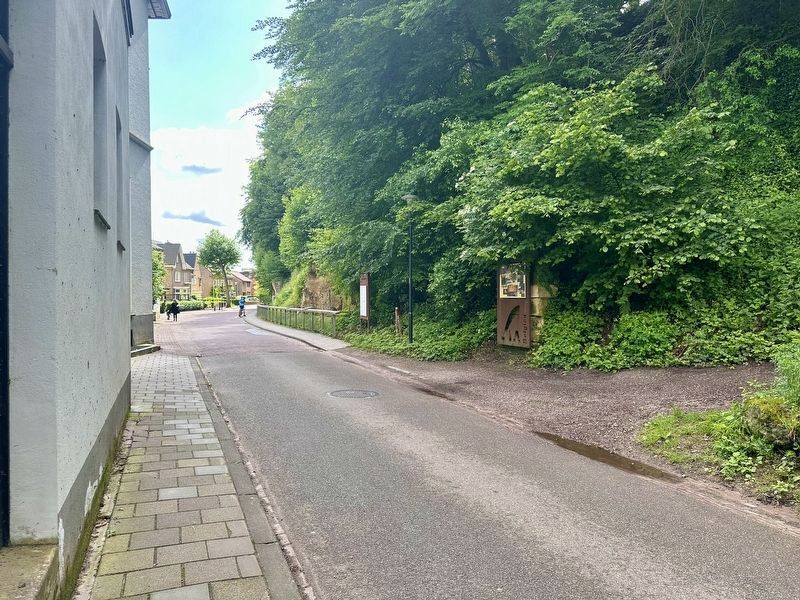
3. De Via Belgica Marker - wide view
Groeven
De Katakomben in Valkenburg zijn nagebouwd in voormalige mergelgroeven. Die van Rome waren ook aangelegd in bestaande groeven: van tufsteen, een belangrijk bouwmateriaal voor de Romeinen. Zowel in Rome als hier waren de uitgehouwen groeven zeer geschikt voor de aanleg van onderaardse begraafplaatsen.
In deze streek gebruikten de Romeinen mergel uit het Geuldal als bouwmateriaal voor hun villa's en als meststof voor hun akkers.
The Via Belgica
An important Roman road ran close to this spot, today known as the Via Belgica. The Via Belgica was the 'A2' of Northwestern Europe. The road connected the French seacoast with Cologne (Colonia Claudia Ara Agrippinensium), at the time the largest city in these parts and capital of the Roman province of Germania Inferior.
In South Limburg, the road runs from Maastricht in the west to Landgraaf in the east. In Valkenburg the road was probably not far from the current main road. Along the road, archaeologists have found remains of graves from Roman times in various places.
Buried in the Roman style
Nowadays we bury our dead in a coffin, a basket or a shroud. Many people are also cremated, after which their ashes are kept in an urn or scattered.
The Roman way of burial was much more limited: in Roman culture the dead were cremated. The cremated remains were then buried in a pit or - if you were rich - in an ash coffin. In Simpelveld and Bocholtz Roman ash chests have been found. They are very well known.
The Romans believed that the deceased traveled through the underworld after their death. That is why they gave them as grave gifts an oil lamp to illuminate the journey through the underworld and a coin to pay for the passage across the river of the dead.
Roman cremation graves have been found in various places along the current main road from Houthem to Valkenburg a/d Geul. You can see where on the map above. Archaeologists found burial pits, urns, grave goods and coins.
Roman Catacombs Museum
In 1910, the Roman Catacombs Museum opened here in Valkenburg, a tourist attraction avant-la-lettre for the whole family. The museum was commissioned by the Diepen family, led by the architect Pierre Cuypers.
The Roman Catacombs Museum portrays underground Rome from the third and fourth centuries. The graves of ordinary Roman citizens and the beautiful, colorful burial chambers of prominent Romans have been brought together in former marl quarries. The early Christians also buried their dead in underground tunnel systems. Not because they were persecuted by the Romans as is often thought, but because the agricultural lands around the city were desperately needed to feed the mouths of all the inhabitants of Rome.
The catacombs in Rome consist of:
• A system of approx. 175 kilometers of tunnels
• Approx. 600,000 - 800,000 graves
An early Christian burial in Valkenburg?
In 1938, archaeologists found a grave from Roman times just outside Valkenburg. On the clear top you can see where.
As was customary with the Romans, it was located outside the settlement and contained Roman finds. But there was something about this grave. There were two skeletons inside: a woman of 1.70 m and a child of 1.30 m.
According to the finders - the well-known South Limburg archaeologists Beckers Sr. and son - this was an early Christian grave from Roman times. The early Christians believed in life after death. Therefore, they did not cremate their dead as was customary in Roman culture, but buried them.
Today there are doubts as to whether this tomb is from the Roman grave. The mother and child may have been buried here only after Roman times. It is not certain that Christians were already living in this region at the end of Roman times. It probably took many centuries before this region truly became Christian, with all the customs that went with it.
Quarries
The Catacombs in Valkenburg have been recreated in former marl quarries. Those in Rome were also constructed in existing quarries: made of tuff, an important building material for the Romans. Both in Rome and here, the dug out quarries were very suitable for the construction of underground cemeteries.
In this region the Romans used marl from the Geul valley as building material for their villas and as fertilizer for their fields.
Erected by Provincie Limburg, Gemeente Valkenburg aan de Geul. (Marker Number 268.)
Topics. This historical marker is listed in these topic lists: Anthropology & Archaeology • Cemeteries & Burial Sites • Roads & Vehicles. A significant historical year for this entry is 1910.
Location. 50° 51.935′ N, 5° 49.358′ E. Marker is in Valkenburg, Limburg, in Valkenburg aan de Geul. It is on Plenkertstraat, on the right when traveling east. Touch for map. Marker is in this post office area: Valkenburg, Limburg 6301 GN, Netherlands. Touch for directions.

Regionally, it is in Europe, the European Union, Atlantic Europe, the Benelux Low Countries, the Schengen Area, Western Europe, and the Western World. Historically, it finds itself in what was once the Roman Empire and specifically also the Holy Roman Empire.
Other nearby markers. At least 8 other markers are within walking distance of this marker: Werktuigen van Vuursteen / Flint Tools (a few steps from this marker); Haksporen / Tool Marks (a few steps from this marker); Vuurstijn-Mijnwerkers / Flint Miners (within shouting distance of this marker); Philips Fabriek / Philips Factory (within shouting distance of this marker); Kruitmolen/ Gunpowder Mill (within shouting distance of this marker); De Vondst Van De Vuursteenmijnen / The Discovery of the Flint Mines (within shouting distance of this marker); Romeinse Katakomben / Roman Catacombs (within shouting distance of this marker); Valkenburg en de NSB / Valkenburg and the NSB (about 240 meters away, measured in a direct line). Touch for a list and map of all markers in Valkenburg.
Also see . . . Via Belgica Romeinen, Rust, Ruimte (Via Belgica, in Dutch). This is the homepage of the website given on the marker, explaining the attractions on the Via Belgica for those contemplating a visit.
Overview (in translation): Via Belgica is the name given in the twentieth century to a 400 kilometer long ancient Roman highway. The road ran from Boulogne-sur-Mer via Arras, Bavay, Tongeren, Maastricht and Heerlen to Jülich and Cologne. Via Belgica was an important part of a large and complex network of (water)ways that stretched to the furthest reaches of the Roman empire. The Romans built guard posts at the junctions or created small villages that grew into larger settlements. Several villas, villages, towns and burial mounds are spread across the landscape. To introduce you to the many Roman stories along the Via Belgica, but also deep into the beautiful hilly landscape, we developed numerous routes packed with stories, 3D visualizations, audio fragments and much more.(Submitted on June 22, 2024.)
Credits. This page was last revised on June 22, 2024. It was originally submitted on June 22, 2024, by Andrew Ruppenstein of Lamorinda, California. This page has been viewed 178 times since then and 20 times this year. Photos: 1, 2, 3. submitted on June 22, 2024, by Andrew Ruppenstein of Lamorinda, California.
