Near Tucson in Pima County, Arizona — The American Mountains (Southwest)
Historic Period

Photographed by James Hulse, June 17, 2024
1. Historic Period Marker
Padre Eusebio Kino and his fellow missionaries first visited the Tucson Basin in 1692. Over the following centuries, Indian people were heavily affected by Spanish, Mexican, and American settlers.
The Spanish Period (1692-1821)
From 1692 to 1821 the Spanish established more than two dozen missions and presidios (military outposts) in southern Arizona and northern Sonora, Mexico. These Spaniards introduced new forms of religion, dress, speech, mining, domestic animals, agricultural crops, tools, and diseases.
The Mexican Period (1821-1853)
Mexican independence in 1821 brought more change. More Mexican farmers, ranchers, and miners moved into southern Arizona taking some of the best land for farms and ranches.
The American Period (1853-present)
The United States gained this territory through the Gadsden Purchase of 1853. The American Indian people now lived under a third flag in as many centuries. Southern Arizona boomed with prospecting
this page online
Although many changes have affected the American Indians of the southwest, they continue to practice many traditional activities. The annual saguaro fruit harvest on park land is but one of these significant traditions still practiced by the Tohono O'Odham people.
Historic Period
1692-1821 • Spanish Period
1821-1853 • Mexican Period
1853-present • American Period
Erected by Saguaro National Park.
Topics. This historical marker is listed in these topic lists: Colonial Era • Exploration • Indigenous Peoples and Communities • Parks & Recreational Areas. A significant historical year for this entry is 1692.
Location. 32° 17.468′ N, 111° 12.511′ W. Marker is
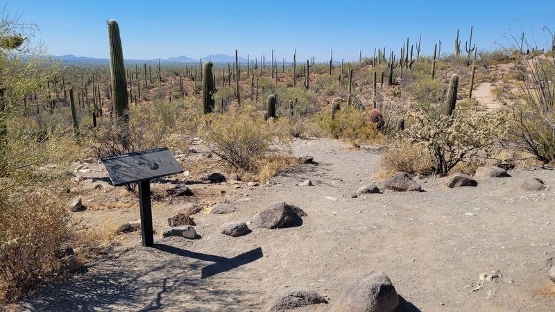
Photographed by James Hulse, June 17, 2024
2. Historic Period Marker

Regionally, this marker is in the Sky Islands, in the Sonoran Desert, and in the Phoenix Metropolitan Area. It is also in the American Borderlands and in the Southwest. Globally, it is in North America, the Western Hemisphere, the Western World, and the Anglosphere. Historically, it finds itself in what was once New Spain and also the Gadsden Purchase.
Other nearby markers. At least 8 other markers are within 18 miles of this marker, measured as the crow flies: Prehistoric People (here, next to this marker); Prehistoric Rock Art (within shouting distance of this marker); Civilian Conservation Corps (The CCC) (about 300 feet away, measured in a direct line); World of the Wash (approx. 2.6 miles away); Desert Life (approx. 2.6 miles away); Seed to Sentinel (approx. 2.6 miles away); Mission San Xavier del Bac (approx. 17.3
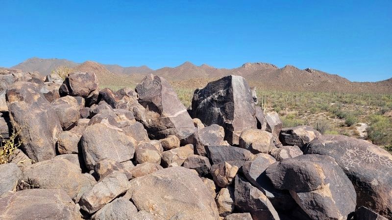
Photographed by James Hulse, June 17, 2024
3. The petroglyphs on Signal Hill
Also see . . . The Beginning of Saguaro National Park. National Park Service
On March 1, 1933, in the last days of his presidency, Herbert Hoover signed a Proclamation establishing Saguaro National Monument in the nearly empty desert, 15 miles east of the sleepy town of Tucson. Wrenched by the Great Depression and awaiting a new administration, few in Washington paid any attention to Hoover’s action. But it was a victory for both botanists and boosters in Arizona who’d worked for years to protect this grandest stand of saguaros. And it was a far-sighted accomplishment that would have incredible benefits for future generations of both Tucsonans and tourists.(Submitted on July 2, 2024, by James Hulse of Medina, Texas.)
Credits. This page was last revised on July 2, 2024. It was originally submitted on July 1, 2024, by James Hulse of Medina, Texas. This page has been viewed 246 times since then and 52 times this year. Photos: 1, 2, 3. submitted on July 2, 2024, by James Hulse of Medina, Texas.
