Cartersville in Bartow County, Georgia — The American South (South Atlantic)
Etowah’s Past, Present, and Future
| — | Etowah Indian Mounds State Historic Site | — |
Photographed by Brandon D Cross
1. Etowah’s Past, Present, and Future Marker
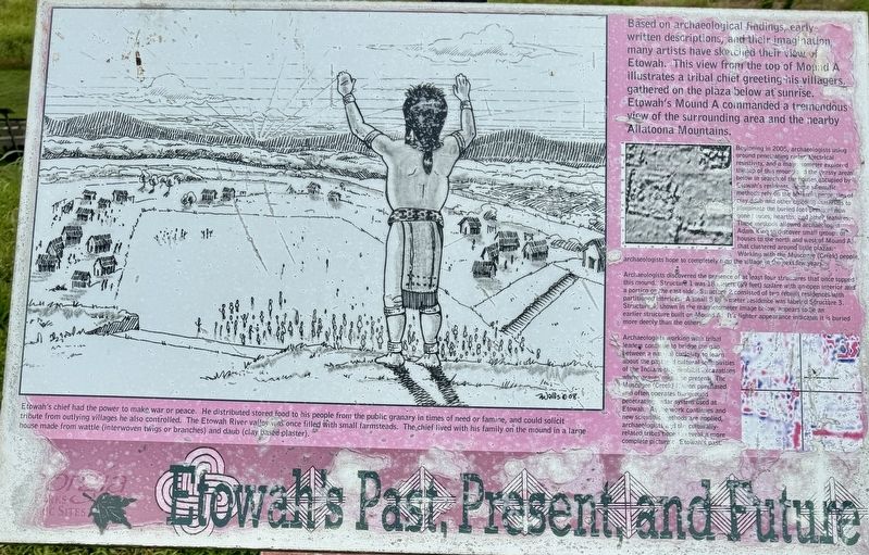
Beginning in 2005, archaeologists using ground penetrating radar, electrical resistivity, and a magnetometer explored the top of this mound and the grassy areas below in search of the houses occupied by, Etowah’s residents. These scientific methods rely on the different properties of cray daub and other building materials to illuminate the buried foot prints of now gone houses, hearths, and other features. These methods allowed archaeologist Adam King to discover small groups of houses to the north and west of Mound A that clustered around little plazas. Working with the Muscogee (Creek) people, archaeologists hope to completely map the village in the next few years.
Archaeologists discovered the presence of at least four structures that once topped this mound.
this page online
Archaeologists working with tribal leaders continue to bridge the gap between a natural curiosity to learn about the past and cultural sensitivities of the Indians that prohibit excavations where graves might be present. The Muscogee (Creek) Nation purchased and often operates the ground penetrating radar system used at Etowah. As the work continues and new scientific methods are applied, archaeologists and the culturally related tribes hope to reveal a more complete picture of Etowah's past.
Etowah's chief had the power to make war or peace. He distributed stored food to his people from the public granary in times of need or famine, and could solicit tribute from outlying villages he also controlled. The Etowah River valley
Photographed by Brandon D Cross
2. Etowah’s Past, Present, and Future Marker
Erected by Georgia Council on American Indian Concerns.
Topics. This historical marker is listed in these topic lists: Anthropology & Archaeology • Indigenous Peoples and Communities • Parks & Recreational Areas. A significant historical year for this entry is 1000 CE.
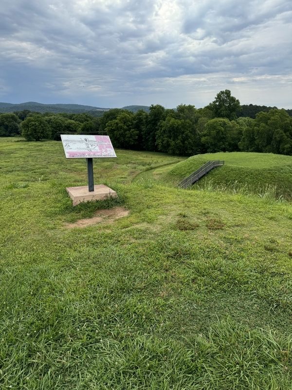
Location. 34° 7.497′ N, 84° 48.44′ W. Marker is in Cartersville, Georgia, in Bartow County. It can be reached from Indian Mounds Road SE 0.2 miles south of Sequoyah Circle, on the left when traveling south. Located on the grounds of Etowah Indian Mounds State Historic Site. Touch for map. Marker is at or near this postal address: 813 Indian Mounds Road SE, Cartersville GA 30120, United States of America. Touch for directions.

Regionally, this marker is in the Mountains. It is also in the American South and specifically in the Deep South. Globally, it is in North America, the Western Hemisphere, the Western World, and the Anglosphere. Historically, it finds itself in what was once the original Cherokee Nation, the territory of the Mississippian Culture, one of the original Thirteen Colonies, one of the Confederate States of America, and the Antebellum South.
Other nearby markers. At least 8 other markers are within walking distance of this marker: Mound A - Symbol of a Chiefdom (within shouting distance of this marker); Mound B and Structure 3 (within shouting distance of this marker); Mound C - Ceremonial Mortuary (about 300 feet away, measured in a direct line); A Chiefly Village on the Etowah (about 600 feet away); Etowah’s River Cane (about 800 feet away); A Return to Native Grasses (approx. 0.2 miles away); The Defensive Ditch/Borrow Pit (approx. 0.2 miles away); Etowah’s Wattle and Daub House (approx. 0.2 miles away). Touch for a list and map of all markers in Cartersville.
Also see . . . Etowah Indian Mounds State Historic Site. (Submitted on July 3, 2024, by Brandon D Cross of Flagler Beach, Florida.)
Credits. This page was last revised on July 4, 2024. It was originally submitted on July 3, 2024, by Brandon D Cross of Flagler Beach, Florida. This page has been viewed 270 times since then and 41 times this year. Photos: 1, 2. submitted on July 3, 2024, by Brandon D Cross of Flagler Beach, Florida. • Bernard Fisher was the editor who published this page.
