Fort Dallas Park in Miami in Miami-Dade County, Florida — The American South (South Atlantic)
Julia Tuttle - The Mother of Miami

Photographed by Tim Fillmon, June 27, 2024
1. Julia Tuttle - The Mother of Miami Marker
Julia Tuttle arrived from Cleveland, Ohio, in 1891, a widow with two grown children. She bought 644 acres on the north bank of the Miami River, which included Fort Dallas. Her neighbors across the river were fellow early pioneers William and Mary Brickell. A visionary, Tuttle announced to a friend, “It is the dream of my life to see this wilderness turned into a prosperous country.” When the “Big Freezes” of December 24 and 28, 1894, and February 6, 1895, froze the orchards further north, Tuttle sent Florida East Coast Railway executive Henry Flagler orange blossoms and oranges to persuade him to bring his railroad south from Palm Beach to Biscayne Bay. In exchange, she provided Flagler with 100 acres of land for a railroad terminal and hotel, and 263 acres in alternate city blocks for the future city of Miami. The first train entered Miami on April 13, 1896, and the city was officially incorporated on July 28, 1896. By the end of 1896, Miami Avenue was lined with stores, and its first laundry, bakery, and dairy were reportedly started by Julia Tuttle. She resided in the remodeled officers’ quarters of Fort Dallas, located
this page online
A Florida Heritage Site
Erected 2020 by Miami-Dade County Commission for Women, and the Florida Department of State. (Marker Number F-1107.)
Topics. This historical marker is listed in these topic lists: Agriculture • Settlements & Settlers • Waterways & Vessels • Women. A significant historical date for this entry is February 6, 1895.
Location. 25° 46.245′ N, 80° 11.524′ W. Marker is in Miami, Florida, in Miami-Dade County. It is in Fort Dallas Park. It can be reached from Southeast 4th Street 0.1 miles east of South Miami Avenue. Marker is located along the Miami River. Parking and walking to the site is the best way to get to it. Touch for map. Marker is at or near this postal address: 60 Southeast 4th Street, Miami FL 33131, United States of America. Touch for directions.

Regionally, this marker is in South Florida and on the Gold Coast. It is also in the American South and on the Eastern Seaboard. Globally, it is in the North Atlantic Region, North America, a Gulf of Mexico state, the Western Hemisphere, the Western World, and the Anglosphere.
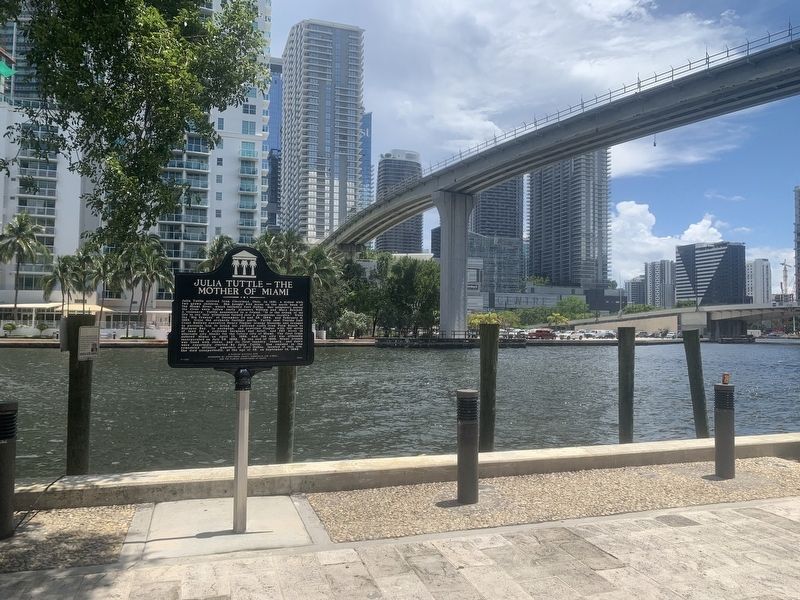
Photographed by Tim Fillmon, June 27, 2024
2. Julia Tuttle - The Mother of Miami Marker
Other nearby markers. At least 8 other markers are within walking distance of this marker: The Miami Circle at Brickell Point (approx. 0.2 miles away); The People of Brickell Point (approx. 0.2 miles away); The Miami Circle (approx. 0.2 miles away); Saving the Circle (approx. 0.2 miles away); Mary Brickell Park (approx. ¼ mile away); Dade County (approx. 0.3 miles away); Menendez on Biscayne Bay (approx. 0.4 miles away); Gesu Catholic Church (approx. 0.4 miles away). Touch for a list and map of all markers in Miami.
Other markers no longer nearby. Brickell Park (was approx. ¼ mile away but has been permanently removed); Great Miami Hurricane of 1926 (was approx. 0.3 miles away but has been confirmed missing).
Also see . . . Meet Julia Tuttle. (Submitted on July 6, 2024, by Tim Fillmon of Webster, Florida.)
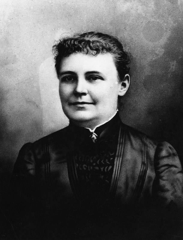
Photographed by Florida Memory, circa Circa 1880
3. Julia Tuttle - The Mother of Miami Marker
Credits. This page was last revised on November 28, 2024. It was originally submitted on July 6, 2024, by Tim Fillmon of Webster, Florida. This page has been viewed 1,007 times since then and 234 times this year. Photos: 1, 2, 3. submitted on July 6, 2024, by Tim Fillmon of Webster, Florida.
