Near Roswell in Fulton County, Georgia — The American South (South Atlantic)
Garrard Landing Park
| — | Garrard Landing Park Trail | — |
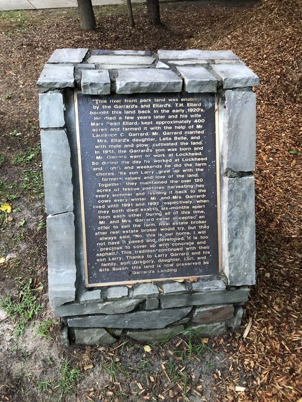
Photographed by Tracy Andersen Roberts, July 6, 2024
1. Garrard Landing Park Marker
This river front park land was enabled by the Garrard's and Ellard's. T.H. Ellard bought this land back in the early 1920's. He died a few years later, and his wife, Mary Pearl Ellard, kept approximately 400 acres and farmed it with the help of Mr. Laurence C. Garrard. Mr. Garrard married Mrs. Ellard's daughter, Lelia Belle, and, with mule and plow, cultivated the land. In 1951, the Garrard's son was born, and Mr. Garrard went to work at Lockheed. So during the day he worked at Lockheed and nights and weekends he did the farm chores. His son Larry grew up with the farmer's values and love of the land. Together they maintained the over 120 acres of fescue pastures, harvesting hay every summer and feeding it back to the cows every winter. Mr. and Mrs. Garrard lived until 1991 and 1992 respectively, when they both died exactly six-months apart from each other. During all of this time, Mr. and Mrs. Garrard never accepted an offer to sell the farm. Real estate broker after real estate broker would try, but they always said, "No, this is our home, I will not have it paved and developed; it is too precious to cover up with concrete
this page online
Topics. This historical marker is listed in these topic lists: Agriculture • Parks & Recreational Areas • Waterways & Vessels. A significant historical year for this entry is 1920.
Location. 33° 58.466′ N, 84° 15.912′ W. Marker is near Roswell, Georgia, in Fulton County. It can be reached from Holcomb Bridge Road (Georgia Route 140) 0.7 miles south of Ellard Drive, on the right when traveling south. The park entrance is located at the Johns Creek Environment Campus. Touch for map. Marker is at or near this postal address: 8000 Holcomb Bridge Road, Alpharetta GA 30022, United States of America. Touch for directions.

Regionally, this marker is in the Piedmont and in Metro Atlanta. It is also in the American South and specifically in the Deep South. Globally, it is in North America, the Western Hemisphere, the Western World, and the Anglosphere. Historically, it finds itself in what was once the territory of the Mississippian Culture, one of the original Thirteen Colonies, one of the Confederate States of America, and the Antebellum South.
Other nearby markers. At least 8 other markers are within 4 miles of this marker, measured as the crow flies: Hightower Indian Trail (approx. 2.4 miles away); "Holy Row" (approx. 3.6 miles away); Site of Norcross Public Library (approx. 3.6 miles away); Historic Baptist Church (approx. 3.6 miles away); You are standing on the Eastern Continental Divide (approx. 3.6 miles away); Brunswick Hotel (approx. 3.7 miles away); Thrasher Park (approx. 3.7 miles away); Norcross, Georgia (approx. 3.7 miles away).
Also see . . .
1. Garrard Landing Park: Roswell’s Best Kept Secret for Families. One Naturalist blogsite (Submitted on January 26, 2026, by Larry Gertner of New York, New York.)
2. Garrard Landing Park Canoe and Raft Launch. Chattahoochee River National Recreation Area, National Park Service (Submitted on July 6, 2024.)
Additional commentary.
1. Garrard Landing
1820s: Charles Gates operated a ferry crossing here.
1834: Robert McAfee built a toll bridge.
July 5, 1864: bridge burned by Confederate troops, rebuilt, and burned again by Union troops.
Post-Civil War: ferry crossing
Early 1900s: single-lane steel truss bridge
1960s: first modern two-lane concrete bridge built nearby
— Submitted July 6, 2024.
Credits. This page was last revised on January 26, 2026. It was originally submitted on July 6, 2024, by Tracy Andersen Roberts of Atlanta, Georgia. This page has been viewed 685 times since then and 75 times this year. Photo 1. submitted on July 6, 2024, by Tracy Andersen Roberts of Atlanta, Georgia. • Bernard Fisher was the editor who published this page.
Editor’s want-list for this marker. Photos of park • Can you help?
