College Hill in Providence in Providence County, Rhode Island — The American Northeast (New England)
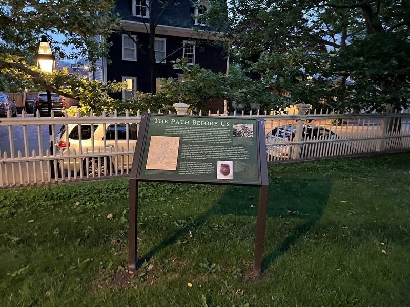
The Path Before Us

The "Nahahiganseck," meaning "people of the small point," were, and are, inhabitants of the coastal woodlands of Rhode Island. The Narragansetts lived in inland villages during the winter months and coastal villages during the summer. Due to this area's proximity to a freshwater spring and the "Great Salt River" (Providence River), where abundant supplies of fish and wild game were found, it was home to a vibrant and vital Narragansett villages. In addition to this, the ecology of the area and abundance of natural resources attracted considerable foot traffic as the Narragansetts and other southern New England native peoples established extensive trail networks to support their hunter-gatherer lifestyles and to promote trade between tribes.
Many of these footpaths intersected in the area surrounding present-day Benefit Street, including the northbound Pawtucket Trail leading to Pawtucket Falls and the westbound Pequot Trail. To the east, the Wampanoag Trail crossed the Seekonk River and stretched into the lands of the Wampanoag. Another path snaked south towards Tockwotton Hill where it was met by the Watchemoket Trail,
this page online
Benefit Street and the surrounding area are home to a vibrant Indigenous past, a history as layered as the landscape itself. It is essential that we study, share, and commemorate these histories and elevate the beauty and vitality of Indigenous heritage and culture in the past, present and for the future.
[Captions:]
Sidney S. Rider's 1903 map of Rhode Island indicating Indigenous place names and the locations of significant events in the history of the colony's native peoples. RIHS Collections RHI X17 4734
Stone fishing weirs, like this one from Coventry, Rhode Island, were used by Indigenous peoples to catch fish at low tide. Native peoples settled along the eastern shore of the Great Salt River in Providence would have used fishing weirs to help catch salmon, trout, and other fresh fish. Undated image. RIHS Collections RHI X17 3847
A Narragansett basket woven of basswood splints and cornhusks interwoven with red wool. This basket is only one of two known seventeenth-century Algonkian baskets in the world. RIHS Collections RHI X17 1685A
Topics.
Location. 41° 49.397′ N, 71° 24.251′ W. Marker is in Providence, Rhode Island, in Providence County. It is in College Hill. It can be reached from Benefit Street north of Power Street, on the right when traveling north. Touch for map. Marker is at or near this postal address: 314 Benefit St, Providence RI 02903, United States of America. Touch for directions.

Regionally, this marker is on Rhode Island’s Narragansett Bay. It is also in the American Northeast, in New England, and on the Eastern Seaboard. Globally, it is in the North Atlantic Region, North America, the Western Hemisphere, the Western World, and the Anglosphere. Historically, it finds itself in what was once one of the original Thirteen Colonies.
Other nearby markers. At least 8 other markers are within walking distance of this marker: The Olmsted Plan (within shouting distance of this marker); The Ives-Gammell House (within shouting distance of this marker); The Gilded Age (within shouting distance of this marker); John Brown House (about 300 feet away, measured in a direct line); Who Built John Brown's House? (about 300 feet away); HMS Gaspee (about 400 feet away); Sons of Liberty (about 400 feet away); Rise of the Gangways (1704-1844) / Fall of the Gangways (1844-1983) (about 700 feet away). Touch for a list and map of all markers in Providence.
Credits. This page was last revised on July 14, 2024. It was originally submitted on July 14, 2024, by Devry Becker Jones of Washington, District of Columbia. This page has been viewed 147 times since then and 17 times this year. Photos: 1, 2. submitted on July 14, 2024, by Devry Becker Jones of Washington, District of Columbia.
Editor’s want-list for this marker. Clear, daylight photos of the marker and its context. • Can you help?
