Illinois Medical District in Chicago in Cook County, Illinois — The American Midwest (Great Lakes)
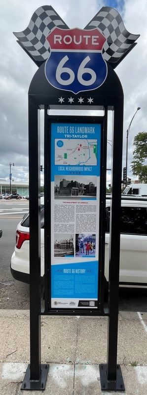
Route 66 Landmark
⎯⎯⎯
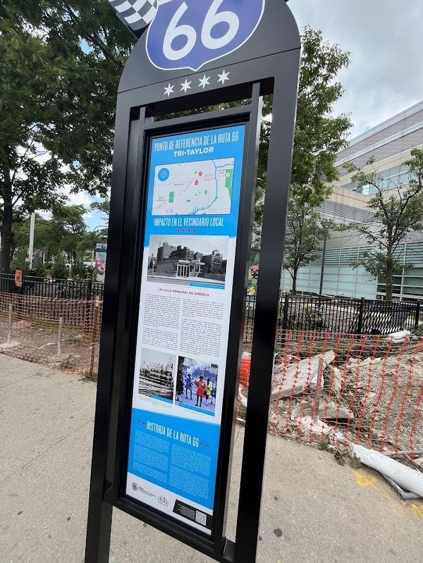
Punto de Referencia de la Ruta 66
Tri-Taylor
| — | Local Neighborhood Impact / Impacto en el Vecindario Local | — |
Photographed by Sean Flynn, July 18, 2024
1. Route 66 Landmark Marker
Cook County Hospital was one of the most recognizable, architecturally distinguished structures on Chicago's stretch of Route 66. As the years passed, this hospital also became the anchor of the 560-acre Illinois Medical District, the nation's largest concentration of hospitals and research institutions. Established by the
this page online
In 2002, "County" closed and was replaced by John H. Stroger, Jr. Hospital, one of many modern institutions in the now-thriving IL Medical District. The old hospital stood vacant for nearly two decades. Preservationists feared the building would be demolished, but Hyatt Hotels transformed it into luxury lodgings, saving a Route 66 landmark. Throughout this journey, the medical facilities were a boon to businesses along Route 66, supplying them with customers and patients. For instance, an Italian-American family from Tri-Taylor opened Lulu's Hot Dogs in 1968, replacing a former Sinclair gas station situated across the street from "County." Today, Lulu's endures as a cherished spot that serves locals and nostalgic travelers alike.
Photographed by Sean Flynn, July 18, 2024
2. Route 66 Landmark Marker (Spanish-language side)
Route 66 was officially established in 1926. The Illinois stretch of Route 66 began as a two-lane road known as SB14, which followed the route of the old Pontiac Trail from Chicago to St. Louis. At first, SB14 began in Cicero, but its designation as Route 66 increased
Photographed by Sean Flynn, July 18, 2024
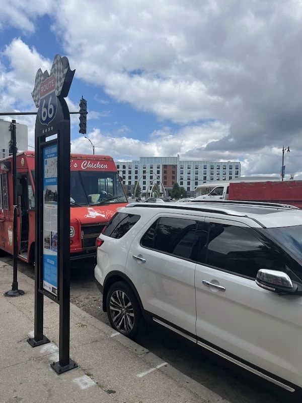
3. Route 66 Landmark Marker
Ogden Avenue has traditionally been a major transportation route into and out of Chicago. This street parallels both the south branch of the Chicago River, which was once the main waterway toward the Mississippi, and the Chicago, Burlington & Quincy railroad tracks. The Route 66 era was the heyday of Ogden Avenue and the neighborhoods it runs through. Route 66 was and still is an emblem of the nation's car culture. From the 1920s through the 1950s, dozens of repair garages, tire suppliers, and automobile dealers set up shop along the street.
The development of the interstate highway system, the result of a bill signed by President Dwight D. Eisenhower, led to the decommissioning of Route 66 and the demise of many of Chicago's Ogden Avenue businesses. Drivers were offered a faster course to the southwest suburbs and central Illinois. In the 1960s, construction began on Interstate 55, and in 1977 the "End of Route 66" signs on Jackson Boulevard came down. A few remaining restaurants and repair shops along Ogden Avenue
Photographed by Sean P. Flynn, October 20, 2024
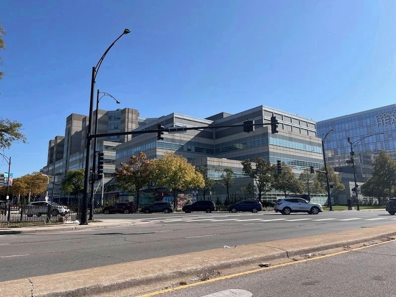
4. Route 66 Landmark / Punto de Referencia de la Ruta 66 Marker
The marker can be seen across Ogden Avenue in this picture, in front of Stroger Hospital.
[Spanish-language text on the east-facing side of the marker:]
El Hospital del Condado de Cook era una de las estructuras arquitectónicamente distinguidas

Photographed by Sean Flynn, July 18, 2024
5. Photo close-up: Illinois Medical District CTA "L" Station
En 2002, el "Condado" cerró y fue reemplazado por el Hospital John H. Stroger, una de las muchas instituciones modernas en el ahora próspero Distrito del Centro Médico de IL. El antiguo hospital permaneció vacío durante casi dos décadas. Los ecologistas temían que el edificio fuera demolido, pero los hoteles Hyatt lo transformaron en alojamientos de lujo, salvando un punto de referencia
Photographed by Sean Flynn, July 18, 2024
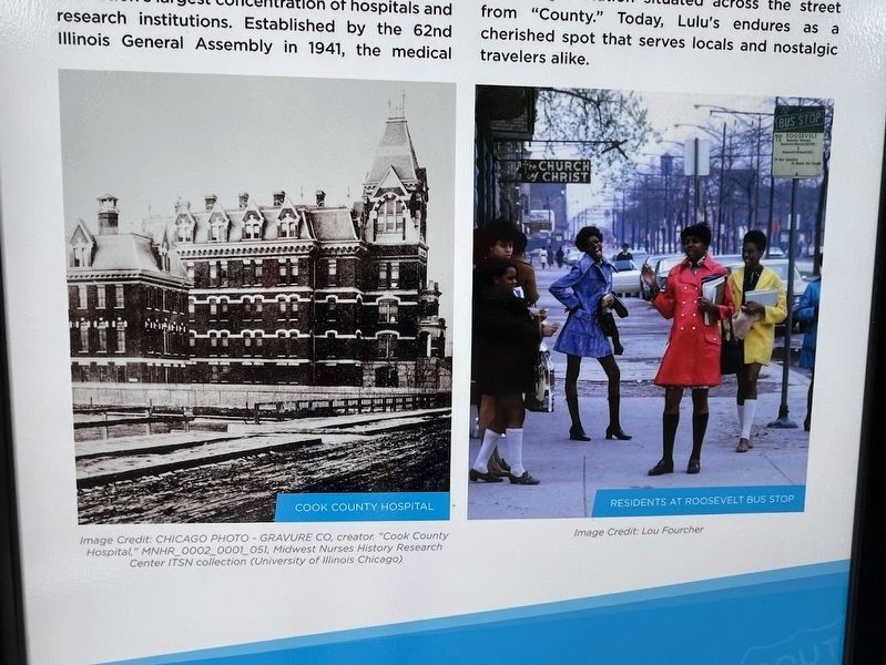
6. Close-up of photos on the marker
The photo on the left is a historic photo of the original Cook County Hospital, which still stands after recently being converted into a hotel. On the right is a photo likely taken in the 1960s of women nearby on Roosevelt Road.
Más automóviles significaron más demanda de carreteras pavimentadas. En 1921, el Congreso aprobó la Ley de Ayuda Federal para Carreteras, que exigía una red de carreteras que cubriera todo el
Photographed by Sean Flynn, July 18, 2024
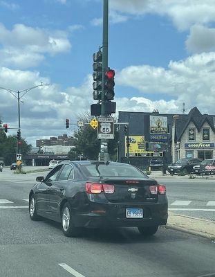
7. Route 66 Historic Route sign
Brown "Historic Route" signs for Route 66 are found occasionally along the old route. This one, at Ogden and Western avenues, is about three-quarters of a mile from the 2024 Route 66 historical marker.
La Ruta 66 se estableció oficialmente en 1926. El tramo de Illinois de la Ruta 66 comenzó como una carretera de dos carriles conocida como SB14, que seguía la ruta del antiguo Pontiac Trail desde Chicago a St. Louis. Al principio, SB14 inició en Cicero, pero su designación como Ruta 66 aumentó el tráfico. Para adaptarse a esto, el punto de partida se trasladó a Michigan Avenue y Jackson Boulevard en Chicago. Ogden Avenue ha sido tradicionalmente una importante ruta de transporte hacia y desde Chicago. Esta calle es paralela tanto al brazo sur del río Chicago, que alguna vez fue la vía fluvial principal hacia el Mississippi, como a las vías del ferrocarril de Chicago, Burlington y Quincy. La era de la Ruta 66 fue el apogeo de Ogden Avenue y los vecindarios que atraviesa. La Ruta 66 fue y sigue siendo un emblema de la cultura automovilística del país. Desde la década de 1920 hasta la de 1950, docenas de talleres de reparación, proveedores de neumáticos y concesionarios de automóviles instalaron tiendas a lo largo de la calle.
El desarrollo del sistema de carreteras interestatales, resultado de un proyecto de ley firmado por el presidente Dwight D. Eisenhower, provocó el desmantelamiento de la Ruta 66 y la desaparición de muchos de los negocios de Ogden Avenue en Chicago. A los conductores se les ofreció un rumbo más rápido hacia los suburbios del suroeste y el centro de Illinois. En la década de 1960, comenzó la construcción de la Interestatal 55, y en 1977 se quitaron las señales de "Fin de la Ruta 66” en Jackson Boulevard. Algunos restaurantes y talleres de reparación que quedan a lo largo de Ogden Avenue todavía exhiben recuerdos de la Ruta 66, lo que garantiza que sus años como parte de la carretera más idealizada de Estados Unidos nunca se olviden.
Erected 2024 by Illinois Department of Commerce & Economic Opportunity; Choose Chicago.
Topics and series. This historical marker is listed in these topic lists: Immigration • Industry & Commerce • Roads & Vehicles • Science & Medicine. In addition, it is included in the Former U.S. Presidents: #34 Dwight D. Eisenhower, and the U.S. Route 66 series lists. A significant historical year for this entry is 1916.
Location. 41° 52.379′ N, 87° 40.561′ W. Marker is in Chicago, Illinois, in Cook County. It is in the Illinois Medical District. It is at the intersection of West Ogden Avenue and South Damen Avenue on West Ogden Avenue. The marker is near the Ogden Avenue entrance to Stroger Hospital. Touch for map. Marker is at or near this postal address: 1969 West Ogden Avenue, Chicago IL 60612, United States of America. Touch for directions.

Regionally, this marker is in the American Midwest. Globally, it is in North America, on the Great Lakes, in the Western Hemisphere, in the Western World, and in the Anglosphere. Historically, it finds itself in what was once the Viceroyalty of New France, the territory of the Mississippian Culture, and the Northwest Territory.
Other nearby markers. At least 8 other markers are within walking distance of this marker: Operation Iraqi Freedom (approx. 0.2 miles away); Samuel Guthrie, M.D. (approx. ¼ mile away); West Side Grounds (approx. 0.3 miles away); Claremont Cottages District (approx. 0.6 miles away); a different marker also named Claremont Cottages District (approx. 0.6 miles away); a different marker also named Claremont Cottages District (approx. 0.6 miles away); a different marker also named Claremont Cottages District (approx. 0.6 miles away); Robert Marvin "Bobby" Hull (approx. 0.6 miles away). Touch for a list and map of all markers in Chicago.
More about this marker. The marker is one of four unveiled in 2024 in coordination with NASCAR's second Grant Park 165 race, a street circuit through Grant Park in downtown Chicago on July 7, 2024. One marker is downtown at the intersection of Adams and Michigan, where Route 66 ends in front of the Art Institute of Chicago; the other two are southwest of here on Ogden Avenue. The bottom of all three Ogden Avenue markers includes a "History of Route 66" with text that is identical to that on the marker in front of the Art Institute. Although Route 66 is a U.S. highway, the marker's styling at the top actually is based on that used by the Interstate Highway System.
Also see . . . Choose Chicago: The ultimate Route 66 Chicago itinerary. From Choose Chicago, a tourism bureau, a blog post about locations alongside Route 66 in and near downtown Chicago. (Submitted on July 18, 2024, by Sean P. Flynn of Oak Park, Illinois.)
Credits. This page was last revised on October 22, 2024. It was originally submitted on July 18, 2024, by Sean P. Flynn of Oak Park, Illinois. This page has been viewed 337 times since then and 34 times this year. Photos: 1, 2, 3. submitted on July 18, 2024, by Sean P. Flynn of Oak Park, Illinois. 4. submitted on October 22, 2024, by Sean P. Flynn of Oak Park, Illinois. 5, 6, 7. submitted on July 18, 2024, by Sean P. Flynn of Oak Park, Illinois.
