Near Randall in Montgomery County, New York — The American Northeast (Mid-Atlantic)
The Canalway Trail: Randall
⎯⎯⎯
A Remarkable Rock
⎯⎯⎯
Queen of the Erie

Photographed by Steve Stoessel, July 21, 2024
1. The Canalway Trail: Randall / A Remarkable Rock / Queen of the Erie Marker
Cooperative initiatives between the New York State Canal Corporation, volunteers, local governments, and federal and state agencies have created this great network of trails for public use. When completed, the Canalway Trail will span over 500 miles connecting numerous cities, towns and villages along the Canal System, making it one of the most extensive trail networks in the country.
Enjoying the Canalway Trail: Safety Tips
The Canalway Trail is intended to accommodate avariety of users. It is important to extend courtesy to all trail users and respect their rights. In order to avoid conflicts,
this page online
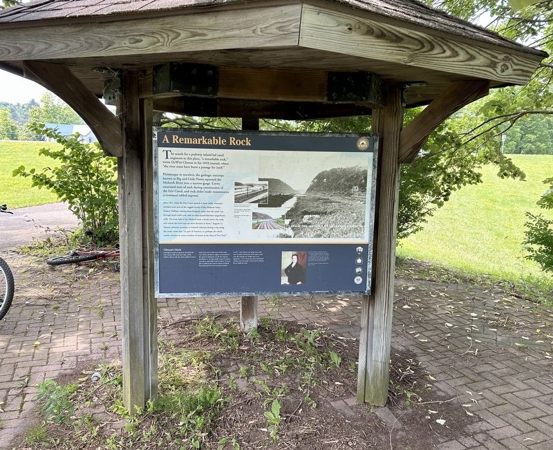
Picturesque to travelers, the geologic outcrops known as Big and Little Noses squeezed the Mohawk River into a narrow gorge. Crews excavated tons of rock during construction of the Erie Canal, and rock slides made maintenance a continual added expense.
After 1825 when the Erie Canal opened to boat traffic, countless travelers took note of the rugged terrain of the Mohawk Valley. Frances Trollope, visiting from England, wrote that the canal "cut through much solid rock, and we often passed between magnificent cliffs. The little falls of the Mohawk form a lovely scene; the rocks over which the river runs are most fantastic in form." Auguste Le Vasseur, personal secretary to General Lafayette during a

Photographed by Steve Stoessel, July 21, 2024
2. A Remarkable Rock
[photos:]
- Big Nose and Little Nose are seen in this postcard from the early 20th-century.
- The Noses, (right) in a postcard looking west, from the north side of the river, about 1910.
- The large photo of the Noses (right) is looking east.
Clinton's Ditch
Although his political opponents described the Erie Canal as folly, little more than a ditch, De Witt Clinton rode the canal to political success.
,br> Early in his career, while mayor of New York City, Clinton decided to support construction of the canal. In making the case for the canal, he described it as "an imperishable cement of connection and an indissoluble bond of union." He knew that it would tap the natural resources of inland New York and tie the west to eastern markets.
In 1817, when Clinton ran for governor of the state, he made construction of the canal a major issue. By winning over 43,000 votes to his opponent's 1,479, Clinton received an undeniable mandate from the people, if not from his political foes, to
Photographed by Steve Stoessel, July 21, 2024
3. Queen of the Erie Marker
In 1821, to justify construction of the Erie Canal, DeWitt Clinton wrote that "this canal ... is without parallel in the history of mankind." "It remains for a free state to create a new era in history, and to erect a work more stupendous, more magnificent, and more beneficial hicherto been achieved by the human race."
Gov. DeWitt Clinton by the painter John Wesley Jarvis, ca. 1816.
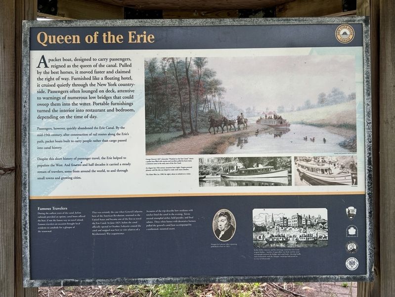
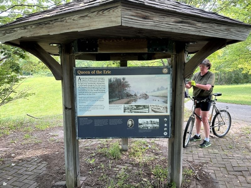
A packet boat, designed to carry passengers,reigned as the queen of the canal. Pulled by the best horses, it moved faster and claimed the right of way. Furnished like a floating hotel, it cruised quietly through the New York country-side. Passengers often lounged on deck, attentive to warnings of numerous low bridges that could sweep them into the water. Portable furnishings turned the interior into restaurant and bedroom, depending on the time of day.
Passengers, however, quickly abandoned the Erie Canal. By the mid-19th century, after construction of rail routes along the Eries path, packet boats built to carry people rather than cargo passed into canal history.
Despite this short history of passenger travel, the Erie helped

Photographed by Steve Stoessel, July 21, 2024
4. The Canalway Trail: Randall Marker
George Harvey's 1837 watercolor "Pittsford on the Erie Canal" shows a packet boat filled with tourists and travellers pulled by horse team, a common scene in the early years of the canal.
An elegant late 19th-century excursion boat (right), Engine-powered pleasure craft like this one helped make mules teams obsolete.
The Kittie West, (ca. 1900, far right), about to embark on a cruise.
Famous Travelers
During the earliest years of the canal, before railroads provided an option, canal boats offered the best, if not the fastest way to travel inland. Famous travelers on occasion brought local residents to canalside for a glimpse of the renowned.
That was certainly the case when General Lafayette, hero of the American Revolution, returned to the United States and became one of the first to travel the Erie Canal. In June 1825, before the canal officially opened in October, Lafayette cruised the canal and stopped near here to visit relatives of a Revolutionary
Photographed by Steve Stoessel, July 21, 2024
5. A Remarkable Rock
Accounts of the trip describe how residents with torches lined the canal in the evening. Towns erected triumphal arches, held parades, and fired salutes. Three white horses with decorative harness pulled the general's canal boat accompanied by a uniformed, mounted escort.
In the 1820s, Lafayette and his entourage toured the Erie Canal to great fanfare ... "another 24 gun salute was fired, and the area's townspeople jammed the bridges and canal boats, cheering loudly and continuously until the Marquis' entourage had passed on its way to Schenectady."
Marquis de Lafayette after a painting published in Paris in 1824.
Erected by National Park Service, NYS Parks, recreation and Historic Preservation, Montgomery County, Mohawk Valley Heritage Corridor.
Topics. This historical marker is listed in these topic lists: Exploration • Immigration • Parks & Recreational Areas • Waterways & Vessels. A significant historical year for this entry is 1810.
Location. 42° 54.65′ N, 74° 26.978′ W. Marker is near Randall, New York, in Montgomery County. It is at the intersection of Empire State Trail and New York State
Photographed by Steve Stoessel, July 21, 2024
6. The Canalway Trail: Randall / A Remarkable Rock / Queen of the Erie Marker

Regionally, this marker is in Upstate New York and in the Mohawk Valley. It is also in the American Northeast and in the Mid-Atlantic. Globally, it is in North America, the Western Hemisphere, the Western World, and the Anglosphere. Historically, it finds itself in what was once the Haudenosaunee (Iroquois) Confederacy, New Netherland, and one of the original Thirteen Colonies.
Other nearby markers. At least 8 other markers are within walking distance of this marker: Volkert Vrooman (approx. 0.2 miles away); The Mohawk Valley (approx. 0.4 miles away); The Erie Canal (approx. 0.4 miles away); Then and Now (approx. 0.4 miles away); The Second Locking (approx. 0.4 miles away); History of the Buoy Boat (approx. 0.4 miles away); Giving Sal a Rest (approx. 0.4 miles away); a different marker also named The Erie Canal (approx. 0.4 miles away). Touch for a list and map of all markers in Randall.
More about this marker. This is a three-sided marker.
Also see . . .
1. Erie Canalway National Heritage Corridor. National Park Service website entry (Submitted on September 16, 2024, by Larry Gertner of New York, New York.)
2. The Erie Canal. Wikipedia entry (Submitted on July 22, 2024, by Steve Stoessel of Niskayuna, New York.)
Credits. This page was last revised on September 16, 2024. It was originally submitted on July 21, 2024, by Steve Stoessel of Niskayuna, New York. This page has been viewed 240 times since then and 15 times this year. Photos: 1, 2, 3, 4, 5, 6. submitted on July 21, 2024, by Steve Stoessel of Niskayuna, New York.
