Newburg in Charles County, Maryland — The American Northeast (Mid-Atlantic)
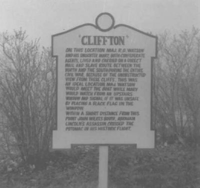
"Cliffton"
Maryland Historical Trust (Historic Sites Survey)
1. "Cliffton" Marker
On this location Maj. R. G. Watson and his daughter Mary, both Confederate agents, lived and carried on a direct mail and slave route between the North and the South during the entire Civil War. Because of the unobstructed view from these cliffs, this was an ideal location. Maj. Watson would meet the boat while Mary would watch from an upstairs window and signal if it was unsafe by placing a black flag in the window.
Within a short distance from this point John Wilkes Booth, Abraham Lincoln's assassin crossed the Potomac in his historic flight.
Topics. This historical marker is listed in these topic lists: Communications • Roads & Vehicles • War, US Civil • Waterways & Vessels.
Location. Marker has been reported missing. It was located near 38° 22.333′ N, 76° 58.97′ W. Marker was in Newburg, Maryland, in Charles County. It was on Overlook Circle. Touch for map. Marker was in this post office area: Newburg MD 20664, United States of America. Touch for directions.

Regionally, this marker was in the Washington Metropolitan Area and in Southern Maryland.
this page online
Other nearby markers. At least 8 other markers are within 2 miles of this location, measured as the crow flies: Laidler's Ferry (approx. 0.8 miles away); Potomac Diversion (approx. 1.2 miles away); John Wilkes Booth (approx. 1.2 miles away); Ways to Explore Southern Maryland’s Scenic and Historic Routes (approx. 1.2 miles away); Explore your Cheaspeake (approx. 1.2 miles away); Discover Southern Maryland’s Amazing Stories of Exploration, Hope, and Courage (approx. 1.2 miles away); In Memory of Robert Crain (approx. 1.2 miles away); a different marker also named Cliffton (approx. 1.3 miles away). Touch for a list and map of all markers in Newburg.
Another marker is no longer nearby. John Wilkes Booth (was approx. 1.2 miles away but has been replaced
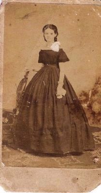
2. Mary Augusta Watson (Carvell) daughter of Major RG Watson
More about this marker. The marker (and Cliffton) no longer exist.
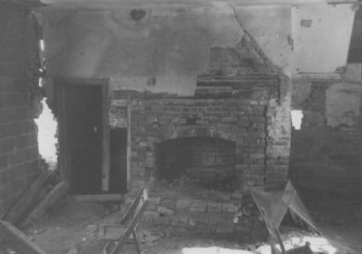
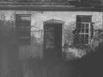
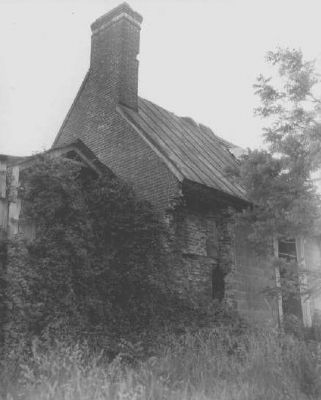
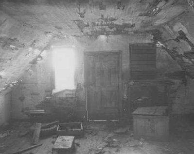
Regarding "Cliffton". According to the report in the Maryland Historical Trust Historic Sites Survey, "Clifton No. 2 was first identified in the early 1970's by J. Richard Rivoire just prior to the site's subdivision, now Clifton on the Potomac. At the time it was believed that this was the home of Josiah Fendall and plans were underway to convert the structure into a museum. Later research revealed that the existing 18th c. structure was likely built as a dependency for a much larger dwelling. After learning this, the building and its plans were abandoned leading to its eventual collapse in the mid-1980's."
Also see . . . Clifton No. 1. Maryland Historical Trust Architectural Survey File PDF (Submitted on August 5, 2019.)
Additional keywords. John Wilkes Booth Escape Route
Historic American Buildings Survey
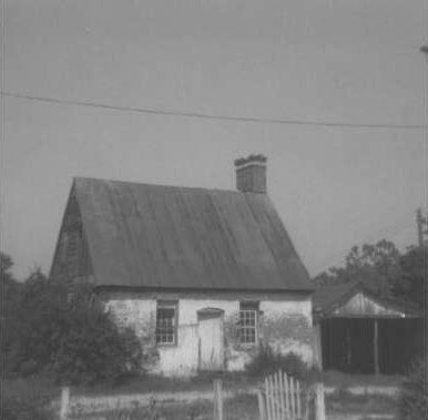
3. Outbuilding, Cliffton
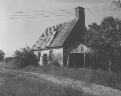
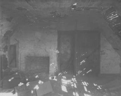
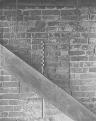
This 18th century structure was thought to have been Cliffton. Further research revealed that it was but one of many outbuildings on the property.
Historic American Buildings Survey
4. Outbuilding, Cliffton
Historic American Buildings Survey
5. Outbuilding, Cliffton (interior)
Historic American Buildings Survey
6. Outbuilding, Cliffton
Historic American Buildings Survey
7. Outbuilding, Cliffton
Historic American Buildings Survey
8. Outbuilding, Cliffton (interior)
Historic American Buildings Survey
9. Outbuilding, Cliffton (interior)
Historic American Buildings Survey
10. Outbuilding, Cliffton (interior)

Photographed by Rico Ramirez, July 25, 2024
11. Corner where the “Cliffton” marker once stood, but is now missing.
Credits. This page was last revised on July 27, 2024. It was originally submitted on March 3, 2008, by Christopher Busta-Peck of Shaker Heights, Ohio. This page has been viewed 3,856 times since then and 80 times this year. Last updated on July 25, 2024, by Rico Ramirez of Prince Frederick, Maryland. Photos: 1. submitted on March 3, 2008, by Christopher Busta-Peck of Shaker Heights, Ohio. 2. submitted on January 17, 2009, by David Watson of Washington DC, United States. 3, 4, 5, 6, 7, 8, 9, 10. submitted on March 3, 2008, by Christopher Busta-Peck of Shaker Heights, Ohio. 11. submitted on July 25, 2024, by Rico Ramirez of Prince Frederick, Maryland. • Devry Becker Jones was the editor who published this page.
