Killdeer in Dunn County, North Dakota — The American Midwest (Upper Plains)
Mountain of the Medicine Hole
Photographed by Barry Swackhamer
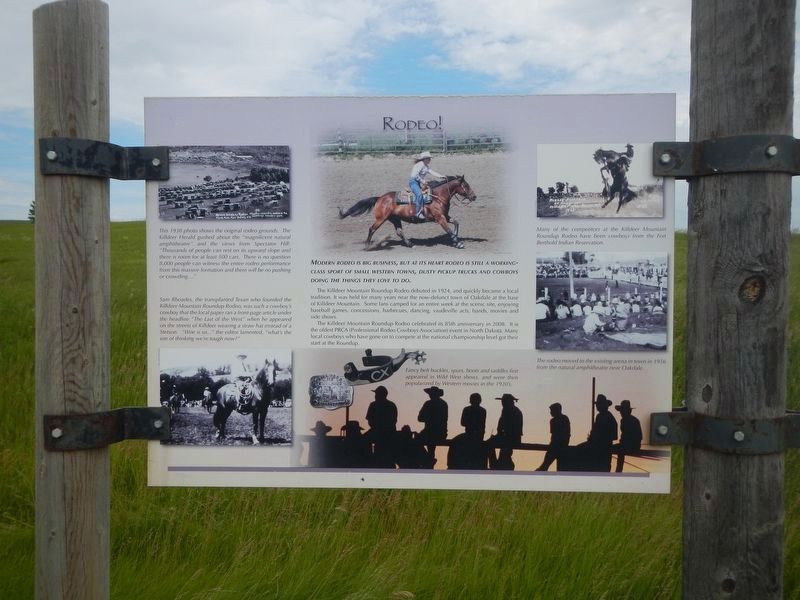
1. Mountain of the Medicine Hole Marker: Rodeo!
Captions: (upper left) This 1930 photo shows the original rodeo grounds. The Killdeer Herald gushed about the "magnificent natural amphitheatre" and the vies from Spectator Hill: "Thousands of people can rest on its upward slope and there is room for at least 500 cars. There is no question 8,000 people can witness the entire rodeo performance from this massive formation and there will be no pushing or crowding...."; (lower left) Sam Rhoades, the transplanted Texan who founded the Killdeer Mountain Rodeo, was such a cowboy's cowboy that the local paper ran a front-page article under the headline "The Last of the West" when he appeared on the streets of Killdeer wearing a straw hat instead of a Stetson. "Woe is us... the editor lamented, "what's the use of thinking we-re tough now?"; (bottom center) Fancy belt buckles, spurs, boots and saddles first appeared in Wild West shoes, and were then popularized by Wester movies in the 1920's.; (upper right) Many of the competitors at the Killdeer Mountain Roundup Rodeo have been cowboys fro the Fort Berthold Indian Reservation.; (lower right) The rodeo moved to the existing arena in town in 1956 from the natural amphitheatre near Oakdale.
Modern rodeo is big business, but at its heart rodeo is still a working class sport of small western towns, dusty pickup trucks and cowboys doing the things they love to do.
The Killdeer Mountain Roundup Rodeo debuted in 1924, and quickly became a local tradition. It was held for many years near the now-defunct town of Oakdale at the base of Killdeer Mountain. Some fans camped for an entire week at the scenic site, enjoying baseball games, concessions, barbecues, dancing, vaudeville acts, bands, movies and side shoes.
The Killdeer Mountain Roundup Rodeo celebrated its 85th anniversary in 2008. It is the oldest PRCA (Professional Rodeo Cowboys Association) event in North Dakota. Many local cowboys who have gone on to compete at the national championship level got their start at the Roundup.
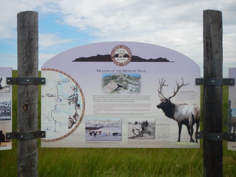
Some native people called the Killdeer Mountains "Takhakanouty," meaning "the place where they kill deer." Others called them Turtle Hill, The mountains and the caves called the Medicine Hole hold deep spiritual significance for native people.
this page online
General Alfred Sully led a heavily-armed force into the Dakota Territory in 1864 to punish the Sioux who had attacked settlers in Minnesota. The army troops attacked an encampment of Indian families just west of here. The Sioux warriors fought back, but were overwhelmed by the cannon of the Federal force, They retreated under cover of the Killdeer Mountains rugged, heavily-forested slopes.
Ten army soldiers and fifty Sioux warriors were killed. It was the loss of their winter supplies that did the greatest harm to the Native Americans. Scattered and demoralized, they were unable to mount effective resistance against the Army for several years.
A persistent story from the fighting is that a group of retreating warriors escaped by entering the Medicine Hole. They are said to have traveled through a series of caves and tunnels to emerge in the Badlands many miles away.
Cowboys of the Killdeer Mountains
"Live a good honorable life. Then when you get older and think back, you'll enjoy it a second time." ~ An Unknown
Photographed by Barry Swackhamer
2. Mountain of the Medicine Hole Marker: center panel
Captions: (left semi-circle) Map of the Killdeer Mountain Four Bears Byway; (bottom center-left) Little Missouri State Park offers hiking and horseback riding on 75 miles of trails that pass through the deepest, most scenic part of the Badlands; (bottom center-right) The Medicine Hole was explored to a depth of about 175 in the middle of the Twentieth Century. Three tunnels branched of at that point with a current of air emerging from one of them. Rocks and debris prevented further exploration. The Medicine Hole is now blocked at a depth of 20-30 feet. One of the two men sitting by the Medicine Hole in this 1930 photo is listening to a radio (not the antenna strung between the bushes). It is not known whether he was trying to get reception from an existing radio station, or listening for signals from within the cave.; (right) The Killdeer Mountain Wildlife Management Area protects more than 7,000 acres of habitat, including some of the largest stands of unbroken forest cover in wester North Dakota. Travelers can view wild life and enjoy exceptional views from the Cap Road Loop that starts just a few miles from here.
Ask twenty cowboys what the "cowboy way" is, and you'll get twenty different answers. Add some coffee (or something stronger), and the conversation might go on for awhile. At the end of the day, you'd still get went different answers, but hard work, honesty and freedom would be in most of them.
Cattle ranching became a way of life in western North Dakota during the 1870s, Ranchers from the southern plains drove their cattle north to graze on open range along the Little Missouri. The herds in the Badlands soon numbered half a million head. The boom went bust in 1886 when early-season blizzards killed and estimated 75% of the herds. Despite the quick demise of the open-range era, many cattlemen hung on, with smaller ranches and fewer animals per acre. The Byway region today includes the leading cattle-producing county in the state, and the cowboy way is alive and well.
Topics. This historical marker is listed in these topic lists: Agriculture • Indigenous Peoples and Communities • Industry & Commerce • Wars, US Indian. A significant historical year for this entry is 1924.
Location. 47° 23.996′ N, 102° 46.808′ W.
Photographed by Barry Swackhamer
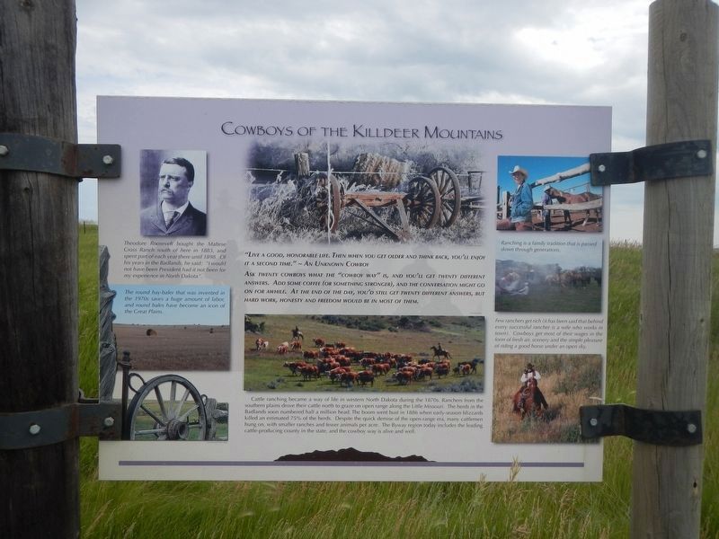
3. Mountain of the Medicine Hole Marker: Cowboys of the Killdeer Mountains
"Live a good honorable life. Then when you get older and think back, you'll enjoy it a second time." ~ An Unknown Cowboy
Ask twenty cowboys what the "cowboy way" is, and you'll get twenty different answers. Add some coffee (or something stronger), and the conversation might go on for awhile. At the end of the day, you'd still get went different answers, but hard work, honesty and freedom would be in most of them.
Cattle ranching became a way of life in western North Dakota during the 1870s, Ranchers from the southern plains drove their cattle north to graze on open range along the Little Missouri. The herds in the Badlands soon numbered half a million head. The boom went bust in 1886 when early-season blizzards killed and estimated 75% of the herds. Despite the quick demise of the open-range era, many cattlemen hung on, with smaller ranches and fewer animals per acre. The Byway region today includes the leading cattle-producing county in the state, and the cowboy way is alive and well.
Ask twenty cowboys what the "cowboy way" is, and you'll get twenty different answers. Add some coffee (or something stronger), and the conversation might go on for awhile. At the end of the day, you'd still get went different answers, but hard work, honesty and freedom would be in most of them.
Cattle ranching became a way of life in western North Dakota during the 1870s, Ranchers from the southern plains drove their cattle north to graze on open range along the Little Missouri. The herds in the Badlands soon numbered half a million head. The boom went bust in 1886 when early-season blizzards killed and estimated 75% of the herds. Despite the quick demise of the open-range era, many cattlemen hung on, with smaller ranches and fewer animals per acre. The Byway region today includes the leading cattle-producing county in the state, and the cowboy way is alive and well.

Regionally, this marker is in the Bakken Oil Patch and on the Missouri Plateau. It is also in the American Lewis & Clark Corridor, on the prairies, and on the Northern Plains. Globally, it is in North America, the Western Hemisphere, the Western World, and the Anglosphere. Historically, it finds itself in what was once Rupert’s Land and also the Louisiana Purchase.
Other nearby markers. At least 4 other markers are within 13 miles of this marker, measured as the crow flies: Killdeer Mountain (approx. 6.7 miles away); A Mystery Exposed (approx. 6.8 miles away); Chelsey and Polly Dinkins Memorial Dam (approx. 7.3 miles away); Lost Bridge of the Badlands (approx. 13.1 miles away).
Photographed by Barry Swackhamer
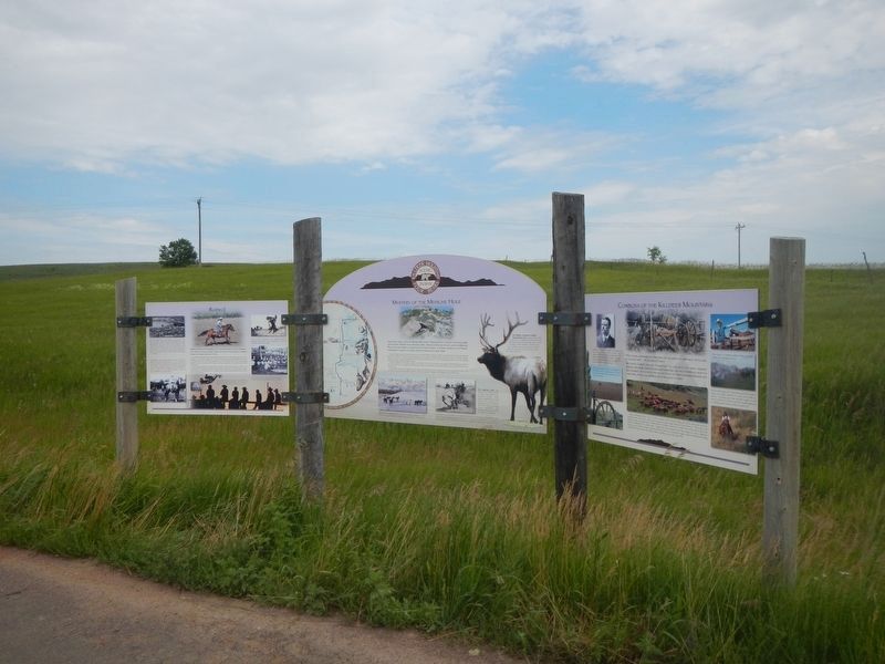
4. Mountain of the Medicine Hole Marker
Credits. This page was last revised on July 31, 2024. It was originally submitted on July 31, 2024, by Barry Swackhamer of Brentwood, California. This page has been viewed 600 times since then and 127 times this year. Photos: 1, 2, 3, 4. submitted on July 31, 2024, by Barry Swackhamer of Brentwood, California.
