Burt Township near Sullivans Landing in Alger County, Michigan — The American Midwest (Great Lakes)
Final Solution for a Long and Difficult Issue
Alger County Road H-58
Photographed by J. J. Prats, August 3, 2024
1. Final Solution for a Long and Difficult Issue Marker
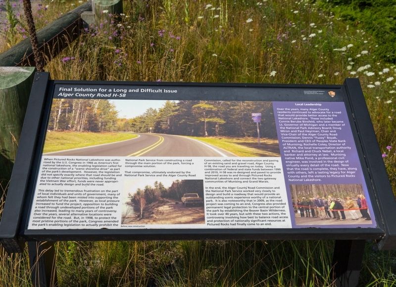
When Pictured Rocks National Lakeshore was authorized by the U.S. Congress in 1966 as America’s first national lakeshore, the enabling legislation called for the construction of a “scenic shoreline drive” as part of the park’s development. However, the legislation did not specify exactly where that road should be and due to other national priorities, including funding the Vietnam War effort, funds were never appropriated to actually design and build the road.
This delay led to tremendous frustration on the part of local individuals and units of government, many of whom felt they had been misled into supporting the establishment of the park. However, as local pressure increased to fund the project, opposition to building a road through undeveloped portions of the park also increased, leading to many years of controversy. Over the years, several alternative locations were considered for the road. But, in 1998, to protect the most pristine portions of the park, Congress amended the park’s enabling legislation to actually prohibit the National Park Service from constructing a road through the main portion of the park, forcing a compromise solution.
That compromise, ultimately endorsed by the National Park Service and the Alger County Road Commission, called for the reconstruction and paving of an existing sand and gravel road, Alger County H-58, the road you are traveling on today. Using a combination of federal and state funds between 1990 and 2010, H-58 was re-designed and paved to provide improved access to and through Pictured Rocks National Lakeshore and connect the two gateway communities
this page online
In the end, the Alger County Road Commission and the National Park Service worked very closely to design and build a roadway that would provide an outstanding scenic experience worthy of a national park, it is also noteworthy that in 2009, as the road project was coming to an end, Congress also provided permanent legal protection to the central portion of the park by establishing the Beaver Basin Wilderness. It took over 40 years, but with these two actions, the controversy involving how best to balance road access and protection of nationally significant resources at Pictured Rocks had finally come to an end.
(sidebar)
Local Leadership. Over the years, many Alger County residents continued to advocate for a road that would provide better access to the National Lakeshore. These included Connie Berube Binsfeld, who later became Lt. Governor of Michigan and a member of the National Park Advisory Board; Doug Miron and Paul Heyman, Chair and Vice-Chair of the Alger County Road Commission; Dennis “Fuzzy” Boyak, President and CEO of Peoples State Bank of Munising; Rochelle Cotey, Director of ALTRAN, the local transportation authority; and Richard and Chuck Nebel, a local banker and attorney at law. Munising native Mike Pond, a professional civil engineer, was involved in the design of virtually every detail of the road. Now that the road is complete, they have, along with others, left a lasting legacy for Alger County and the visitors to Pictured Rocks National Lakeshore.
Erected by Pictured Rocks National Lakeshore, National Park Service, U.S. Department of
Photographed by J. J. Prats, August 3, 2024
2. Final Solution for a Long and Difficult Issue Marker
Topics. This historical marker is listed in these topic lists: Environment • Parks & Recreational Areas • Roads & Vehicles. A significant historical year for this entry is 1966.
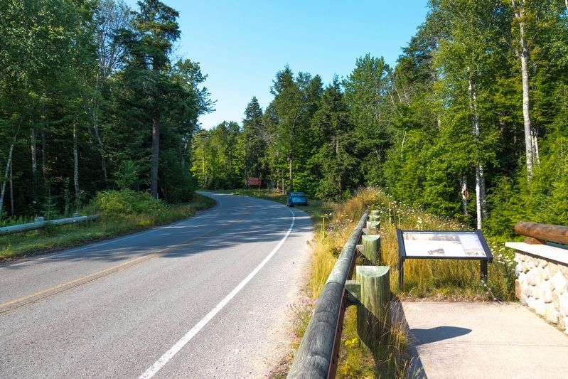
Location. 46° 39.81′ N, 86° 9.997′ W. Marker is near Sullivans Landing, Michigan, in Alger County. It is in Burt Township. It is on Au Sable Point Trail (County Road H-58) 1.9 miles east of Sullivans Landing, on the left when traveling east. It is on the bridge over the Hurricane River, next to the Hurricane River Campground parking lot. Touch for map. Marker is in this post office area: Grand Marais MI 49839, United States of America. Touch for directions.

Regionally, this marker is on the Upper Peninsula. It is also in the American Midwest and on Lake Superior’s South Shore Region. Globally, it is in North America, in the Great North Woods, on the Great Lakes, in the Western Hemisphere, in the Western World, and in the Anglosphere. Historically, it finds itself in what was once the Northwest Territory.
Other nearby markers. At least 7 other markers are within 9 miles of this marker, measured as the crow flies: Tools of the Trade (approx. 2.8 miles away); Cabin in the Clearing (approx. 2.8 miles away); Pickle Barrel House / The Teenie Weenies (approx. 8.7 miles away); Grand Marais Greenspace (approx. 8.7 miles away); In Honor of Our Country’s Defenders (approx. 8.7 miles away); Grand Marais (approx. 8.7 miles away); Bay Shore Park Anchor (approx. 8.7 miles away).
More about this marker. The marker faces westbound traffic, so it is difficult to spot when traveling east. Stop at the parking lot and use the sidewalk
By Nakor (CC BY-SA 3.0) via Wikimedia Commons, August 29, 2008
3. Grand Portal at Pictured Rocks National Lakeshore
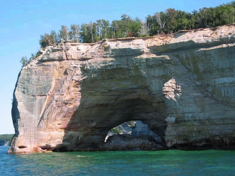
Road H-58 has made access to various points on the shore of this picturesque national park more safe and pleasant without marring views from the water as it is sited well away from the shoreline.
Also see . . . Pictured Rocks National Lakeshore. Excerpt:
Pictured Rocks National Lakeshore is a U.S. National Lakeshore in the Upper Peninsula of Michigan, United States. It extends for 42 mi along the shore of Lake Superior and covers 73,236 acres (114 sq mi.). The park has extensive views of the hilly shoreline between Munising and Grand Marais in Alger County, with picturesque rock formations, waterfalls, and sand dunes.(Submitted on August 11, 2024.)
Pictured Rocks derives its name from the 13 miles of colorful sandstone cliffs northeast of Munising. The cliffs reach up to 200 feet above lake level. They have been naturally sculptured into a variety of shallow caves, arches, and formations resembling castle turrets and human profiles.
Credits. This page was last revised on January 9, 2026. It was originally submitted on August 11, 2024, by J. J. Prats of Powell, Ohio. This page has been viewed 442 times since then and 60 times this year. Photos: 1, 2, 3. submitted on August 11, 2024, by J. J. Prats of Powell, Ohio.
