Whitefish Dunes State Park in Sturgeon Bay in Door County, Wisconsin — The American Midwest (Great Lakes)
The Other Side of the Dunes

Photographed by Sean Flynn, August 9, 2024
1. The Other Side of the Dunes Marker
Long ago, when Lake Michigan was much higher, the dunes in front of you were being formed along its ancient shoreline. As the lake level dropped, new sand dunes formed in front of these and so on and so on. The new dunes in the front row are called foredunes. These older dunes in the back rows are called backdunes. Because backdunes are shielded from strong winds by the foredunes, plants can grow on them more easily. Over time, forests take over making the backdunes look like regular hills.
"A gust of wind lifted a spray of sand and danced it across the dunes."
–Tui T. Sutherland
Ecological Succession
Ecological succession is the process by which species and habitat in an area changes over time. Whitefish Dunes State Park is a unique area to experience all stages of ecological succession from shoreline to pioneer species then thru intermediate species, and finally to climax forest.
How are dunes formed?
As
this page online
Topics. This historical marker is listed in these topic lists: Horticulture & Forestry • Parks & Recreational Areas • Science & Medicine • Waterways & Vessels.
Location. 44° 55.674′ N, 87° 10.959′ W. Marker is in Sturgeon Bay, Wisconsin, in Door County. It is in Whitefish Dunes State Park. It is on Clark Lake Road south of Cave Point Road, on the right. The marker is near the end of the Yellow/Green Trail, not far from the Nature Center and the main entrance to Whitefish Dunes State Park. Touch for map. Marker is at or near this postal address: 3275 Clark Lake Road, Sturgeon Bay WI 54235, United States of America. Touch for directions.

Regionally, this marker is on the Door Peninsula. It is also in the American Midwest and in the Corn Belt. Globally, it is in North America, on the Great Lakes, in the Western Hemisphere, in the Western World, and in

Photographed by Sean Flynn, August 9, 2024
2. The Other Side of the Dunes Marker
A view of the marker and the Green/Yellow Trail as it heads north away from the Nature Center and the park's main entrance.
Other nearby markers. At least 8 other markers are within walking distance of this marker: Whitefish Dunes State Park (about 300 feet away, measured in a direct line); Shipwrecks Tell Stories (about 500 feet away); From Wind to Steam (about 500 feet away); Why Do Ships Wreck? (about 500 feet away); Ship's Skeleton (about 600 feet away); Anchors Aweigh! (about 600 feet away); Scow Schooner Ocean Wave (about 600 feet away); Sailing Straight and Strong (about 600 feet away). Touch for a list and map of all markers in Sturgeon Bay.
Also see . . . Whitefish Dunes geology. From the Wisconsin Department of Natural Resources
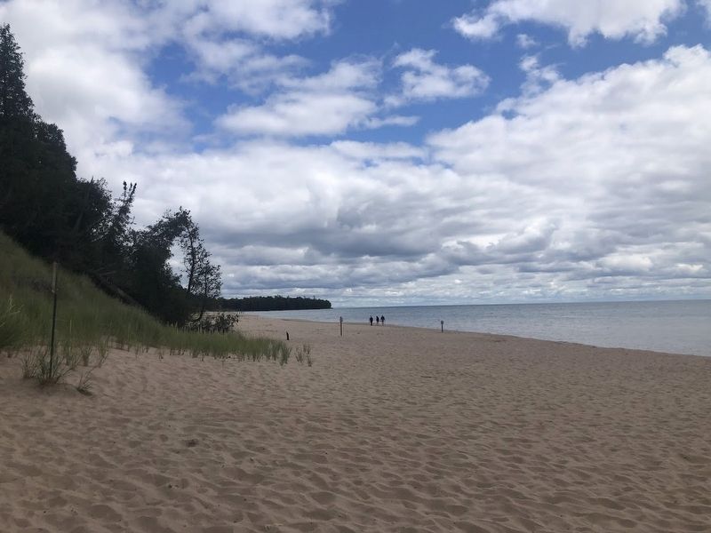
Excerpt: "Over thousands of years, accumulating sand has closed off Clark Bay to create Whitefish Dunes and Clark Lake. The formation of the dunes and the closing of Clark Bay took a long time. About 5,000 years ago, Cave Point defined the bay. When water levels rose, the point was submerged but remained as a sand bar. This slowed down water currents, causing the sand(Submitted on August 12, 2024, by Sean P. Flynn of Oak Park, Illinois.)that water carried to deposit southwest of the point. When the water began to recede, the first bits of what would become the dunes peeked above the lake level. Since, they have continued to grow, eventually closing the bay and forming what we know today as Whitefish Dunes."Photographed by Sean Flynn, August 9, 20243. Whitefish DunesThe high dunes can be seen on the left, overlooking the Whitefish Dunes beach and Lake Michigan.
Credits. This page was last revised on August 12, 2024. It was originally submitted on August 12, 2024, by Sean P. Flynn of Oak Park, Illinois. This page has been viewed 138 times since then and 17 times this year. Photos: 1, 2, 3. submitted on August 12, 2024, by Sean P. Flynn of Oak Park, Illinois.
