Liberty Grove in Ellison Bay in Door County, Wisconsin — The American Midwest (Great Lakes)
This Is Karst Country
Caves by Land and Sea

Photographed by Sean Flynn, August 10, 2024
1. This Is Karst Country Marker
The Niagara Escarpment, a high limestone ridge along Green Bay, tilts at a 6-degree angle toward Lake Michigan where it disappears under water. This limestone is easily dissolved by acidic rainwater. The resulting karst topography is defined by sinkholes, disappearing streams, caves, and springs. Since water rushes through Door County's thin soils and fissured bedrock nearly unfiltered, special efforts must be taken to prevent groundwater contamination.
Dissolution Caves
Door County has some of the state's best examples of dissolution caves Horseshoe Bay Cave near Egg Harbor is the second longest cave in Wisconsin. It formed as slightly acidic water ran through rock fissures and slowly dissolved the stone into chambers.
Sea Caves
Sea caves form in limestone cliffs when waves work away at faults and weak areas. Some caves are perched high above Green Bay where ancient lakes levels were 30 feet higher than they are in today's Great Lakes.
[Caption for first photo:]
A flowstone formation in Horseshoe Bay Cave.
[Caption for second photo:]
Lake Michigan waves are still eroding sea caves at Cave Point County Park.
[Caption for third photo:]
This sea cave in Peninsula State Park, shown here circa 1920, has attracted generations of tourists.
[Caption for bottom photo:]
Eagle Bluff in Peninsula State Park features a sea cave formed more than 5,000 years ago when lake levels were much higher.
Erected by Door
this page online
Topics and series. This historical marker is listed in these topic lists: Environment • Parks & Recreational Areas • Science & Medicine. In addition, it is included in the Door County Coastal Byway (Wisconsin) series list.
Location. 45° 14.88′ N, 87° 5.095′ W. Marker is in Ellison Bay, Wisconsin, in Door County. It is in Liberty Grove. It is on State Highway 42 0.1 miles south of Humbug Road, on the left when traveling north. This set of markers is on the northeastern edge of the Liberty Grove Historical Society. Touch for map. Marker is at or near this postal address: 11831 Wisconsin 42, Ellison Bay WI 54210, United States of America. Touch for directions.

Regionally,

Photographed by Sean Flynn, August 9, 2024
2. This Is Karst Country Marker
Other nearby markers. At least 8 other markers are within walking distance of this marker: A Grand View (here, next to this marker); Ecological Treasures (here, next to this marker); Meet Gunnar (here, next to this marker); Bead Breaker and Tire Changer (a few steps from this marker); Outhouse (a few steps from this marker); Platform Swing (within shouting distance of this marker); Corn Crib (within shouting distance of this marker); Rowleys Bay Bell
Photographed by Sean Flynn, August 9, 2024
3. Door County Coastal Byway
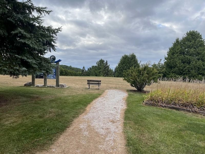
The walkway from the Liberty Grove Historical Society grounds to the Door County Coastal Byway experience hub that sits on its northern end. The background of the photo is the bluff that overlooks Ellison Bay.
More about this marker. This marker is next to two others describing the history of the area and another about the Door County Land Trust, a local preservation group.
About 10 additional Coastal Byway "experience hubs" can be found across Door County along the 66-mile loop including highways 57 and 42. One more easily spotted set of markers can be found here at the Liberty Grove Historical Society, about a ¼ mile south of this marker, next to the driveway into the parking lot.
Also see . . .
1. Door County Coastal Byway. The official site for the Door County Coastal Byway, a 66-mile loop that travels from Northport at the tip of Door County to the intersection of highways 57 and 42 north of

Photographed by Sean Flynn, August 9, 2024
4. Door County Land Trust
The experience hub at Liberty Grove includes a sign about the Door County Land Trust and the properties in Door County that it has preserved.
2. Karst Landscapes. A description of karst from the National Park Service (Submitted on August 14, 2024, by Sean P. Flynn of Oak Park, Illinois.)
Credits. This page was last revised on August 15, 2024. It was originally submitted on August 14, 2024, by Sean P. Flynn of Oak Park, Illinois. This page has been viewed 220 times since then and 28 times this year. Photos: 1, 2, 3, 4. submitted on August 14, 2024, by Sean P. Flynn of Oak Park, Illinois.
