
Near Stafford in Stafford County, Virginia — The American South (Mid-Atlantic)
Ebenezer Cemetery
Photographed by Kevin W., September 14, 2007
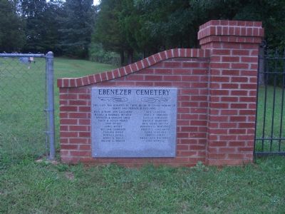
1. Ebenezer Cemetery Marker (Left Brickwork)
(Left Gate Structure)
This gate was donated by those below in loving memory of family and friends buried here.
Billy & Mary Ann Gallahan, Jack Garrison, Russell & Barbara Decatur, James T Edwards, Kenneth & Darlene Davis, Lucille Ferguson, David & Susan Pierce, Edith F. Harrison, John Myers, Rose Marie Miller, James Myers, Barbara G. Moriarty, William Garrison, Ernest L. Gallahan, Thelria Roles, Lynda Flatford, Patricia Ozols, Shirley Emery, Agnes A. Mills, Emma Jane Matthews, Wilson G. Freeze, John Kidwell
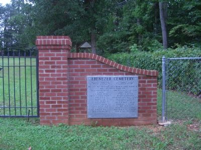
(Right Gate Structure)
This gate was donated by those below in loving memory of family and friends buried here.
Joe & Barbara Duffey, Troy & Annette Lancaster, JD Moore, Mary Johnson, Jo D. Knight Moore,Clarice V. Watson, Rusty & Bonnie Knight, Phyllis S. Dahlgren, Mary S. Cloe, Katherine G. Liebenow, Jessie Holmes, Maria E. Spence, Nanoy F. King, Willie & Grace L. Griffis, Stella S. Fritter, Lindburgh A. Fritter, Chuck Bartholomew, Bob Coffman, Pat D. Bartholomew, Becky Duffey Coffman, Gene & Myrna Kniseley, Rodger & Betty Anderson, Rick & Lisa Butler, Tony & Ann Digennaro
Erected by Family
this page online
Topics. This historical marker is listed in these topic lists: Cemeteries & Burial Sites • Colonial Era • Religion & Religious Structures • War, US Civil.
Location. 38° 29.06′ N, 77° 25.622′ W. Marker is near Stafford, Virginia, in Stafford County. It is on Onville Road 0.1 miles south of Ebenezer Church Road, on the right when traveling north. Touch for map. Marker is at or near this postal address: 168 Onville Road, Stafford VA 22556, United States of America. Touch for directions.

Regionally, this marker is in the Washington Metropolitan Area, in Northern Virginia, and in the Piedmont. It is also in the American South, specifically in the Upper South, in the Mid-Atlantic, and on the Eastern Seaboard. Globally, it is in the North Atlantic Region, North America, the Western Hemisphere, the Western World, and the Anglosphere. Historically, it finds itself in what was once the territory of the Mississippian Culture, one of the original Thirteen Colonies, one of the Confederate States of America, and the Antebellum South.
Photographed by Kevin W., September 14, 2007
2. Ebenezer Cemetery Marker (Right Brickwork)
Other nearby markers. At least 8 other markers are within 2 miles of this marker, measured as the crow flies: In the Beginning (approx. one mile away); Austin Hall (approx. one mile away); Growth of Training (approx. one mile away); A Period of Firsts (approx. one mile away); An Established Front (approx. 1.1 miles away); Raider Hall (approx. 1.1 miles away); Ray Hall (approx. 1.2 miles away); Gonzalez Hall (approx. 1.2 miles away).
Another marker is no longer nearby. F/A – 18A Hornet (was approx. 1.2 miles away but has been confirmed missing).
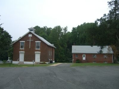
Regarding Ebenezer Cemetery. The church was built in 1856 using bricks made in a field adjacent to it. It was one of the first churches to be in ministry to the Stafford community. The building was built on donated land which is now at the corner of Onville Road and Ebenezer Church Road. The Church was given the name “Ebenezer” in reference to the Bible passage of 1 Samuel where the army of God’s People were victorious in battle. The name “Ebenezer” means “God is our Rock of Help.”
During the Civil War, Union soldiers burned the floors, broke the windows, defaced the walls, and
Photographed by Kevin W., September 14, 2007
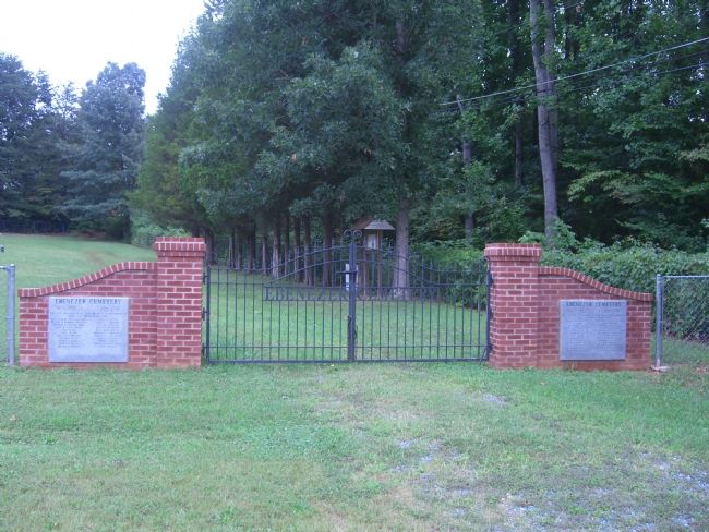
3. Entrance Gate to Ebenezer Cemetery
Photographed by Kevin W., September 14, 2007
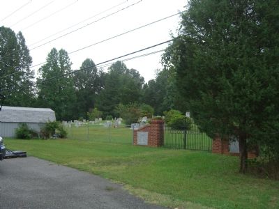
4. Ebenezer Cemetery and Gate
Photographed by Kevin W., September 14, 2007
5. Ebenezer Church and Memorial Hall
Photographed by Kevin W., September 14, 2007
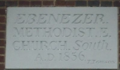
6. Ebenezer Church Marker (Near roof peak on front of church)
Methodist. E.
Church. South.
A.D. 1856
J. Johnson
Photographed by Kevin W., September 14, 2007
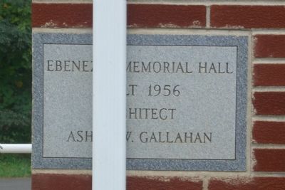
7. Ebenezer Memorial Hall Marker
Built 1956
Architect
Ashby W. Gallahan
Photographed by Kevin W., September 14, 2007
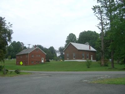
8. Ebenezer Church - Rear View
Credits. This page was last revised on July 9, 2021. It was originally submitted on September 17, 2007, by Kevin W. of Stafford, Virginia. This page has been viewed 2,242 times since then and 48 times this year. Photos: 1, 2, 3, 4, 5, 6, 7, 8. submitted on September 17, 2007, by Kevin W. of Stafford, Virginia. • J. J. Prats was the editor who published this page.
