
Near Battlefield in Greene County, Missouri — The American Midwest (Upper Plains)
Morning Disrupted
Wilson's Creek National Battlefield
| — | National Park Service, U.S. Department of the Interior | — |
Photographed by Jason Armstrong, July 30, 2023
1. Morning Disrupted Marker
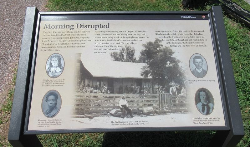
According to Olivia Ray, at 6 a.m. August 10, 1861, her sister Livonia and brother Wesley were herding their horses in the valley south of the springhouse (across the Tour Road). Suddenly a Confederate soldier rode up on horseback and said, "Get out of here, children! They'll be fighting like hell here in less than ten minutes."
As troops advanced over the horizon, Roxanna and Rhoda took the children into the cellar. John Ray stayed on the front porch to watch the battle in his cornfield. Although cannon rounds landed in the backyard, the house sustained no damage and the Rays were unharmed.
(captions)
(Top Left) Olivia Ray was 6 years old on the day of the battle. Her memories are the basis of this family's story. Shown here as a young woman.
(Bottom Left) Rhoda never forgot the battle and the many dreadful sights she and her children saw that day. Shown here later in life.
(Center) The Ray House circa 1883. The Rays lived in this house until their deaths in the 1870s.
(Top Right) Wesley Ray shown here as a young man.
(Bottom Right) Livonia Ray helped haul water for wounded soldiers after the battle. Shown here later in life.
Erected by National
this page online
Topics. This historical marker is listed in these topic lists: Parks & Recreational Areas • War, US Civil • Women. A significant historical date for this entry is August 10, 1861.
Location. 37° 6.427′ N, 93° 23.873′ W. Marker is near Battlefield, Missouri, in Greene County. It can be reached from Wilson Creek National Battlefield Tour Road 2 miles east of Missouri Highway ZZ, on the left when traveling south. This marker is located at the Ray House (Tour Stop 2). Touch for map. Marker is at or near this postal address: 6424 W Farm Rd 182, Brookline MO 65619, United States of America. Touch for directions.

Regionally, this marker is in Greater Springfield. It is also in the American Ozarks, in the Lewis & Clark Corridor, and in the Corn Belt. Globally, it is in North America, the Western Hemisphere, the Western World, and the Anglosphere. Historically, it finds itself in what was once the territory of the Mississippian Culture, the Louisiana Purchase, and the Antebellum South.
Other nearby markers. At least 8 other markers are within walking distance of this marker: The Ray Family
Photographed by Jason Armstrong, July 30, 2023
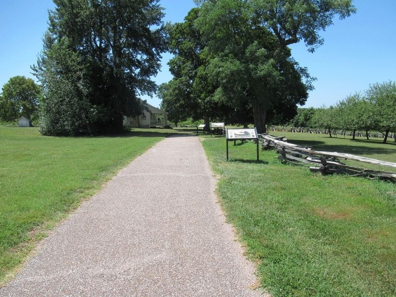
2. Walkway from Parking area to Ray House
Also see . . . Wilson's Creek National Battlefield. National Park Service (Submitted on August 31, 2024.)

Photographed by Jason Armstrong, July 30, 2023
3. Ray House
Credits. This page was last revised on August 31, 2024. It was originally submitted on August 30, 2024, by Jason Armstrong of Talihina, Oklahoma. This page has been viewed 172 times since then and 18 times this year. Photos: 1, 2, 3. submitted on August 30, 2024, by Jason Armstrong of Talihina, Oklahoma. • Bernard Fisher was the editor who published this page.
