
Anastasia in St. Augustine in St. Johns County, Florida — The American South (South Atlantic)
Juan Ponce de León - The 1513 Voyage of Discovery

Photographed by Craig Doda, September 1, 2024
1. Juan Ponce de León - The 1513 Voyage of Discovery Marker
Indian Slaves on Española were dying off; the Spaniards needed this free labor force and raided the Lucayan Islands (the Bahamas and Turks & Caicos Islands) for more Taino Indian slaves. Between 1509 and 1512 the islands were almost completely depopulated.
During this period of Spanish slave raids, Florida was first discovered by Diego Miruelo, a pilot whose ship was driven north by a storm. The crew of the lost ship took no captives and engaged in friendly trade only. However, the crew of the next ship, after making friends with the Florida Indians, invited them aboard their ship. After luring them below deck the Spaniards closed the hatches and sailed back to Española with the captives. This chance discovery and the beginning of slave raids in Florida were critical factors in Ponce's 1513 voyage of discovery to Florida.
Ponce's Log Books: Lost to History
What we know about Ponce de León's voyage to La Florida comes to us from the writings of Antonio de Herrera y Tordesillas, who in the early res compiled the Descripción De Las Indias Ocidentales, part of an enormous encyclopedic
this page online
The Voyage to La Florida
As a result of the lawsuit brought by Diego Columbus, the King had to remove Ponce de León from the governorship of Puerto Rico. However, he wanted to reward Ponce for his excellent service and place him where his loyalty to the Spanish crown would be of benefit. Consequently the King instructed Ponce de León to mount a voyage of exploration and discovery to the north where slavers had found a new land.
Juan Ponce de León prepared for his expedition in the port of Salvaleón de Higuey on Española in January of 1513. The caravels Santiago and Santa María de la Consolación sailed to the port of San Germán on the west coast of Puerto Rico in early February where they were joined by a third caravel, the San Cristóbal.
In San Germán the small fleet took three weeks to prepare for the voyage of exploration, departing March 4th, 1513. Sailing northwest by north they raised the Lucayan Islands on March 8th. These islands
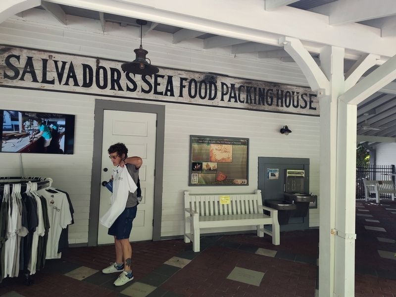
Photographed by Craig Doda, September 1, 2024
2. Juan Ponce de León - The 1513 Voyage of Discovery Marker
Departing Guanahani, the fleet steered to the northwest. On Easter Sunday, March 27th, 1513, land believed to be an island was sighted. This was the first sighting of the east coast of Florida by Juan Ponce de León. The fleet sailed to the north along the coast for a few days before running into a storm April 1st.
When the weather cleared April 2nd, the fleet approached shore and the fleet's pilot, Antón Alaminos, made a noon observation of the sun using either a quadrant or astrolabe. The height of the sun above the horizon was then combined with information from tables of declination of the sun to arrive at a latitude reading of 30 degrees 8 minutes north. This latitude reading defined the fleet's position north of the equator. This line of latitude lies a short distance to the north of St. Augustine in the vicinity of South Ponte Vedra.
After taking the noon observation of the sun near present day St. Augustine on April 2nd, the fleet began looking for a good anchorage. They anchored offshore that evening in 48 feet of water and went ashore the next morning to claim the land for Spain. Juan Ponce de León named the new land La Florida because of its lushness and its discovery during the time of Easter. After landing on April 3rd, 1513, the Spanish remained in the area for five days. There is no record of where they went or what they did during this time but it is possible that they ranged inland as well as north and south along the coast. Departing, they sailed north along the coast for one day before turning south.
Clearing the Florida Keys, the fleet sailed to the north and northeast making the west coast of Florida on May 23rd, 1513. Here they encountered a Florida Indian tribe called the Calusa. The Spanish noticed that the Calusa Indians of West Florida had guanines, body ornaments made of low grade gold. They traded for these as well as animal hides. A number of interactions with the Calusa were violent and at least one Spaniard was killed. They departed West Florida on the 15th of June and began the return journey east to Puerto Rico where Juan Ponce de León arrived in the middle of October of 1513, having been away at sea for some seven and a half months.
(Captions)
Florida's coastline is visible at the center top of the 1511 Peter Martyr Map, labelled as "illa de beimeni" - the writing is rotated upside down on the Martyr map. To the left, it is rotated to read correctly.
Model of the Santa Maria de la Consolación.
A trio of typical 16th century caravels, featuring a mix of square and lateen (triangular) sails.
A quadrant was used to help early navigators determine latitude. Equipped with these and other instruments, sailors from Spain and Portugal set forth to the New World.
Topics. This historical marker is listed in these topic lists: Colonial Era • Exploration • Indigenous Peoples and Communities • Waterways & Vessels. A significant historical year for this entry is 1513.
Location. 29° 53.097′ N, 81° 17.286′ W. Marker is in St. Augustine, Florida, in St. Johns County. It is in Anastasia. It can be reached from the intersection of Red Cox Drive and Ocean Vista Avenue, on the right when traveling south. Mounted on the back wall of the Visitors Center. Touch for map. Marker is at or near this postal address: 100 Red Cox Dr, Saint Augustine FL 32080, United States of America. Touch for directions.

Regionally, this marker is in First Coast and in Greater Jacksonville. It is also in the American South. Globally, it is in the North Atlantic Region, North America, a Gulf of Mexico state, the Western Hemisphere, the Western World, and the Anglosphere. Historically, it finds itself in what was once New Spain, the territory of the Mississippian Culture, one of the Confederate States of America, and the Antebellum South.
Other nearby markers. At least 8 other markers are within walking distance of this marker: A Historical Comparison (here, next to this marker); Historic Small Craft (here, next to this marker); St. Augustine Dugout Canoe (here, next to this marker); History of Dugout Canoes (a few steps from this marker); Discover Four Authentic Experiences (a few steps from this marker); Juan Ponce de León - Adelantado and the Final Voyage to Florida (a few steps from this marker); Bevin's Skiff (a few steps from this marker); Discover... Four Authentic Experiences (within shouting distance of this marker). Touch for a list and map of all markers in St. Augustine.
Credits. This page was last revised on September 5, 2024. It was originally submitted on September 5, 2024, by Craig Doda of Napoleon, Ohio. This page has been viewed 403 times since then and 64 times this year. Photos: 1, 2. submitted on September 5, 2024, by Craig Doda of Napoleon, Ohio. • Bernard Fisher was the editor who published this page.
