
Near Yorktown in York County, Virginia — The American South (Mid-Atlantic)
Indian Field Creek
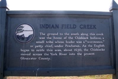
Photographed by Bernard Fisher, December 21, 2009
1. Indian Field Creek Marker
Topics. This historical marker is listed in these topic lists: Colonial Era • Indigenous Peoples and Communities • Settlements & Settlers. A significant historical year for this entry is 1630.
Location. 37° 16.095′ N, 76° 33.364′ W. Marker is near Yorktown, Virginia, in York County. It can be reached from Colonial National Historic Parkway 0.8 miles west of Mason Row, on the left when traveling west. Touch for map. Marker is in this post office area: Yorktown VA 23691, United States of America. Touch for directions.

Regionally, this marker is on Virginia’s Peninsula, in Coastal Virginia, and in the Hampton Roads Metropolitan Area. It is also in the American South, specifically in the Upper South, in the Tidewater, and on the Eastern Seaboard. Globally, it is in the North Atlantic Region, North America, the Western Hemisphere,
this page online
Other nearby markers. At least 8 other markers are within 3 miles of this marker, measured as the crow flies: Powhatan's Village (about 500 feet away, measured in a direct line); York River (approx. 0.9 miles away); Naval Weapons Station (approx. 1.3 miles away); Bellfield Plantation (approx. 1.3 miles away); Cheatham Annex (approx. 1.4 miles away); Nathaniel Bacon (approx. 1.6 miles away); Ringfield Plantation (approx. 1.6 miles away); Powhatan’s Chimney (approx. 2.1 miles away). Touch for a list and map of all markers in Yorktown.
Also see . . . Colonial Parkway. Colonial National Historical Park (Submitted on December 24, 2009.)
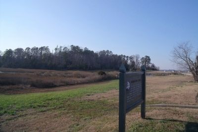
Photographed by Bernard Fisher, December 21, 2009
2. Indian Field Creek
Credits. This page was last revised on November 14, 2021. It was originally submitted on December 24, 2009, by Bernard Fisher of Richmond, Virginia. This page has been viewed 2,299 times since then and 79 times this year. Photos: 1, 2. submitted on December 24, 2009, by Bernard Fisher of Richmond, Virginia.
