New Edinburgh in Ottawa, Ontario — Central Canada (North America)
Canada's Discovery Route/La voie de la découverte du Canada
Photographed by William Fischer, Jr., October 12, 2024
1. Canada's Discovery Route/La voie de la découverte du Canada Marker

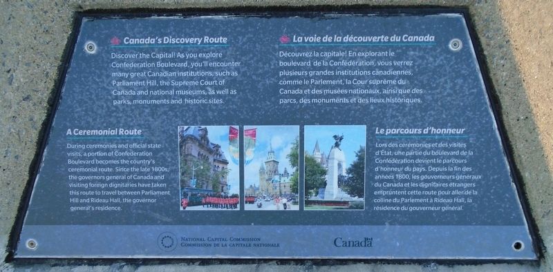
Canada's Discovery Route
Discover the Capital! As you explore Confederation Boulevard, you'll encounter many great Canadian institutions, such as Parliament Hill, the Supreme Court of Canada and national museums, as well as parks, monuments and historic sites.
A Ceremonial Route
During ceremonies and official state visits, a portion of Confederation Boulevard becomes the country's ceremonial route. Since the late 1800s, the governors general of Canada and visiting foreign dignitaries have taken this route to travel between Parliament Hill and Rideau Hall, the governor general's residence.
Découvrez la capitale! En explorant le boulevard de la Confédération, vous verrez plusieurs grandes institutions canadiennes, comme le Parlement, la Cour suprême du Canada et des musées nationaux, ainsi que des parcs, des monuments et des lieux historiques.
Le parcours d'honneur
Lors des cérémonies et des visites d'Etat, une partie du boulevard de la Confédération devient le parcours d'honneur du pays. Depuis la fin des années 1800, les gouverneurs généraux du Canada et les dignitaires
this page online
Erected by National Capital Commission/Commission de la Capitale nationale.
Topics. This historical marker is listed in these topic lists: Arts, Letters, Music • Entertainment • Parks & Recreational Areas • Roads & Vehicles. A significant historical year for this entry is 1880.
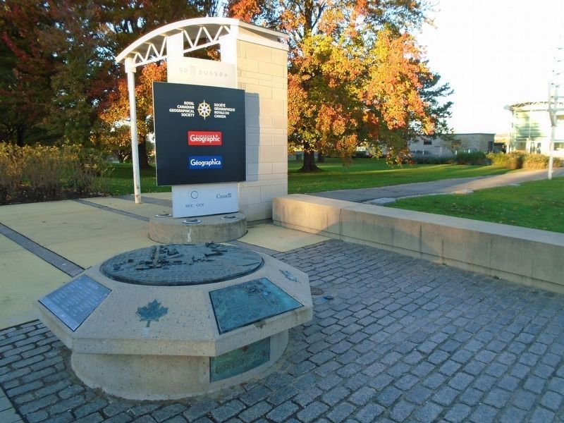
Location. 45° 26.519′ N, 75° 41.669′ W. Marker is in Ottawa, Ontario. It is in New Edinburgh. It is at the intersection of Sussex Drive (County Highway 93) and Stanley Avenue, on the left when traveling north on Sussex Drive. Marker and relief are in Rideau Falls Park. Touch for map. Marker is at or near this postal address: 50 Sussex Drive, Ottawa ON K1M 2K1, Canada. Touch for directions.

Regionally, this marker is in Eastern Ontario. It is also in Central Canada. Globally, it is in North America, the Western Hemisphere, the Western World, and the Anglosphere. Historically, it finds itself in what was once a British colony, the Viceroyalty of New France, the Haudenosaunee (Iroquois) Confederacy, and Rupert’s
Photographed by William Fischer, Jr., October 12, 2024
2. Canada's Discovery Route/La voie de la découverte du Canada Marker
Other nearby markers. At least 8 other markers are within walking distance of this marker: Ten Years of Democracy in South Africa (within shouting distance of this marker); Iznik Tiles/Céramique d'Iznik (within shouting distance of this marker); CANLOAN Memorial (within shouting distance of this marker); Reflection/Réflexion (within shouting distance of this marker); The International Peace Garden/Le Jardin International de la Paix (within shouting distance of this marker); Thomas McKay 1792-1855 (about 120 meters away, measured in a direct line); New Edinburgh's First School/Première école de New Edinburgh (about 120 meters away); Fraser Schoolhouse/
Related marker. Click here for another marker that is related to this marker.
Also see . . . Confederation Boulevard. (Submitted on October 13, 2024, by William Fischer, Jr. of Reynoldsburg, Ohio.)
Photographed by William Fischer, Jr., October 12, 2024
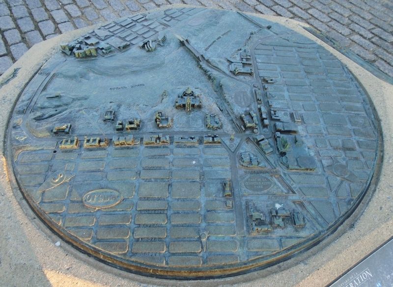
3. Canada's Discovery Route/La voie de la découverte du Canada Relief
Credits. This page was last revised on October 13, 2024. It was originally submitted on October 13, 2024, by William Fischer, Jr. of Reynoldsburg, Ohio. This page has been viewed 169 times since then and 14 times this year. Photos: 1, 2, 3. submitted on October 13, 2024, by William Fischer, Jr. of Reynoldsburg, Ohio.
