
Highland Park in Saint Paul in Ramsey County, Minnesota — The American Midwest (Upper Plains)
Two Rivers Overlook
The Confluence of the Mississippi and Minnesota Rivers
Photographed by McGhiever, October 11, 2024
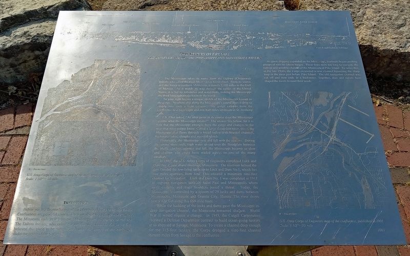
1. Two Rivers Overlook Marker
U.S. Army Corps of Engineers map of the confluence, published in 1896.
Scale: 1 1/2" = 1/2 mile
Below you lies the confluence of the Mississippi and Minnesota Rivers. Confluences are powerful places. They are about beginnings and endings. The Minnesota ends as it joins the Mississippi on its journey to the sea. The Dakota Indians, who called the confluence Ma-ko-ce Co-ka-ya Kin, believed this place to be "immediately over the center of the earth and under the center of the heavens."
The Mississippi takes its name from the Ojibwe (Chippewa) Indians who called the river Missi Sipi or Great River. From its source in Lake Itasca in northern Minnesota, it travels 2,350 miles to the Gulf of Mexico. As it wends it way through the center of the United States, it is fed by tributaries and watersheds, making the Mississippi the third largest drainage basin in the world.
To your right begins a unique stretch of the Mississippi known as the gorge. Nowhere else along the Mississippi's course does it drop so deeply into such a tight canyon. The gorge extends from the confluence to a point eight and one-half
this page online
T.S. Eliot asked, "At what point in its course does the Mississippi become what the Mississippi means?" The answer lies below, for it is here that the Mississippi emerges from the gorge and changes to the river that most people know. Called a large floodplain river, this is the Mississippi that flows through abroad valley with braided channels, backwater lakes, sloughs and wooded islands.
Historically, the Mississippi rose and fell with the seasons. During the spring snow melt, high water spread over the floodplain between the bluffs. In late summer and fall, the Mississippi became so slow and shallow you could have waded across on one of the many sandbars.
In 1930, the U.S. Army Corps of Engineers completed Lock and Dam No. 2, just above Hastings, Minnesota. The reservoir behind the dam flooded the low-lying lands up to Lock and Dom No, 1, which lies two miles upstream from here. This ensured a minimum nine-foot channel for navigation. Lock and Dam No. 1 was completed in 1918 to improve navigation between Saint Paul and Minneapolis where swift currents and huge boulders posed a threat.
Photographed by McGhiever, October 11, 2024
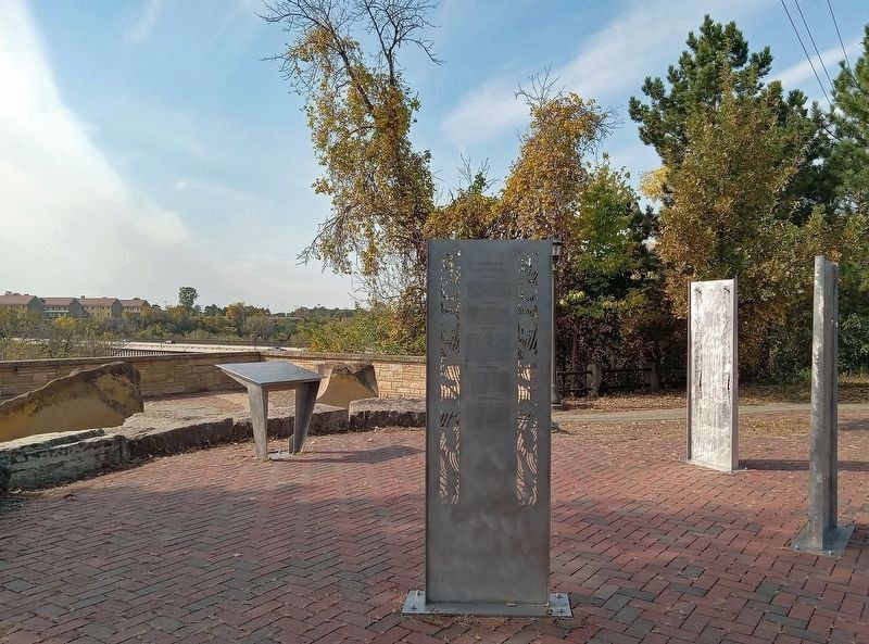
2. Two Rivers Overlook Marker (left, background) at the Two Rivers Overlook
While the building of the locks and dams gave the Mississippi its deep navigation channel, the Minnesota remained shallow. World War II would require a change. In 1943, the Cargill Corporation received a Defense Department contract to build ocean-going tankers at its shipyard at Savage, Minnesota. To create a channel deep enough for the 315-foot tankers, the Corps dredged a nine-foot channel thirteen miles from Savage to the confluence.
As grain shipping expanded on the Mississippi, towboats began pushing groups of nine to fifteen barges. These tows were too long to navigate the narrow and winding channel of the Minnesota at Pike Island. To solve this, in the late 1960s, the Corps excavated a new channel bypassing the sharp look in the river just before Pike Island. The old navigation channel was cut off and now ends in a backwater. Together, man and nature have shaped the rivers to meet their needs.
U.S. Army Corps of Engineers map of the confluence, published in 2001.
Scale: 1 1/2" = 1/2 mile
Erected 2005.
Topics. This historical marker is listed in these topic lists: Environment • Indigenous Peoples and Communities • War, World II • Waterways & Vessels.
Location. 44° 53.745′ N, 93° 10.72′ W. Marker is in Saint Paul, Minnesota, in Ramsey County. It is in Highland Park. It is at the intersection of Mississippi River Boulevard and Crosby Farm Road, on the right when traveling east on Mississippi River Boulevard. The marker is at the Two Rivers Overlook. Touch for map. Marker is at or near this postal address: 2711 Shepard Road, Saint Paul MN 55116, United States of America. Touch for directions.

Regionally, this marker is in the Twin Cities Metropolitan Area. It is also in the American Midwest, in the Corn Belt, and in the Great River Road Region. Globally, it is in North America, the Western Hemisphere, the Western World, and the Anglosphere. Historically, it finds itself in what was once Rupert’s Land, the territory of the Mississippian Culture, and the Louisiana Purchase.
Other nearby markers. At least 8 other markers are within walking distance of this marker: Settling the Frontier (here, next to this marker); The Lay of the Land (here, next to this marker); De Dakod Makoce Unkitawapi E E (here, next to this marker); Enlisted Barracks (approx. 0.2 miles away); Commanding Officer’s House (approx. 0.2 miles away); Officers’ Quarters (approx. ¼ mile away); Working Women of Fort Snelling (approx. ¼ mile away); The Sutler Store (approx. ¼ mile away). Touch for a list and map of all markers in Saint Paul.
Credits. This page was last revised on July 13, 2025. It was originally submitted on October 13, 2024, by McGhiever of Minneapolis, Minnesota. This page has been viewed 747 times since then and 138 times this year. Photos: 1. submitted on October 13, 2024, by McGhiever of Minneapolis, Minnesota. 2. submitted on October 12, 2024, by McGhiever of Minneapolis, Minnesota.
