Near Big Timber in Sweet Grass County, Montana — The American West (Mountains)
The Cattle Drive of 1866
(The First Cattle Drive on the Bozeman Trail)
| — | The Mysterious Death of John Bozeman | — |

Photographed by Barry Swackhamer, July 23, 2021
1. The Cattle Drive of 1866 Marker
In 1866, Nelson Story and two dozen cowboys drove six hundred longhorn cattle from Texas over 1400 miles to the Livingston area in Montana. The journey was an epic one, the stuff of countless Hollywood Westerns.
The Montana mining camps provided a lucrative market for those who "mined the miners." Although bison and local game was plentiful, the miners had a taste for beef and there were men willing to provide it to them. One of those, Nelson Story, had panned enough gold in the placer mines to invest in other economic pursuits, including provisioning the mining camps. In 1866, he purchased rangy Texas longhorns with the intent of driving them to Montana to sell in Virginia City. He and his hired hands left Fort Worth in the spring and began the long journey north.
On the way, they evaded toll collectors, outfoxed rustlers, and swam the cattle across flood-swollen streams - then the trouble really started. Story resolved to drive his cattle up the Bozeman Trail in central Wyoming. In 1866 the trail was hotly contested as the Lakota and Northern Cheyenne Indians defended their hunting grounds from the hundreds
this page online
Near the first post, Fort Reno, the Indians ran off many of Story's cattle. Not to be intimidated, Story and his men followed the Indians into the badlands and retrieved the animals after a short skirmish that left two of his cowboys wounded. When they neared Fort Phil Kearney, the post commander, Henry Carrington, made them camp three miles from the post. He didm't want the cattle to eat all the grass adjacent to the fort. Story cooled his heels for two weeks, waiting for Carrington's permission to push on. Eventually, he decided to go without the officer's consent.
Traveling by night and corralling the cattle during the day, the crew largely managed to avoid trouble with the Indians. When they reached the third post, Fort C.F. Smith, in Montana, the danger had passed. But they remained vigilant as they pushed up the Yellowstone Valley to near present Livingston, where Story established
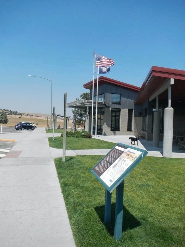
Photographed by Barry Swackhamer, July 23, 2021
2. The Cattle Drive of 1866 Marker
The Mysterious Death of John Bozeman
About thirty miles west of here on April 18, 1867, Blackfeet Indians allegedly shot and killed John Bozeman, the blazer of the Bozeman Trail and a founder of the city named for him. But is that what really happened?
Bozeman and Tom Cover hoped to secure four contracts with the military at Bozeman Trail forts. While stopped near the mouth of Mission Creek, several Indians approached the men's camp. Thinking they were Crow Indians, Bozeman waved them in. Too late did he realize they were Blackfeet, who opened fire killing Bozeman and wounding Cover. He returned fire, killing one of the Indians. The Blackfeet fled with the pair's horses. Cover made his way back up the Yellowstone River finding refuge in Nelson Story's cattle camp.
Cover's account of the incident widely varied and rumors persisted that he had shot Bozeman. Evidence at the site suggested there were no Indians. Strikingly handsome, Bozeman was a noted Beau Brummel with a reputation as a ladies' man. Could Bozeman have dallied with Clover's wife? The answer will never be known, so, the official story stands.
Erected by Montana Department of Transportation.
Topics. This historical marker is listed in these topic lists: Agriculture • Notable Events • Roads & Vehicles. A significant historical date for this entry is April 18, 1867.
Location. 45° 44.145′ N, 109° 45.378′ W. Marker is near Big Timber, Montana, in Sweet Grass County. It can be reached from Interstate 90 at milepost 377, on the right when traveling west. The marker is located at the westbound Greycliff Rest Area. Touch for map. Marker is in this post office area: Greycliff MT 59033, United States of America. Touch for directions.

Regionally, this marker is in Yellowstone Country. It is also in the American Mountain West and in the Lewis & Clark Corridor. Globally, it is in North America, the Rocky Mountains, the Western Hemisphere, the Western World, and the Anglosphere. Historically, it finds itself in what was once Rupert’s Land and also the Louisiana Purchase.
Other nearby markers. At least 8 other markers are within 2 miles of this marker, measured as the crow flies: Montana's Jurassic Park (here, next to this marker); The Crazy Mountains (original title obscured) (within shouting distance of this marker); The Crazy Mountains (within shouting distance of this marker); Captain Wm. Clark (within shouting distance of this marker); The Great Highway of the Northwest: The Yellowstone Trail (about 700 feet away, measured in a direct line); a different marker also named Montana's Jurassic Park (about 700 feet away); The Bozeman Trail (about 700 feet away); a different marker also named The Thomas Party (approx. 2 miles away). Touch for a list and map of all markers in Big Timber.
Another marker is no longer nearby. The Thomas Party (was approx. 2 miles away but has been replaced with another marker now near it).
Credits. This page was last revised on October 15, 2024. It was originally submitted on January 25, 2022. This page has been viewed 887 times since then and 251 times this year. Last updated on October 14, 2024. Photos: 1, 2. submitted on January 25, 2022, by Barry Swackhamer of Brentwood, California. • Devry Becker Jones was the editor who published this page.
