Mount Vernon in Fairfax County, Virginia — The American South (Mid-Atlantic)
Native Americans
Mount Vernon's First Residents
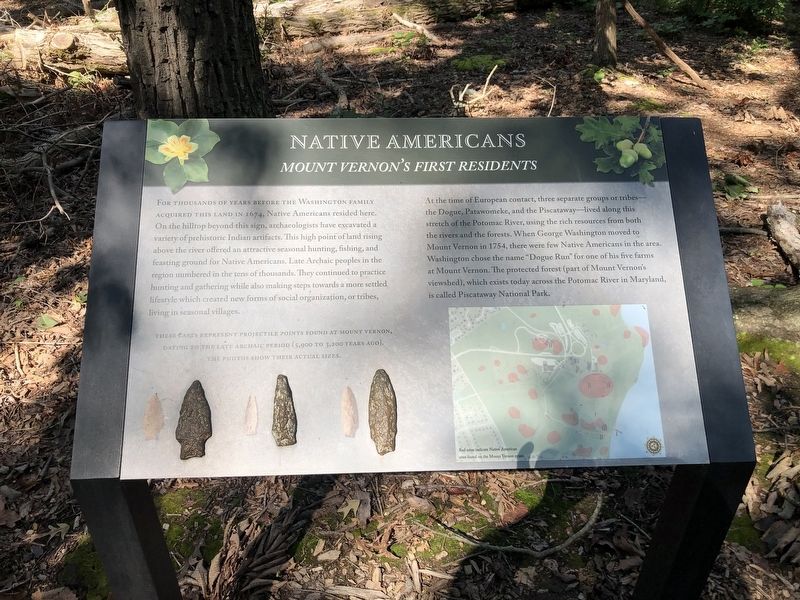
For thousands of years before the Washington family acquired this land in 1674, Native Americans resided here. On the hilltop beyond this sign, archaeologists have excavated a variety of prehistoric Indian artifacts. This high point of land rising above the river offered an attractive seasonal hunting, fishing, and feasting ground for Native Americans. Late Archaic peoples in the region numbered in the tens of thousands. They continued to practice hunting and gathering while also making steps toward a more settled lifestyle which created new forms of social organization, or tribes, living in seasonal villages.
At the time of European contact, three separate groups or tribes—the Dogue, Patawomeke, and the Piscataway—live along this stretch of the Potomac River, using the rich resources from both the rivers and the forests. When George Washington moved to Mount Vernon in 1754, there were few Native Americans in the area. Washington chose the name "Dogue Run" for one of his five farms at Mount Vernon. The protected forest (part of Mount Vernon's viewshed), which exists today across the Potomac River in in Maryland, is
this page online
[Captions:]
These casts represent projectile points found at Mount Vernon, dating to the late Archaic period (5,900 to 3,200 years ago). The photos show their actual sizes.
Topics and series. This historical marker is listed in these topic lists: Anthropology & Archaeology • Colonial Era • Indigenous Peoples and Communities • Settlements & Settlers. In addition, it is included in the Former U.S. Presidents: #01 George Washington series list. A significant historical year for this entry is 1674.
Location. 38° 42.487′ N, 77° 5.436′ W. Marker is in Mount Vernon, Virginia, in Fairfax County. It can be reached from the intersection of Mount Vernon Memorial Highway (Virginia Route 235) and George Washington Memorial Highway, on the right when traveling east. Touch for map. Marker is in this post office area: Alexandria VA 22309, United States of America. Touch for directions.

Regionally, this marker is in the Washington Metropolitan Area and in Northern Virginia. It is also in the American South, specifically in the Upper South, in the Mid-Atlantic, and on the Eastern Seaboard. Globally,

Photographed by Brandon D Cross, August 9, 2025
2. Native Americans Marker
Other nearby markers. At least 8 other markers are within walking distance of this marker: George Washington (within shouting distance of this marker); Creatures in the Forest (within shouting distance of this marker); Domestic Animals (within shouting distance of this marker); Washington's Trees (within shouting distance of this marker); Other Useful Resources (about 300 feet away, measured in a direct line); Slave Cabin (about 400 feet away); George Washington's Forest (about 400 feet away); Sunrise to Sunset (about 400 feet away).
Credits. This page was last revised on August 12, 2025. It was originally submitted on September 27, 2021, by Devry Becker Jones of Washington, District of Columbia. This page has been viewed 320 times since then and 24 times this year. Last updated on November 3, 2024, by T.L. Zagraniski of Reston, Va, Usa. Photos: 1. submitted on September 27, 2021, by Devry Becker Jones of Washington, District of Columbia. 2. submitted on August 9, 2025, by Brandon D Cross of Flagler Beach, Florida. • Bernard Fisher was the editor who published this page.
