
The Landing in Shakopee in Scott County, Minnesota — The American Midwest (Upper Plains)
Subsistence Existence
1857 Farm

Photographed by McGhiever, November 8, 2024
1. Subsistence Existence Marker
Transforming Minnesota's forests and prairies into profitable, Euro-American style farms took many years of hard labor. Trees had to be cut down, stumps removed, and the soil plowed before crops could be planted. It often took a family of settlers 15-20 years to clear a 160-acre plot of land - a standard farmstead in the 1850s.
Without nearby markets or stores, they had to be self-sufficient. The family relied on the resources of the land and the things they brought with them to create a new life. They used logs from the trees they had cleared to build their home and farm buildings. They grew good crops for their own consumption and raised the livestock they needed to survive. Only after the land was fully cleared could they shift their focus from basic survival to economic profit.
Built: 1850s
Original Location: Jessenland Township, MN
Building Name: Berger Farm
Did You Know?
Germans were the largest immigrant population in this area until 1910.
The First Farmers
Native peoples were farming the river valleys of the Upper Midwest at least 1,000 years before the arrival of Euro-Americans. They grew corn,
this page online
The Dakota practices small-scale agriculture along the Minnesota River and used it to supplement an abundance of wild food sources like bison, wild rice, and maple sugar. The Dakota's semi-nomadic lifestyle allowed them to follow seasonal patters of good and resource gathering. Some Native peoples, such as the Mandan, Hidatsa, and Arikara of North Dakota, practiced agriculture more intensively. These groups lived in more permanent settlements and would often grow enough crops for themselves and for trade with neighboring people like the Dakota. A braided string of 54 to 56 ears of corn could be traded for one tanned bison hide.
Companion Planting
Native farmers would often grow corn, beans, and squash in the same field. Corn would be planted in small mounds or ridges in groups of four to eight plants. The beans and squash would be planted in between the corn mounds. The tall corn stalks provide support to the vines of the bean plants. The bean plants

Photographed by McGhiever, November 8, 2024
2. The First Farmers Marker
When cooked and eaten together, corn and beans form a complete protein. Their seeds are can [sic] also be dried and stored for several years and used when other food sources are scarce. Squash can also be stored for long periods of time, especially when cut into strips and dried in the sun.
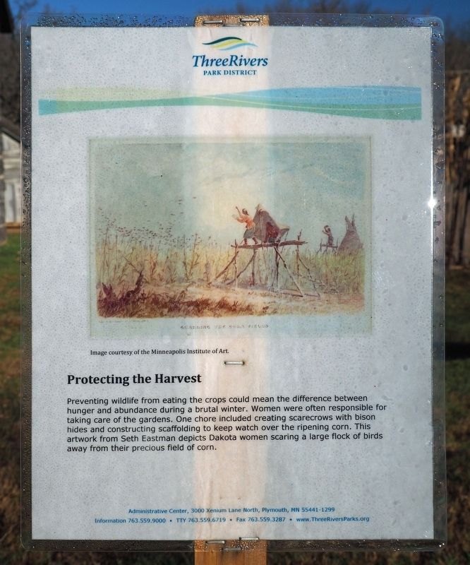
Image courtesy of the Minneapolis Institute of Art.
Protecting the Harvest
Preventing wildlife from eating the crops could mean the difference between hunger and abundance during a brutal winter. Women were often responsible for taking care of the gardens. One chore included creating scarecrows with bison hides and constructing scaffolding to keep watch over the ripening corn. This artwork from Seth Eastman depicts Dakota women scaring a large flock of birds away from their precious fields of corn.
Erected by Three Rivers Park District.
Topics. This historical marker is listed in these topic lists: Agriculture • Indigenous Peoples and Communities
Photographed by McGhiever, November 8, 2024
3. Protecting the Harvest Marker
Location. 44° 48.206′ N, 93° 29.126′ W. Marker is in Shakopee, Minnesota, in Scott County. It is in The Landing. It can be reached from County Road 101. The marker is at The Landing heritage park, at the 1857 Farm. Touch for map. Marker is at or near this postal address: 2187 County Highway 101, Shakopee MN 55379, United States of America. Touch for directions.

Regionally, this marker is in the Minnesota River Valley and in the Twin Cities Metropolitan Area. It is also in the American Midwest and in the Corn Belt. Globally, it is in North America, the Western Hemisphere, the Western World, and the Anglosphere. Historically, it finds itself in what was once Rupert’s Land, the territory of the Mississippian Culture, and the Louisiana Purchase.
Other nearby markers. At least 8 other markers are within walking distance of this marker: Sunlight Wanted (a few steps from this marker); Clearing the Way (within shouting distance of this marker); Cultural Exchange (within shouting distance of this marker); Oak Savanna Restoration Project (about
Photographed by McGhiever, November 8, 2024
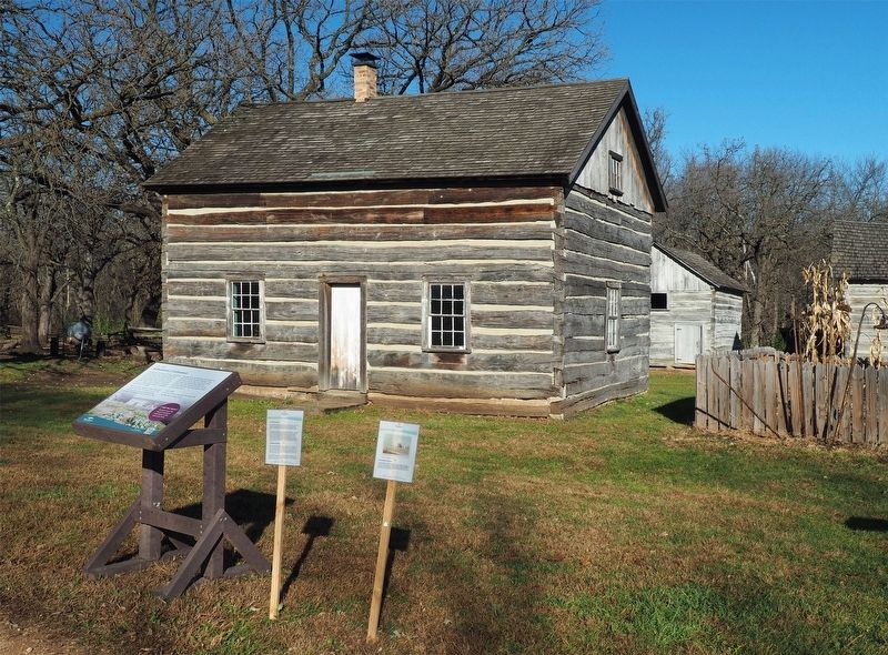
4. Subsistence Existence marker and the 1857 Farm at The Landing
More about this marker. The grounds of The Landing are free to access year-round.
Also see . . . Look Inside (QR code on marker). (Submitted on December 26, 2024, by McGhiever of Minneapolis, Minnesota.)
Credits. This page was last revised on December 26, 2024. It was originally submitted on December 26, 2024, by McGhiever of Minneapolis, Minnesota. This page has been viewed 182 times since then and 31 times this year. Photos: 1, 2, 3, 4. submitted on December 26, 2024, by McGhiever of Minneapolis, Minnesota.
