Surry in Surry County, Virginia — The American South (Mid-Atlantic)
Eastern Virginia Indians
Chippokes State Park
Photographed by Brandon D Cross
1. Eastern Virginia Indians Marker
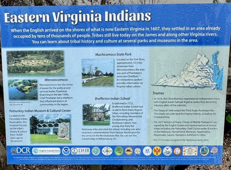
You can learn about tribal history and culture at several parks and museums in the area.
Werowocomoco
Werowocomoco was the center of power for the political and spiritual leader, Powhatan. Beginning in the late 1500s, Chief Powhatan led a chiefdom that influenced dozens of communities in the region.
Pamunkey Indian Museum & Cultural Center
Located on the Pamunkey Indian Reservation, this museum focuses on the tribe's history & culture from 14,000 years ago to the present.
Machicomoco State Park
Located on the York River, approximately 10 miles downriver from Werowocomoco, the area was part of Powhatan's extensive Chiefdom. An interpretive pavilion provides information on Virginia Indian culture.
Brafferton Indian School
Established in 1722, Brafferton Indian School had students from many Virginia tribes, including members of the Pamunkey, Nansemond, Chickahominy, and Nottoway nations.
this page online
Treaties
• In 1614, the Chickahominy negotiated an independent treaty with English leader Samuel Argall at James Fort, becoming tributary allies of the colonists.
• The Treaty of 1646 ended the Third Anglo-Powhatan War. This treaty set aside land for Virginia Indians, including the Chickahominy.
• The 1677 Articles of Peace, (Treaty of Middle Plantation) was signed by the English Crown and representatives of several tribes including the Pamunkey Chief Cockacoeske; & leaders of the Nottoway, Nansemond, Monacan, Appomattoc, Wayonoake, Saponi, Nanzatico, & Meherrin tribes.
• The 1713 treaty recognized the Nottoway land rights.
This interpretive signage, designed in consultation with the Virginia Department of Historic Resources, the Virginia Department of Conservation & Recreation, and invaluable input from the Pamunkey, Chickahominy, and Nottoway Tribes.
(caption) Werowocomoco National Park, near Gloucester, VA
Erected by Chippokes
Photographed by Brandon D Cross, December 18, 2024
2. Eastern Virginia Indians Marker
Topics. This historical marker is listed in these topic lists: Colonial Era • Indigenous Peoples and Communities • Parks & Recreational Areas • Settlements & Settlers. A significant historical year for this entry is 1607.
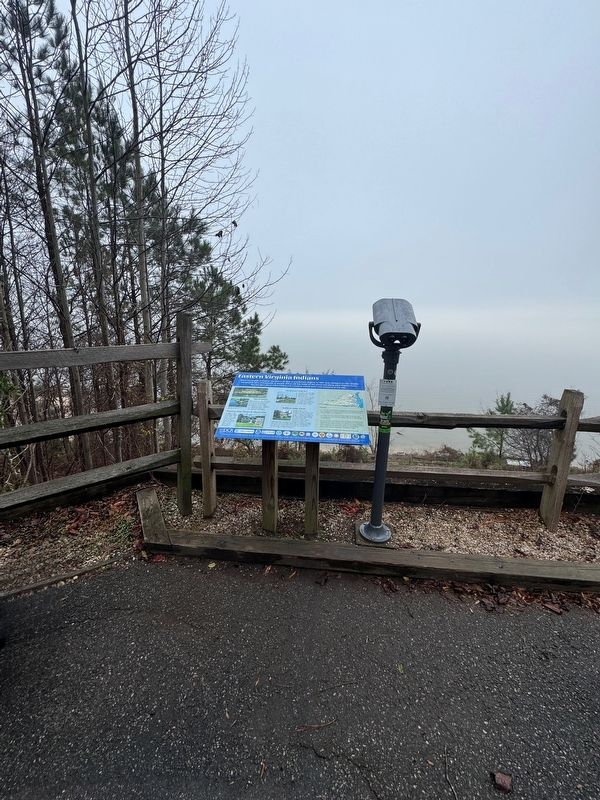
Location. 37° 8.77′ N, 76° 44.308′ W. Marker is in Surry, Virginia, in Surry County. It can be reached from Chippokes Park Road west of Plantation Road, on the right when traveling west. The marker is located on the grounds of Chippokes State Park, behind the Visitor Center near the James River. Touch for map. Marker is at or near this postal address: 695 Chippokes Park Road, Surry VA 23883, United States of America. Touch for directions.

Regionally, this marker is in Coastal Virginia and in the Hampton Roads Metropolitan Area. It is also in the American South, specifically in the Upper South, in the Tidewater, and on the Eastern Seaboard. Globally, it is in the North Atlantic Region, North America, the Western Hemisphere, the Western World, and the Anglosphere. Historically, it finds itself in what was once the territory of the Mississippian Culture, one of the original Thirteen

Photographed by Encyclopedia Britannica
3. Powhatan
Other nearby markers. At least 8 other markers are within walking distance of this marker: Community Life (here, next to this marker); A Deep History (here, next to this marker); Working the Land (a few steps from this marker); Chippokes Plantation (approx. 0.7 miles away); The River House (approx. 0.7 miles away); Steam: The Great Connector (approx. ¾ mile away); A History of Silence (approx. 0.8 miles away); An Agricultural Legacy (approx. 0.9 miles away). Touch for a list and map of all markers in Surry.
Another marker is no longer nearby. Captain John Smith’s Adventures on the James (was a few steps from this marker but has been permanently removed).
Also see . . .
1. Powhatan American Indian Chief. (Submitted on December 27, 2024, by Brandon D Cross of Flagler Beach, Florida.)
2. Surry County: Chippokes Plantation. (Submitted on December 27, 2024, by Brandon D Cross of Flagler Beach, Florida.)
3. Chippokes State Park. (Submitted on December 27, 2024, by Brandon D Cross of Flagler Beach, Florida.)
Credits. This page was last revised on December 28, 2024. It was originally submitted on December 27, 2024, by Brandon D Cross of Flagler Beach, Florida. This page has been viewed 218 times since then and 24 times this year. Photos: 1, 2, 3. submitted on December 27, 2024, by Brandon D Cross of Flagler Beach, Florida. • Bernard Fisher was the editor who published this page.
