Surry in Surry County, Virginia — The American South (Mid-Atlantic)
A Deep History
Chippokes State Park
Photographed by Brandon D Cross
1. A Deep History Marker
In the Beginning
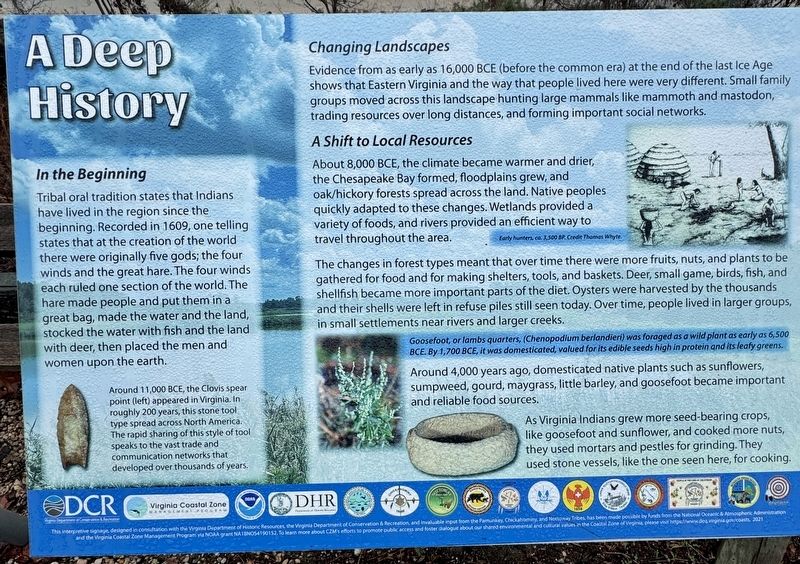
Tribal oral tradition states that Indians have lived in the region since the beginning. Recorded in 1609, one telling states that at the creation of the world there were originally five gods; the four winds and the great hare. The four winds each ruled one section of the world. The hare made people and put them in a great bag, made the water and the land, stocked the water with fish and the land with deer, then placed the men and women upon the earth.
Changing Landscapes
Evidence from as early as 16,000 BCE (before the common era) at the end of the last Ice Age shows that Eastern Virginia and the way that people lived here were very different. Small family groups moved across this landscape hunting large mammals like mammoth and mastodon, trading resources over long distances, and forming important social networks.
A shift to Local Resources
About 8,000 BCE, the climate became warmer and drier, the Chesapeake Bay formed, floodplains grew, and oak/hickory forests spread across the land. Native peoples quickly adapted to these changes. Wetlands provided a variety of foods, and rivers provided
this page online
The changes in forest types meant that over time there were more fruits, nuts, and plants to be gathered for food and for making shelters, tools, and baskets. Deer, small game, birds, fish, and shellfish became more important parts of the diet. Oysters were harvested by the thousands and their shells were left in refuse piles still seen today. Over time, people lived in larger groups, in small settlements near rivers and larger creeks.
Around 4,000 years ago, domesticated native plants such as sunflowers, sumpweed, gourd, maygrass, little barley, and goosefoot became important and reliable food sources.
As Virginia Indians grew more seed-bearing crops, like goosefoot and sunflower, and cooked more nuts, they used mortars and pestles for grinding. They used stone vessels, like the one seen here, for cooking.
(captions)
Around 11,000 BCE, the Clovis spear point (left) appeared in Virginia. In roughly 200 years, this stone tool type spread across North America. The rapid sharing of this style of tool speaks to the vast trade and communication networks that developed over thousands of years.
Early hunters, ca. 3,500 BP. Credit Thomas Whyte.
Goosefoot, or lambs quarters, (Chenopodium berlandieri) was foraged as a wild plant as early as 6,500 BCE. By 1,700 BCE, it was domesticated, valued for its edible seeds high in protein and its leafy greens.
Erected by Chippokes
Photographed by Brandon D Cross
2. A Deep History Marker
Topics. This historical marker is listed in these topic lists: Agriculture • Anthropology & Archaeology • Indigenous Peoples and Communities.
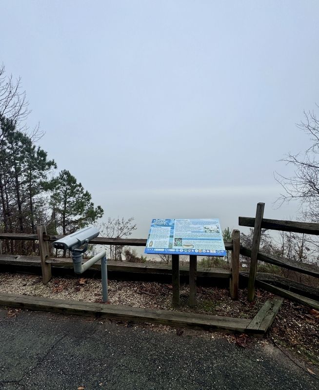
Location. 37° 8.769′ N, 76° 44.304′ W. Marker is in Surry, Virginia, in Surry County. It can be reached from Chippokes Park Road 0.1 miles west of Plantation Road, on the right when traveling west. The marker is located on the grounds of Chippokes State Park, behind the Visitor Center near the James River. Touch for map. Marker is at or near this postal address: 695 Chippokes Park Road, Surry VA 23883, United States of America. Touch for directions.

Regionally, this marker is in Coastal Virginia and in the Hampton Roads Metropolitan Area. It is also in the American South, specifically in the Upper South, in the Tidewater, and on the Eastern Seaboard. Globally, it is in the North Atlantic Region, North America, the Western Hemisphere, the Western World, and the Anglosphere. Historically, it finds itself in what was once the territory of the Mississippian Culture, one of the original Thirteen Colonies, one of the Confederate States of America, and the Antebellum South.
Other nearby markers. At least 8 other markers are within walking distance of this marker: Community Life (here, next to this marker); Eastern Virginia Indians (here, next to this marker); Working the Land (here, next to this marker); Chippokes Plantation (approx. 0.7 miles away); The River House (approx. 0.7 miles away); Steam: The Great Connector (approx. ¾ mile away); A History of Silence (approx. 0.8 miles away); An Agricultural Legacy (approx. 0.9 miles away). Touch for a list and map of all markers in Surry.
Another marker is no longer nearby. Captain John Smith’s Adventures on the James (was here, next to this marker but has been permanently removed).
Also see . . .
1. Before Chippokes: A Year with the Quiyoughcohannock. (Submitted on December 27, 2024, by Brandon D Cross of Flagler Beach, Florida.)
2. Surry County: Chippokes Plantation. (Submitted on December 27, 2024, by Brandon D Cross of Flagler Beach, Florida.)
3. Chippokes State Park. (Submitted on December 27, 2024, by Brandon D Cross of Flagler Beach, Florida.)
Credits. This page was last revised on December 31, 2024. It was originally submitted on December 27, 2024, by Brandon D Cross of Flagler Beach, Florida. This page has been viewed 141 times since then and 18 times this year. Photos: 1, 2. submitted on December 27, 2024, by Brandon D Cross of Flagler Beach, Florida. • Bernard Fisher was the editor who published this page.
