Danville, Virginia — The American South (Mid-Atlantic)
The Historic Dan River
Life on the Dan River
Photographed by C. Ryan Dodson, November 30, 2024
1. Life on the Dan River Marker
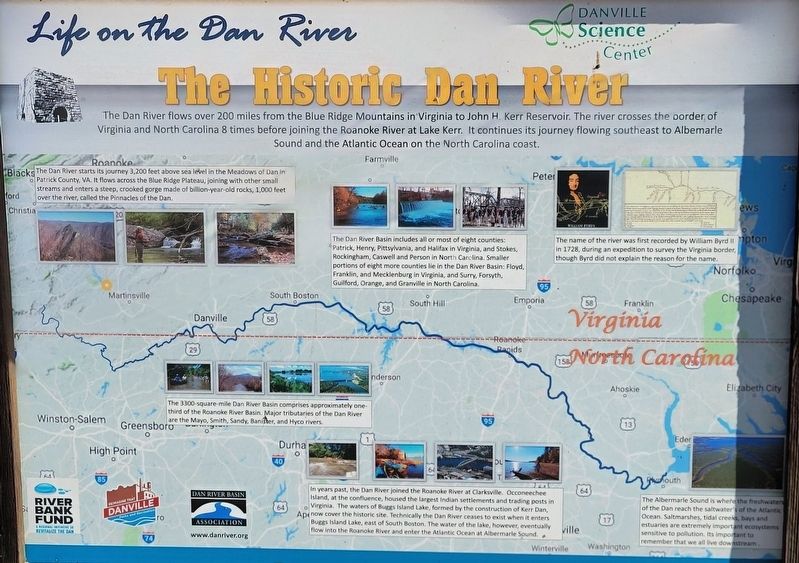
The Dan River flows over 200 miles from the Blue Ridge Mountains in Virginia to John H Kerr Reservoir. The river crosses the border of Virginia and North Carolina 8 times before joining the Roanoke River at Lake Kerr. It continues its journey flowing southeast to Albemarle Sound and the Atlantic Ocean on the North Carolina coast.
The Dan River starts its journey 3,200 feet above sea level in the Meadows of Dan in Patrick County, VA. It flows across the Blue Ridge Plateau, joining with other small streams and enters a steep, crooked gorge made of billion-year-old rocks, 1,000 feet over the river, called the Pinnacles of the Dan.
The Dan River Basin includes all or most of eight counties: Patrick, Henry, Pittsylvania, and Halifax in Virginia, and Stokes, Rockingham, Caswell, and Person in North Carolina. Smaller portions of eight more counties lie in the Dan River Basin: Floyd, Franklin, and Mecklenburg in Virginia, and Surry, Forsyth, Guilford, Orange, and Granville in North Carolina.
The name of the river was first recorded by William Byrd II in 1728, during an expedition to survey the Virginia border, though
this page online
The 3300-square-mile Dan River Basin comprises approximately one third of the Roanoke River Basin. Major tributaries of the Dan River are the Mayo, Smith, Sandy, Banister, and Hyco rivers.
In years past, the Dan River joined the Roanoke River at Clarksville. Occoneechee Island, at the confluence, housed the largest Indian settlements and trading posts in Virginia. The waters of Buggs Island Lake, formed by the construction of Kerr Dam, now cover the historic site. Technically the Dan River ceases to exist when it enters Buggs Island Lake, east of South Boston. The water of the lake, however, eventually flow into the Roanoke River and enter the Atlantic Ocean Albermarle Sound.
The Albermarle Sound is where the freshwaters of the Dan reach the saltwater of the Atlantic Ocean. Saltmarshes, tidal creeks, bays and estuaries are extremely important ecosystems sensitive to pollution. Its important to remember that we all live downstream.
Erected by City of Danville, Dan River Basin Association, and Danville Science Center.
Topics. This historical marker is listed in these
Photographed by C. Ryan Dodson, November 27, 2024
2. Life on the Dan River Marker
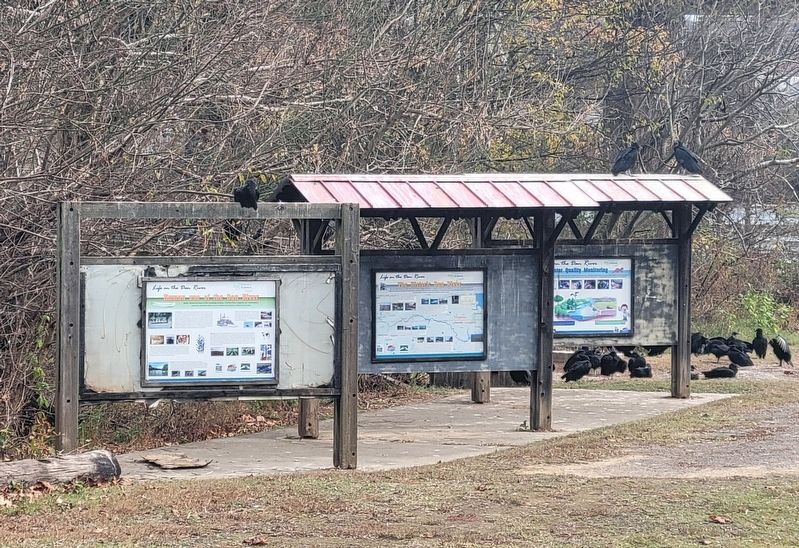
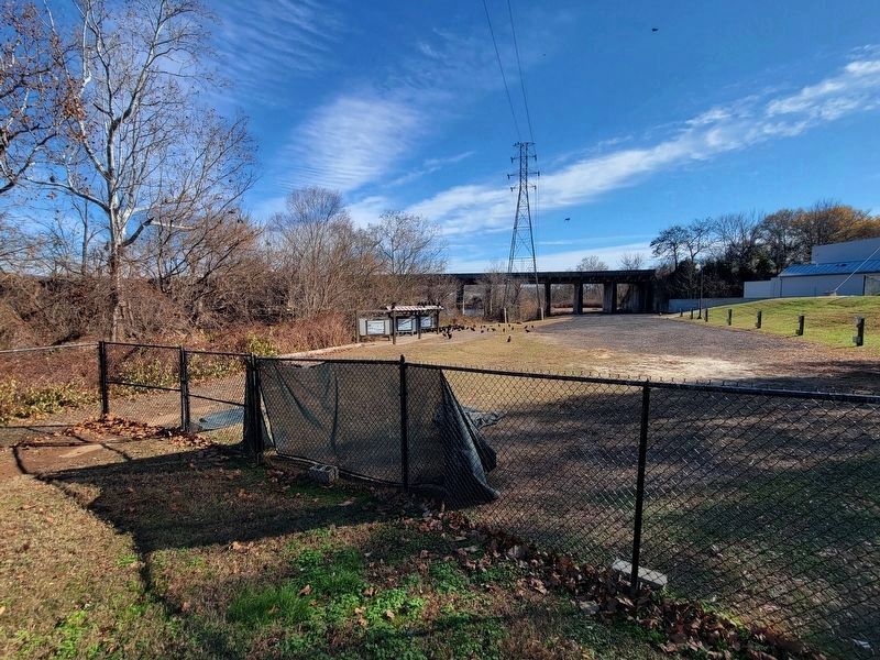
Location. 36° 35.156′ N, 79° 22.971′ W. Marker is in Danville, Virginia. It can be reached from Colquhoun Street north of Bridge Street, on the right when traveling north. The Marker is located along the Riverwalk Trail near the Crossing at the Dan trailhead, behind the Carrington Pavillion and Bark Park. Touch for map. Marker is at or near this postal address: 629 Craghead Street, Danville VA 24541, United States of America. Touch for directions.

Regionally, this marker is in Southside Virginia and specifically in Central Virginia. It is also in the American South and specifically in the Upper South. Globally, it is in North America, the Western Hemisphere, the Western World, and the Anglosphere. Historically, it finds itself in what was once the territory of the Mississippian Culture, one of the original Thirteen Colonies, one of the Confederate States of America, and the Antebellum South.
Other nearby markers. At least 8 other markers are within walking distance
Photographed by C. Ryan Dodson, November 30, 2024
3. Life on the Dan River Marker
Located behind Bark Park
Another marker is no longer nearby. Railroad History Preserved (was about 300 feet away, measured in a direct line but has been replaced with another marker now near it).
Photographed by C. Ryan Dodson, November 30, 2024
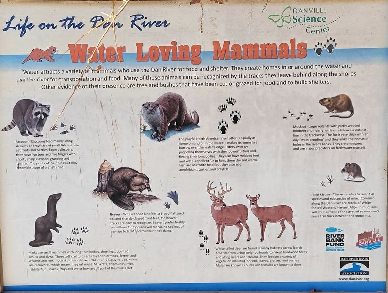
4. Water Loving Mammals sign
Located adjacent to the Marker.

Photographed by C. Ryan Dodson, November 30, 2024
5. Fish of the Dan River sign
Located adjacent to the Marker.

Photographed by C. Ryan Dodson, November 27, 2024
6. Bark Park sign
Located near the Marker.
Credits. This page was last revised on January 11, 2025. It was originally submitted on January 11, 2025, by C. Ryan Dodson of Danville, Virginia. This page has been viewed 928 times since then and 139 times this year. Photos: 1, 2, 3, 4, 5, 6. submitted on January 11, 2025, by C. Ryan Dodson of Danville, Virginia. • Bernard Fisher was the editor who published this page.
