Charles Village in Baltimore, Maryland — The American Northeast (Mid-Atlantic)
Howard St
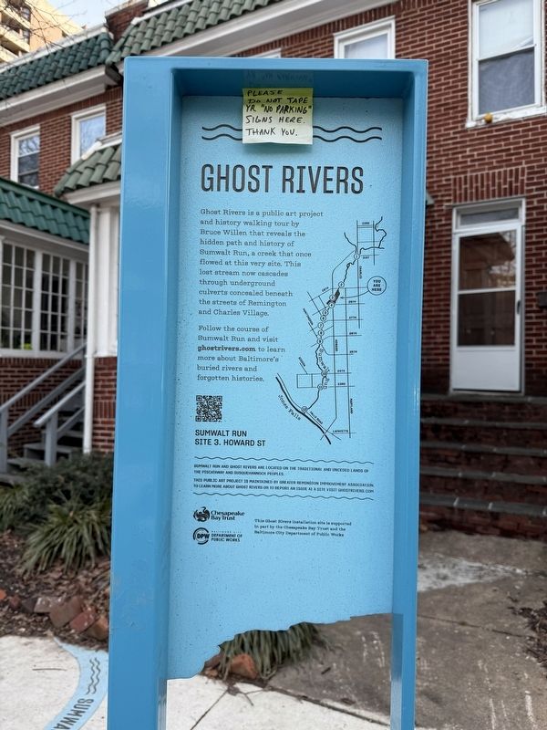
| — | Ghost Rivers | — |
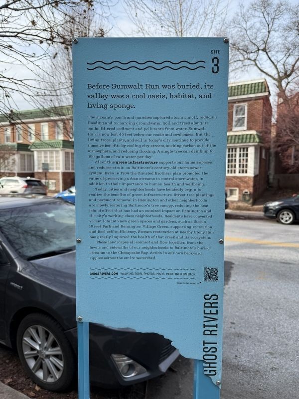
Before Sumwalt Run was buried, its valley was a cool oasis, habitat, and living sponge.
The stream's ponds and marshes captured storm runoff, reducing flooding and recharging groundwater. Soil and trees along its banks filtered sediment and pollutants from water. Sumwalt Run is now 40 feet below our roads and rowhouses. But the living trees, plants, and soil in today's city continue to provide the massive benefits by cooling city streets, sucking carbon out of the atmosphere, and reducing flooding. A single tree can drink up to 150 gallons of rain water per day!
All of this green infrastructure supports our human spaces and reduces strain on Baltimore's century-old storm sewer system. Even in 1904 the Olmsted Brothers plan promoted the value of preserving urban streams to control stormwater, in addition to their importance to human health and wellbeing.
Today, cities and neighborhoods have belatedly begun to realize the benefits of green infrastructure. Street tree plantings and pavement removal in Remington and other neighborhoods are slowly restoring Baltimore's tree canopy, reducing the heat island effect
this page online
These landscapes all connect and flow together, from the lawns and sidewalks of our neighborhoods to Baltimore's buried streams to the Chesapeake Bay. Action in our own back yard ripples across the entire watershed.
Erected by Greater Remington Association. (Marker Number 3.)
Topics. This historical marker is listed in these topic lists: Architecture • Environment • Natural Features • Waterways & Vessels. A significant historical year for this entry is 1904.
Location. 39° 19.341′ N, 76° 37.199′ W. Marker is in Baltimore, Maryland. It is in Charles Village. It is on North Howard Street just south of West 29th Street, on the left when traveling south. Touch for map. Marker is at or near this postal address: 2819 N Howard St, Baltimore MD 21218, United

Regionally, this marker is in Central Maryland. It is also in the American Mid-Atlantic, in the Chesapeake Bay Region, and on the Eastern Seaboard. Globally, it is in the North Atlantic Region, North America, the Western Hemisphere, the Western World, and the Anglosphere. Historically, it finds itself in what was once one of the original Thirteen Colonies and also the Antebellum South.
Other nearby markers. At least 8 other markers are within walking distance of this marker: 28th St (within shouting distance of this marker); Cresmont Ave (about 400 feet away); Wyman Park Dell (about 500 feet away); Remington Ave (about 600 feet away); Remington (about 700 feet away); Robert E. Lee and Thomas. J. “Stonewall” Jackson Monument (about 700 feet away); Harriet Tubman Grove (about 700 feet away); Union Soldiers and Sailors Monument (approx. 0.2 miles away). Touch for a list and map of all markers in Baltimore.
Other markers no longer nearby. Wyman Park Dell at 29th St (was about 400 feet away, measured in a direct line but has been confirmed missing); Lee Jackson Monument (was about

Additional keywords. landscape architecture
Credits. This page was last revised on February 2, 2025. It was originally submitted on February 2, 2025, by Devry Becker Jones of Washington, District of Columbia. This page has been viewed 142 times since then and 14 times this year. Photos: 1, 2, 3. submitted on February 2, 2025, by Devry Becker Jones of Washington, District of Columbia.
