Central Office District in Richmond, Virginia — The American South (Mid-Atlantic)
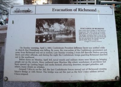
Evacuation of Richmond
Before dawn on Monday, April 3rd, naval vessels and military stores were blown up, bringing people out on the streets. Many gathered near Shockoe Slip where warehouses of provisions had been opened up. Looting began and mobs formed, attracting deserters, escaped prisoners, and others, many drunk on whiskey.
Around 7:30 a.m. on the 3rd, the last Confederate forces moved out of Richmond crossing Mayo’s Bridge at 14th Street. The bridge was set fire just as the first Union soldiers arrived. Chaos reigned.
Topics. This historical marker is listed in these topic lists: Notable Events • War, US Civil. A significant historical date for this entry is April 2, 1800.
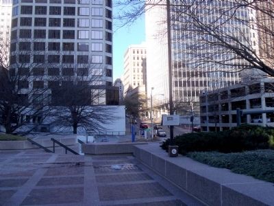
Location. 37° 32.267′ N, 77° 26.302′ W. Marker is in Richmond, Virginia. It is in the Central Office District. Marker can be reached from the intersection of East Cary Street and South 8th Street. This marker is located along the Dominion Building plaza. Touch for map. Marker is at or near this postal address: 701 East Cary Street, Richmond VA 23219, United States of America. Touch for directions.
Other nearby markers. At least 8 other markers are within walking distance of this marker. Evacuation Fire (here, next to this marker); Downtown Richmond Millsites (within shouting distance of this marker); Basin Race (within shouting distance of this marker); Kanawha Plaza (about 400 feet away, measured in a direct line); Canal Walk (about 400 feet away); The First National Bank Building (about 500 feet away); Richmond Evacuation Fire (about 700 feet away); Great Turning Basin (about 800 feet away). Touch for a list and map of all markers in Richmond.
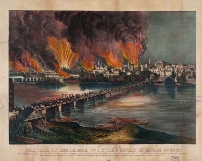
More about this marker. On top is an image of the "Evacuation of Richmond" with the caption, "View north, Mayo’s Bridge at 14th Street in foreground. This 1865 Currier & Ives print, while dramatic, is not historically accurate. The bridges, including Mayo’s, were set fire early, before the flames had spread through the city, and before the Arsenal went up and its shells began to explode. (Courtesy of Valentine Museum)"
Also see . . .
1. Reaction to the Fall of Richmond. American Battlefield Trust (Submitted on January 18, 2010.)
2. America’s Civil War: The Fall of Richmond. Historynet (Submitted on January 18, 2010.)
3. Fall of Richmond. Civil War Richmond (Submitted on January 18, 2010.)

Photographed By Currier & Ives, circa 1865
3. The fall of Richmond, Va. on the night of April 2d. 1865
This strong hold the Capital City of the Confederacy, was evacuated by the Rebels in consequence of the defeat at "Five forks" of the Army of Northern Virginia under Lee, and capture of the South side Rail-Road by Genl Grant. Before abandoning the City, the Rebels set fire to it, destroying a vast amount of property; and the conflagration continued until it was subdued by the Union troops on the following morning.
Library of Congress [LC-DIG-pga-03629]
Library of Congress [LC-DIG-pga-03629]
Credits. This page was last revised on February 1, 2023. It was originally submitted on January 18, 2010, by Bernard Fisher of Richmond, Virginia. This page has been viewed 2,150 times since then and 70 times this year. Photos: 1, 2, 3. submitted on January 18, 2010, by Bernard Fisher of Richmond, Virginia.

