Moorhead in Clay County, Minnesota — The American Midwest (Upper Plains)
Red River of the North

Photographed by Cosmos Mariner, June 27, 2024
1. Red River of the North Marker
The Red River of the North starts In Breckenridge, Minnesota, where the Otter Tail and Bois de Sioux rivers flow together then winds a sinuous 548.7 miles to Lake Winnipeg, a straight-line distance of 286 miles. The Red River watershed is about 45,000 square miles in size which is about the size of Ohio.
Water Quantity
The most common question asked by people unfamiliar with the Red River is: How deep is it? That depends, of course, on where and what stage the river is in. Stage is how much water is in the river.
In its upper reaches, from Breckenridge to just south of Fargo, the River is about 100 feet to 150 feet wide and can be as deep as 10 feet to 20 feet, but mid-channel it is more likely to be about 5 feet deep, or less. At normal flow a bobber floating down the middle of the stream might travel at three or four miles per hour.
Downstream of Fargo, the River continues to grow deeper and wider as each additional tributary adds to the flow. By the time it reaches Grand Forks it has more than doubled in width and flow. The average depth has increased as well, to around 10 to 15 feet in mid-channel at normal flow, with
this page online
The River channel itself only drops only about six inches per mile in what was, 10,000 years ago, the bed of glacial Lake Agassiz. Many of the tributaries have similarly flat watersheds, all of which contributes to periodic, major flooding.
Water Quality
The second most asked question about the Red River is: "Is it polluted?" Red River water is actually cleaner than about three-fourths of the rivers in the continental United States. What concerns people about the Red's water is the way it looks, like a cup of hot chocolate. That is due to the high sediment (very fine clay soil particles) which stay suspended in the River's moving water.
Urban storm sewer discharge, overland runoff, and agricultural runoff, may occasionally cause spikes in waterborne pollutants. Those spikes are usually short lived and, especially during high flows, are quickly diluted. Outflows from municipal wastewater treatment plants into the Red River are normally cleaner than water already in the River.
The River's water quality is closely monitored by state/provincial, municipal and federal governments. Water quality in the Red
Photographed by Cosmos Mariner, June 27, 2024
2. Red River of the North Marker
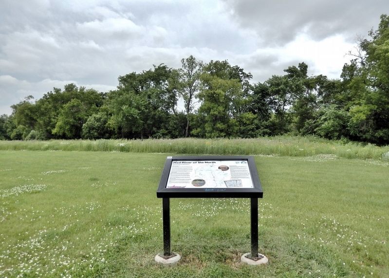
Looking north from the interpretive trail in M. B. Johnson Park. The Red River is obscured by trees in the background.
Riparian Area
Trees are scarce in the Red River watershed for two reasons. First, much of the area was part of the tall-grass prairie before European settlement. Second, because of the flat, fertile soils, trees were removed in favor of cultivated crops. The riparian forest along the Riverbanks is home to many native wildlife species and serves as a migratory route for birds.
Dams
There are eight dams on the Red River in the United States. None of them are navigable during normal water levels. All but one of the eight lowhead dams have been retrofitted with rock boulders to eliminate the undertow and allow fish movement at nearly all water levels. A retrofit for the last one at Drayton, ND is in the works.
Human Dimensions
Long before European trappers and traders first came to this area, Native Americans lived in parts of the Red River watershed. Archaeological evidence of human existence dates back to just after the last glaciers, or about 10,000 years ago. Europeans came to the Red River area only 400 to 500 years ago.
Steamboats flourished on the Red from about 1860 to 1909. They carried lumber, cattle, grain, people, whiskey, and anything else people wanted up or down the Red. The railroad came in 1872, slowly replacing steamboats and Red River carts. (See the Local History interpretive sign.)
People have harvested fish from the Red River, probably from the time they first inhabited the area. In the middle 1800s, Randolph Probstfield, the first European rural homesteader in Clay County, Minnesota, reported catching goldeyes and selling them both in town and to riverboat passengers. (See the What Lives in the Red River and Fishing interpretive signs.)
Red River mussels were once harvested from the River bottom for food. Native mussels were harvested both for food and for making buttons and jewelry. The latest mussel to inhabit the Red is the dreaded invasive, the zebra mussel (See Invasive Species interpretive sign.)
When the Red was no longer the primary method of transportation, it was ignored. In fact, it was even thought to be dangerous and people were encouraged to stay away. Today the River provides municipal water for many towns and is a valuable natural resource that supports many forms of outdoor recreation.
The Minnesota Department of Natural Resources (MN DNR) designated the Red River as a State Water Trail in 2001. The Trails Division of MN DNR produced a Canoeing and Boating Master Plan as well as an excellent set of maps of the United States portion of the River. Interactive river maps and river level reports are also available at the MN DNR Trails website.
Did you know?
It is a common misconception that the Red River of the North is unique in that it flows primarily northward in North America. There are at least 20 other north-flowing rivers in North America. There are at least 12 other Red Rivers in North America.
Erected by River Keepers; and Moorhead, Minnesota.
Topics. This historical marker is listed in these topic lists: Anthropology & Archaeology • Indigenous Peoples and Communities • Settlements & Settlers • Waterways & Vessels.
Location. 46° 54.779′ N, 96° 45.267′ W. Marker is in Moorhead, Minnesota, in Clay County. It can be reached from 36th Avenue North just north of 11th Street North, on the right when traveling north. The marker is located along the interpretive trail in M. B. Johnson Park, overlooking the Red River. Touch for map. Marker is at or near this postal address: 3601 11th Street North, Moorhead MN 56560, United States of America. Touch for directions.

Regionally, this marker is in the American Midwest and in the Corn Belt. Globally, it is in North America, the Western Hemisphere, the Western World, and the Anglosphere. Historically, it finds itself in what was once Rupert’s Land, the territory of the Mississippian Culture, and the Louisiana Purchase.
Other nearby markers. At least 8 other markers are within 3 miles of this marker, measured as the crow flies: Local History (about 700 feet away, measured in a direct line); M. B. Johnson Park (approx. 0.2 miles away); In Honor of Those Who Have Served in Defense of Our Country (approx. 1.6 miles away); National Guard and Armory (approx. 1.6 miles away); Homestead Park (approx. 2 miles away); John Bergquist (approx. 2 miles away); The Bergquist Cabin (approx. 2 miles away); Churchill Residence Hall (approx. 2½ miles away in North Dakota). Touch for a list and map of all markers in Moorhead.
Related markers. Click here for a list of markers that are related to this marker.
Credits. This page was last revised on February 26, 2025. It was originally submitted on February 23, 2025, by Cosmos Mariner of Cape Canaveral, Florida. This page has been viewed 239 times since then and 50 times this year. Photos: 1, 2. submitted on February 26, 2025, by Cosmos Mariner of Cape Canaveral, Florida.
