Near Beaver Bay in Lake County, Minnesota — The American Midwest (Upper Plains)
View of the Lighthouse
An Enduring North Shore Tourist Destination
Photographed by Cosmos Mariner, June 23, 2024
1. View of the Lighthouse Marker
The Lighthouse
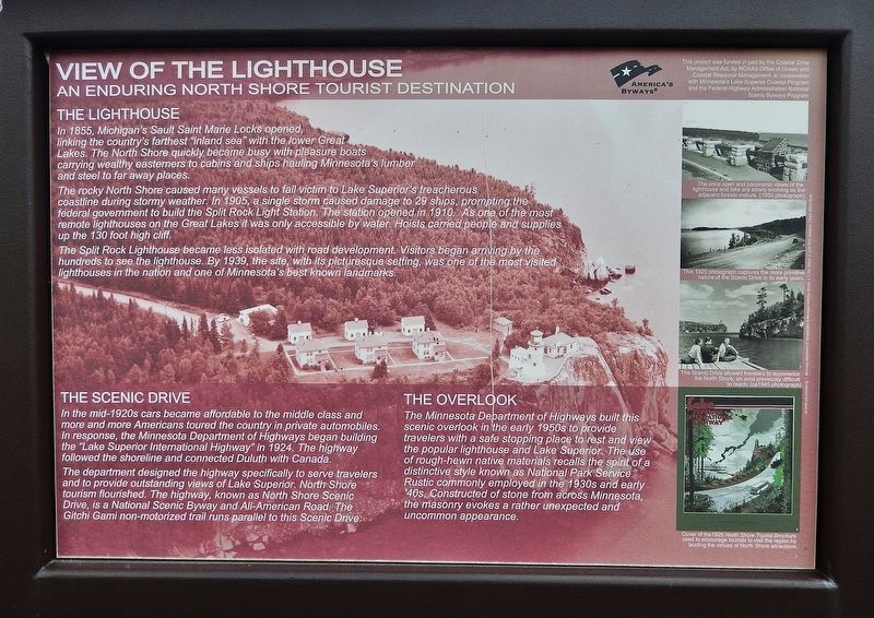
In 1855, Michigan's Sault Saint Marie Locks opened, linking the country's farthest "inland sea" with the lower Great Lakes. The North Shore quickly became busy with pleasure boats carrying wealthy easterners to cabins and ships hauling Minnesota's lumber and steel to far away places.
The rocky North Shore caused many vessels to fall victim to Lake Superior's treacherous coastline during stormy weather. In 1905, a single storm caused damage to 29 ships, prompting the federal government to build the Split Rock Light Station. The station opened in 1910. As one of the most remote lighthouses on the Great Lakes it was only accessible by water. Hoists carried people and supplies up the 130 foot high cliff.
The Split Rock Lighthouse became less isolated with road development. Visitors began arriving by the hundreds to see the lighthouse. By 1939, the site, with its picturesque setting, was one of the most visited lighthouses in the nation and one of Minnesota's best known landmarks.
The Scenic Drive
In the mid-1920s cars became affordable to the middle class and more and more Americans toured the country in private
this page online
The department designed the highway specifically to serve travelers and to provide outstanding views of Lake Superior. North Shore tourism flourished. The highway, known as North Shore Scenic Drive, is a National Scenic Byway and All-American Road. The Gitchi Gami non-motorized trail runs parallel to this Scenic Drive.
The Overlook
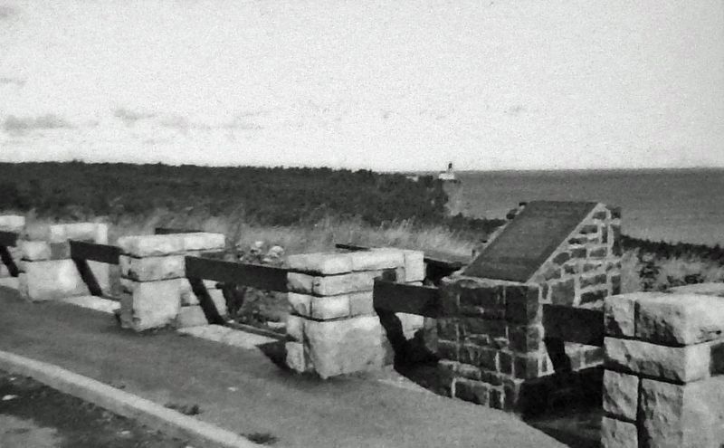
The Minnesota Department of Highways built this scenic overlook in the early 1950s to provide travelers with a safe stopping place to rest and view the popular lighthouse and Lake Superior. The use of rough-hewn native materials recalls the spirit of a distinctive style known as National Park Service Rustic commonly employed in the 1930s and early ‘40s. Constructed of stone from across Minnesota, the masonry evokes a rather unexpected and uncommon appearance.
This project was funded in part by the Coastal Zone Management Act, by NOAA's Office of Ocean and Coastal Resource Management, in cooperation with Minnesota's Lake Superior Coastal Program and the Federal Highway Administration National Scenic Byways Program.
Erected by America's
Minnesota Department of Transportation & Minnesota Historical Society
2. Marker detail: Wayside Scenic View in 1955
The once open and panoramic views of the lighthouse and lake are slowly evolving as the adjacent forests mature.
Topics and series. This historical marker is listed in these topic lists: Industry & Commerce • Parks & Recreational Areas • Roads & Vehicles • Waterways & Vessels. In addition, it is included in the Lighthouses series list. A significant historical year for this entry is 1910.
Location. 47° 11.953′ N, 91° 22.786′ W. Marker is near Beaver Bay, Minnesota, in Lake County. It is on North Shore Scenic Drive (Voyageur Highway) (State Highway 61) ¾ mile south of Split Rock Lighthouse Road, on the left when traveling south. The marker is located in the scenic wayside on Minnesota Highway 61, about ¾ mile south of Split Rock Lighthouse State Park. Touch for map. Marker is in this post office area: Two Harbors MN 55616, United States of America. Touch for directions.

Regionally, this marker is in the Arrowhead Region, in the Iron Range, and in the North Shore. It is also in the American Midwest and in the Corn Belt. Globally, it is in North America, in the Great North Woods, on the Great Lakes, on Lake Superior’s North Shore, in the Western Hemisphere, in the Western World, and in the Anglosphere. Historically,
Courtesy Don Spavin
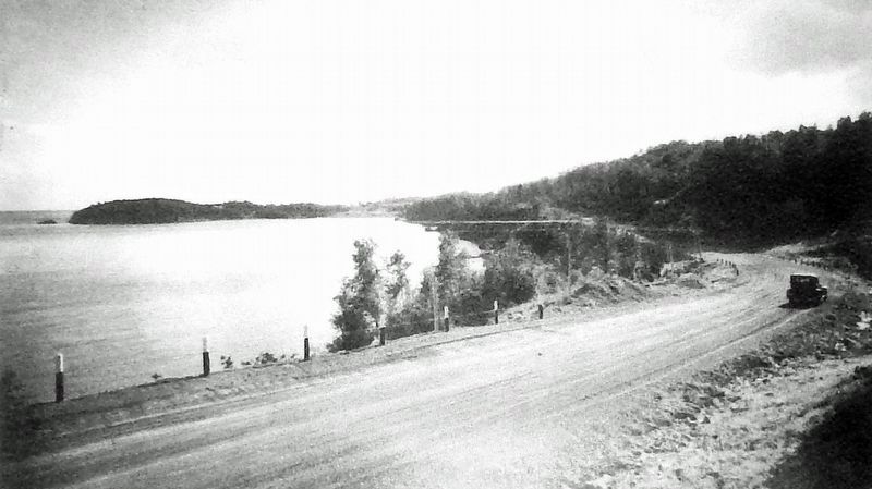
3. Marker detail: North Shore Scenic Drive, 1925
This 1925 photograph captures the more primitive nature of the Scenic Drive in its early years.
Other nearby markers. At least 8 other markers are within walking distance of this marker: Geology of Minnesota (a few steps from this marker); Dock Site and Pumphouse (approx. 0.4 miles away); A Split Rock Mystery... (approx. half a mile away); Tramway (approx. half a mile away); Little Two Harbors (approx. 0.6 miles away); Storage Barn (approx. 0.6 miles away); Home Away From Home (approx. 0.6 miles away); Fog Signal (approx. 0.6 miles away). Touch for a list and map of all markers in Beaver Bay.
Also see . . .
1. Split Rock Lighthouse (Minnesota Historical Society).
Excerpt: A November gale that wrecked nearly 30 ships in 1905 prompted this rugged landmark's construction. When the U.S. Lighthouse Service completed Split Rock Light Station in 1910, it soon became one of Minnesota's best-known destinations.(Submitted on February 24, 2025, by Cosmos Mariner of Cape Canaveral, Florida.)
Nestled in a Minnesota State Park, Split Rock Lighthouse is one of the most photographed and visited spots in the state, with a drama-filled history and breathtakingLake Superior views. If you haven't visited lately, now is the time to pay homage to a true North Shore icon.Courtesy Louis Perry Gallagher4. Marker detail: North Shore Tourism, circa 1945The Scenic Drive allowed travelers to experience the North Shore, an area previously difficult to reach.

2. North Shore Scenic Drive (National Scenic Byway Foundation).
Excerpt: The road is perfectly positioned between Lake Superior and the ridgeline, offering views of waves crashing on the rocky beaches and forested hills rising along the ridges. In addition, there are multiple rivers that cascade down from the Lake Superior highlands to meet Lake Superior. The first people to settle the North Shore region arrived about 10,000 years ago. These Native Americans entered the region during the final retreat of the Wisconsin glaciation. Many waves of Native American people inhabited the North Shore prior to European contact. The first Europeans, French explorers, and fur traders reached Lake Superior country around 1620. By 1780, the Europeans had established fur trading posts at the mouth of the St. Louis River near Duluth and at Grand Portage Bay at Grand Portage. The recent history of the North Shore encompassing fur trading, logging,(Submitted on February 24, 2025, by Cosmos Mariner of Cape Canaveral, Florida.)fishing, and mining, among many other activities, begins here. Many of these historical industries are linked by the shipping and rail industry, which has dominated the economy for over a century. 5. Marker detail: Cover of the 1926 North Shore Tourist BrochureUsed to encourage tourists to visit the region by lauding the virtues of North Shore attractions.

Photographed by Cosmos Mariner, June 23, 2024
6. View of the Lighthouse Marker
Looking southeast through the wayside; Lake Superior is in the background.
Photographed by Cosmos Mariner, June 23, 2024
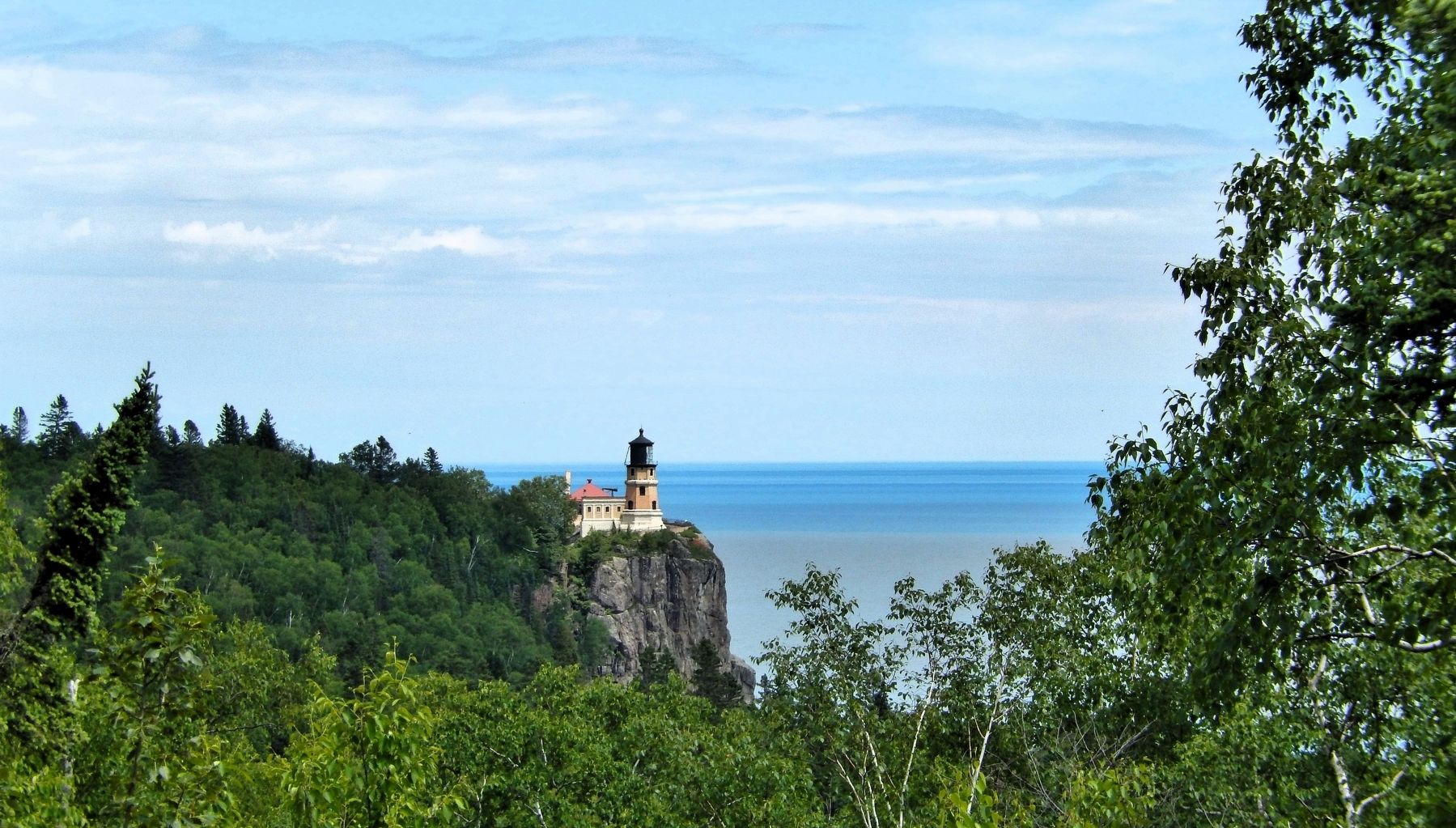
7. Split Rock Lighthouse
View looking east from the wayside.
Credits. This page was last revised on August 12, 2026. It was originally submitted on February 23, 2025, by Cosmos Mariner of Cape Canaveral, Florida. This page has been viewed 131 times since then and 23 times this year. Photos: 1, 2, 3, 4, 5, 6, 7. submitted on February 24, 2025, by Cosmos Mariner of Cape Canaveral, Florida.
