Duquesne Heights in Pittsburgh in Allegheny County, Pennsylvania — The American Northeast (Mid-Atlantic)
Mount Washington
Native Americans in the Upper Ohio Valley
| — | Emerald View Park | — |

Photographed by Bradley Owen, September 3, 2024
1. Mount Washington Marker
The first prehistoric peoples arrived in the upper Ohio Valley over 16,000 years ago, living as a hunting and gathering society. As the climate warmed and glaciers receded, experiments with agriculture became possible, and native peoples began to domesticate crops and develop a more settled way of life. In this area, the Monongahela People, as they became known to modern day anthropologists, lived in circular villages, cultivating corn, beans and squash, and supplementing their livelihoods with hunting, gathering, fishing, and trading.
EUROPEAN EXPANSION THROUGH PITTSBURGH
In the French and Indian War, both the British and the French claimed rights to the forks of the Ohio River, a gateway to the West. Most native groups fought with the French, believing them more likely to act favorably regarding land rights. Native fears were well founded, and as the British gained control of large land areas, a royal proclamation acknowledging Native American land rights west of the Allegheny Mountains went largely ignored.
A NEW WORLD ORDER
By 1635 the Monongahela People had disappeared, either falling victim to the onslaught
this page online
(Sidebar):
February 1754
The British rush to establish Fort Prince George at the point where the three rivers meet.
April 1754
French forces, floating down the Allegheny, easily overwhelm Fort Prince George and proceed to build Fort Duquesne on the site.
May - July 1754
An attempt to retake the area by the British, with a column led by George Washington, is quashed; Washington surrenders at Fort Necessity, south of Pittsburgh.
July 1755
Another British force under General Edward Braddock advances to within miles of Fort Duquesne, but is routed by an Indian ambush and is forced to retreat.
September 1758
General John Forbes leads one more campaign to capture Fort
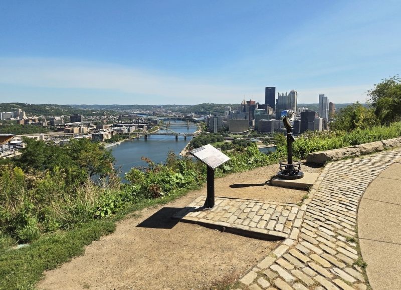
Photographed by Bradley Owen, September 3, 2024
2. Mount Washington Marker
November 1758
Forbes receives word that the French are faring poorly on other fronts and decides to launch an immediate attack rather than wait until spring. This time, he is successful in driving the French from the fort. Pittsborough is named.
1759-1761
Fort Pitt is constructed at the confluence of the rivers. Today, the fort's remaining blockhouse is the oldest authenticated structure still standing west of the Appalachian Mountains and contains a museum of Pittsburgh's early history.
Erected by Federal Highway Administration, the Pennsylvania Department of Transportation, Laurel Foundation, Port of Pittsburgh Commission, VisitPittsburgh, the City of Pittsburgh and the Mount Washington Community Development Corporation.
Topics. This historical marker is listed in these topic lists: Agriculture • Forts and Castles • Indigenous Peoples and Communities • War, French and Indian. A significant historical year for this entry is 1635.
Location. 40° 26.362′ N, 80° 1.28′ W. Marker is in Pittsburgh, Pennsylvania, in Allegheny County. It is in Duquesne Heights. It is at the intersection of Grandview Avenue and Sweetbriar Street, on the right when traveling north on Grandview Avenue. Touch for map. Marker is at or near this postal address: 1429 Grandview Avenue, Pittsburgh PA 15211, United States of America. Touch for directions.

Regionally, this marker is in the American Northeast, in the Mid-Atlantic, in the Ohio River Valley, in Appalachia, and specifically in Northern Appalachia. Globally, it is in North America, the Western Hemisphere, the Western World, and the Anglosphere. Historically, it finds itself in what was once the Viceroyalty of New France, the Haudenosaunee (Iroquois) Confederacy, and one of the original Thirteen Colonies.
Other nearby markers. At least 8 other markers are within walking distance of this marker: "Points of View" (a few steps from this marker); Duquesne Incline (about 800 feet away, measured in a direct line); Pittsburgh Glass Works (approx. 0.2 miles away); Whittier School (approx. ¼ mile away); 19th Ward Veterans Honor Roll (approx. ¼ mile away); Three Rivers Heritage Trail (approx. 0.4 miles away); Langley Observatory Clock (approx. half a mile away); The Pittsburgh Point (approx. half a mile away). Touch for a list and map of all markers in Pittsburgh.
Credits. This page was last revised on March 1, 2025. It was originally submitted on September 28, 2024, by Bradley Owen of Morgantown, West Virginia. This page has been viewed 266 times since then and 29 times this year. Last updated on February 28, 2025, by Carl Gordon Moore Jr. of North East, Maryland. Photos: 1, 2. submitted on September 28, 2024, by Bradley Owen of Morgantown, West Virginia. • J. Makali Bruton was the editor who published this page.
