Roseau in Roseau County, Minnesota — The American Midwest (Upper Plains)
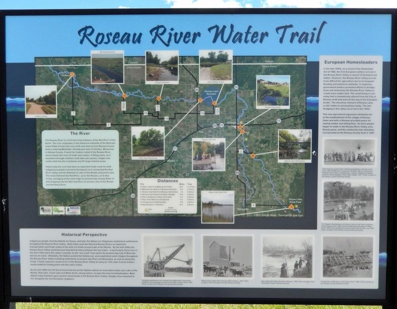
Roseau River Water Trail
Photographed by Cosmos Mariner, June 19, 2024
1. Roseau River Water Trail Marker
The River
The Roseau River is a 214-mile-long tributary of the Red River of the North. The river originates in the extensive wetlands of the Beltrami Island State Forest and runs north and west across Roseau County before entering Manitoba, Canada just west of Caribou, Minnesota in Kittson County. French fur traders called it the Roseau River, which means the river of reeds and rushes. A fitting name, as it meanders through common reed (aka cane grass), sedges and rushes that line the riverbanks and fill large lowland areas.
Historically the river has been an important trade route for both indigenous peoples and early Europeans as it connected the Red River Valley and the Dakotas to Lake of the Woods and points east. The route followed the Red River, up to the Roseau, on to Hay Creek, portaging at the sand ridge on present day County Road 12 and dropping into the Warroad River to access Lake of the Woods and the Rainy River.
Historical Perspective
Indigenous people, first the Dakota (or Sioux), and later the Ojibwe (or Chippewa) established settlements throughout the Roseau River Valley. Both tribes used the Red and Roseau
this page online
By the mid-1800s the US Government had moved the Ojibwe nations to reservation lands near Lake of the Woods, Red Lake, Leech Lake and White Earth, among others, to open the west to homesteaders. Most Ojibwe tribal members gave up their homesteads in the Roseau River Valley, though a few remained to live alongside the new European neighbors.
European Homesteaders
In the late 1800s, as a result of the Homestead Act of 1862, the first European settlers arrived
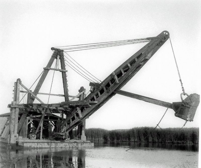
Roseau County Historical Society, 1906
2. Marker detail: Dredging, Roseau River, 1906
Dredging established a river channel and helped drain surrounding wetlands. The last dredge occurred in the 1930s.
This new agricultural expansion ultimately led to the establishment of the village of Roseau. Dams and mills in Roseau provided power for sawing lumber and milling flour. As more people began to settle in the Roseau River Valley area, Roseau grew, and the community was ultimately incorporated as the Roseau County Seat in 1895.
Topics. This historical marker is listed in these topic lists: Agriculture • Indigenous Peoples and Communities • Settlements & Settlers • Waterways & Vessels.
Location. 48° 50.766′ N, 95° 45.634′ W.
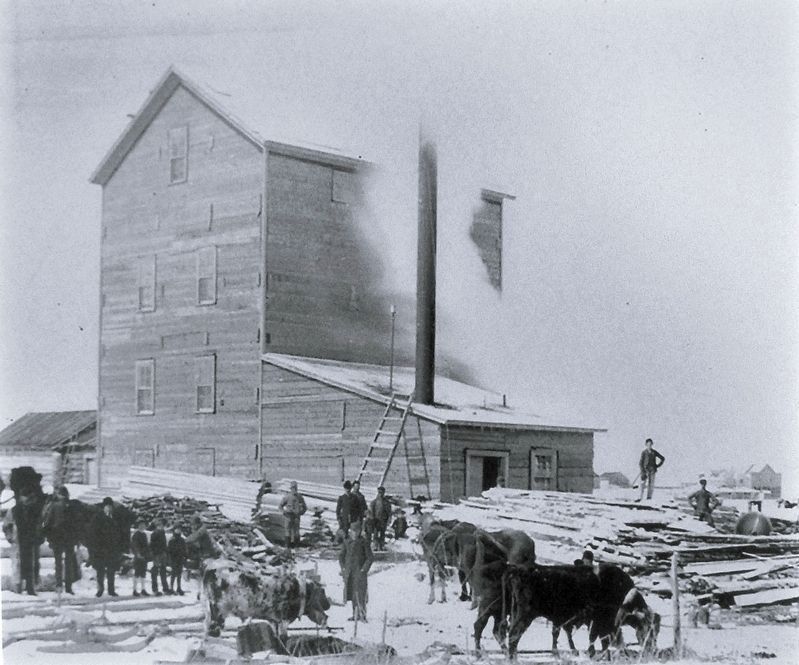
Pennington County Historical Society, 1905
3. Marker detail: Winter at the Jacklin Flour and Saw Mill in Roseau, 1905

Regionally, this marker is in the Northland. It is also in the American Midwest, in the Corn Belt, on the prairies, on the Great Plains, and specifically on the Northern Plains. Globally, it is in North America, the Great North Woods, the Western Hemisphere, the Western World, and the Anglosphere. Historically, it finds itself in what was once Rupert’s Land, the territory of the Mississippian Culture, and the Louisiana Purchase.
Other nearby markers. At least one other marker is within walking distance of this marker: The Heritage of this Place (about 600 feet away, measured in a direct line).
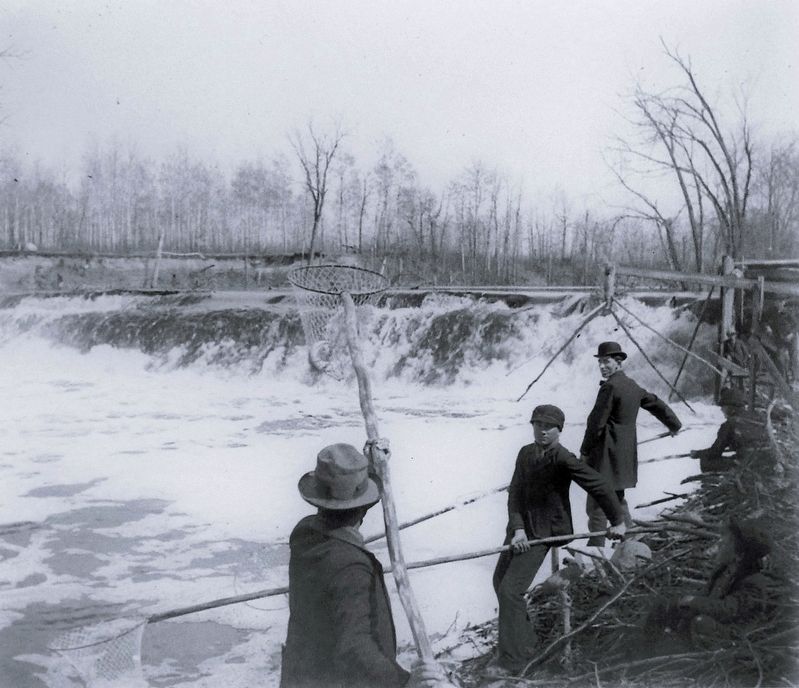
Pennington County Historical Society, 1905
4. Marker detail: Men netting fish below the dam in Roseau, 1905
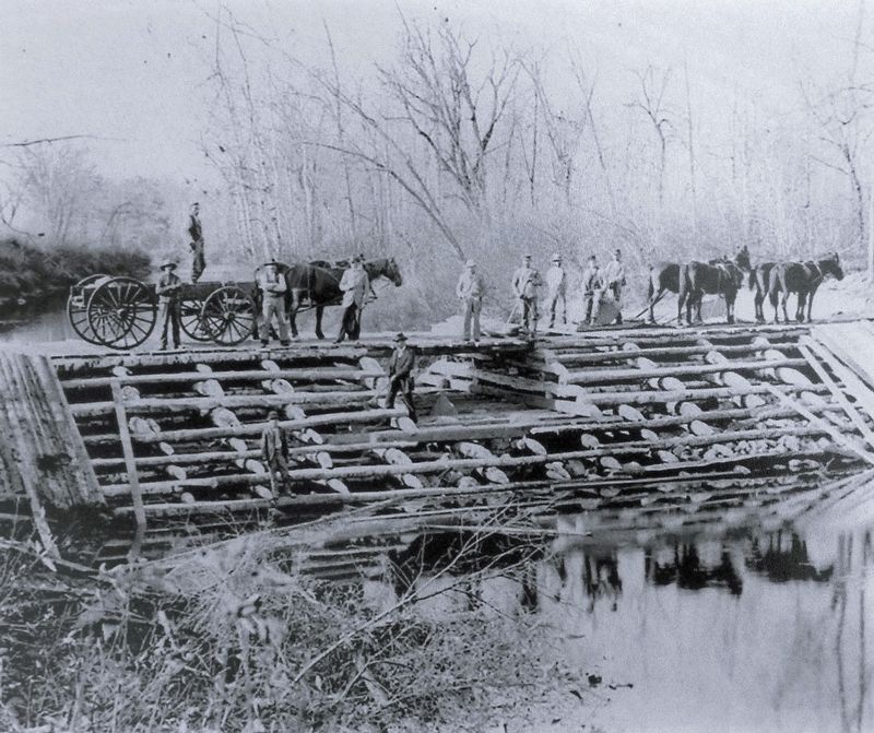
Roseau County Historical Society, 1880
5. Marker detail: Construction of Mill dam on the Roseau River, 1880
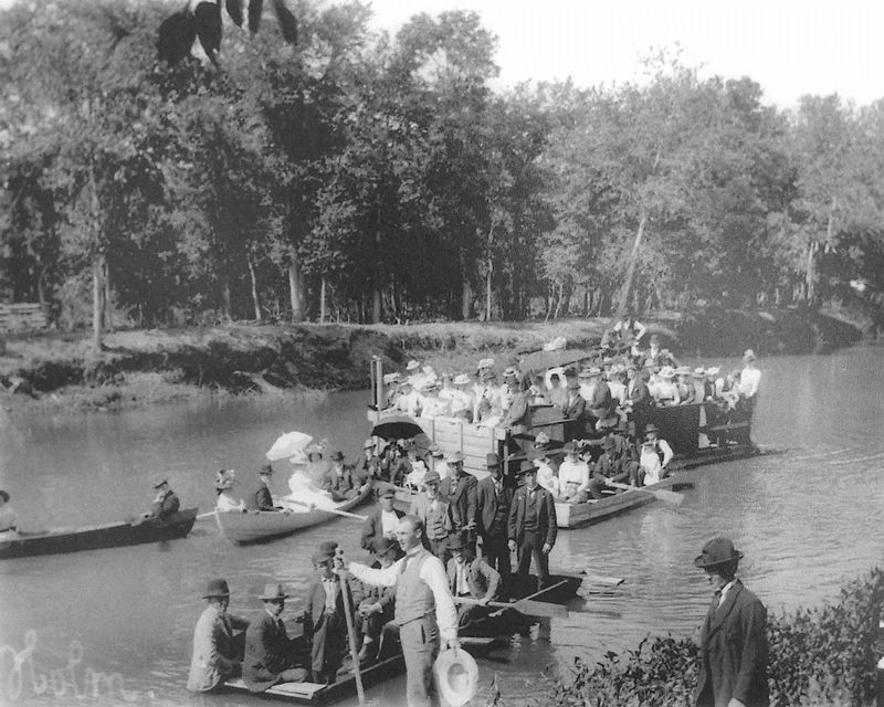
Roseau County Historical Society, July 1898
6. Marker detail: Modern Woodworkers of America Picnic, July 1898
The “Modern Woodworkers of America” picnic at the Holm residence on the Roseau River. Mike Holm was Minnesota Secretary of State (1921-1952) and is standing on the riverbank with his tuba.
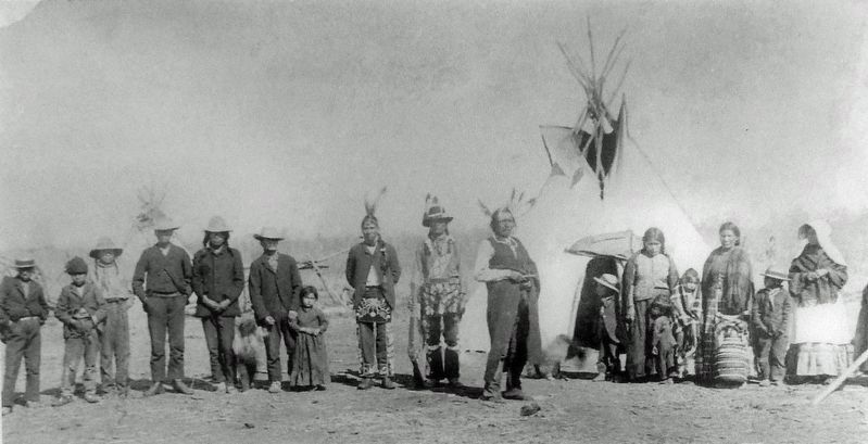
Roseau County Historical Society, 1887
7. Marker detail: Chief Cobenas and family
Chief Cobenas (center with a feathered headdress) with two of his wives, Billy McGillis and a young girl. McGillis' wife is in the bonnet. Nineteen local Indians, including men, women, children and babies posed for this photograph. Ross Indian Village, 1887.
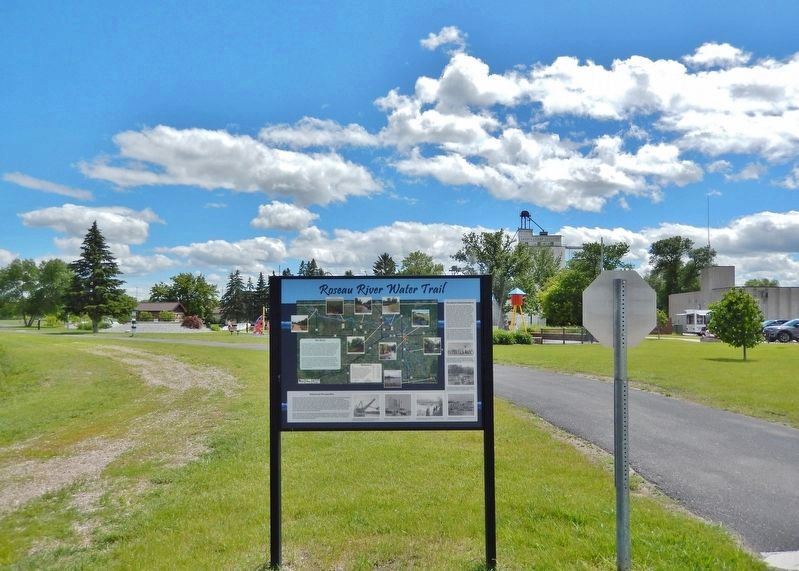
Photographed by Cosmos Mariner, June 19, 2024
8. Roseau River Water Trail Marker
Looking south from Center Street East. The Roseau River Water Trail is on the right. The Roseau River is just beyond the left/east edge of this photo.
Credits. This page was last revised on March 1, 2025. It was originally submitted on March 1, 2025, by Cosmos Mariner of Cape Canaveral, Florida. This page has been viewed 205 times since then and 27 times this year. Photos: 1, 2, 3, 4, 5, 6, 7, 8. submitted on March 1, 2025, by Cosmos Mariner of Cape Canaveral, Florida.
