Grand Portage in Cook County, Minnesota — The American Midwest (Upper Plains)
High Falls
The first barrier upstream from Lake Superior
Photographed by Cosmos Mariner, June 21, 2024
1. High Falls Marker
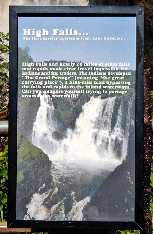
High Falls and nearly 20 miles of other falls and rapids made river travel impossible for Indians and fur traders. The Indians developed “The Grand Portage” (meaning “the great carrying place”), a nine-mile trail bypassing the falls and rapids to the inland waterways. Can you imagine yourself trying to portage around this waterfalls?
Topics. This historical marker is listed in these topic lists: Indigenous Peoples and Communities • Industry & Commerce • Natural Features • Waterways & Vessels.
Location. 48° 0.255′ N, 89° 35.867′ W. Marker is in Grand Portage, Minnesota, in Cook County. It can be reached from Voyageur Highway (State Highway 61) 0.4 miles east of Ryden Road, on the left when traveling east. The marker is located along the High Falls Trail in Grand Portage State Park. Touch for map. Marker is at or near this postal address: 9393 East Minnesota Highway 61, Grand Portage MN 55605, United States of America. Touch for directions.

Regionally, this marker is on the Boundary Waters Canoe Area Wilderness, in the Arrowhead Region, in the Iron Range, and in the North Shore. It is also in the American Midwest and in the Corn Belt. Globally, it is in North America, in the Great North Woods, on the Great Lakes, on Lake Superior’s North Shore, in the Western Hemisphere, in the Western World, and in the Anglosphere. Historically, it finds itself in what was once the Viceroyalty of New France, Rupert’s Land, the territory of the Mississippian Culture, and the Northwest Territory.
Other nearby markers. At least 8 other markers are within 5 miles of this marker, measured as the crow flies: Logs over the High Falls? (a few steps from this marker); Minnesota's Northern Border / Welcome to Minnesota (approx. 0.4 miles away); Webster-Ashburton Treaty of 1842
this page online
Also see . . .
1. The Pigeon River High Falls.
Excerpt: Because of the dramatic drop at both the High Falls and the smaller Middle Falls made the Pigeon River impassable by hunters and fur traders, an alternate route had to be found. Originally, it was used by the local Anishinaabe tribe, who knew it as Gichi Onigamiing. Then, later, by French fur traders working for the North West Company.(Submitted on March 2, 2025, by Cosmos Mariner of Cape Canaveral, Florida.)
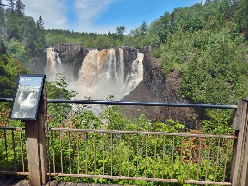
While the Grand Portage didn’t see much use by the fur trade after operations moved to Canada in the early 1800s, many still travel along it as a connecting point during canoe and hiking trips. The popularity of the Grand Portage and the High Falls on the Pigeon River led to the first-ever collaboration between a US state and a Native American tribe to open the area up to visitors. To this day, the GrandPortage State Park holds the unique title of being the only park in the nation that is managed in partnership between a state and a tribe. This makes it a historic state park in more ways than one.Photographed by Cosmos Mariner, June 21, 20242. High Falls MarkerView from the High Falls Trail, about ½-mile from the Grand Portage State Park Welcome Center.
2. Grand Portage (Wikipedia).
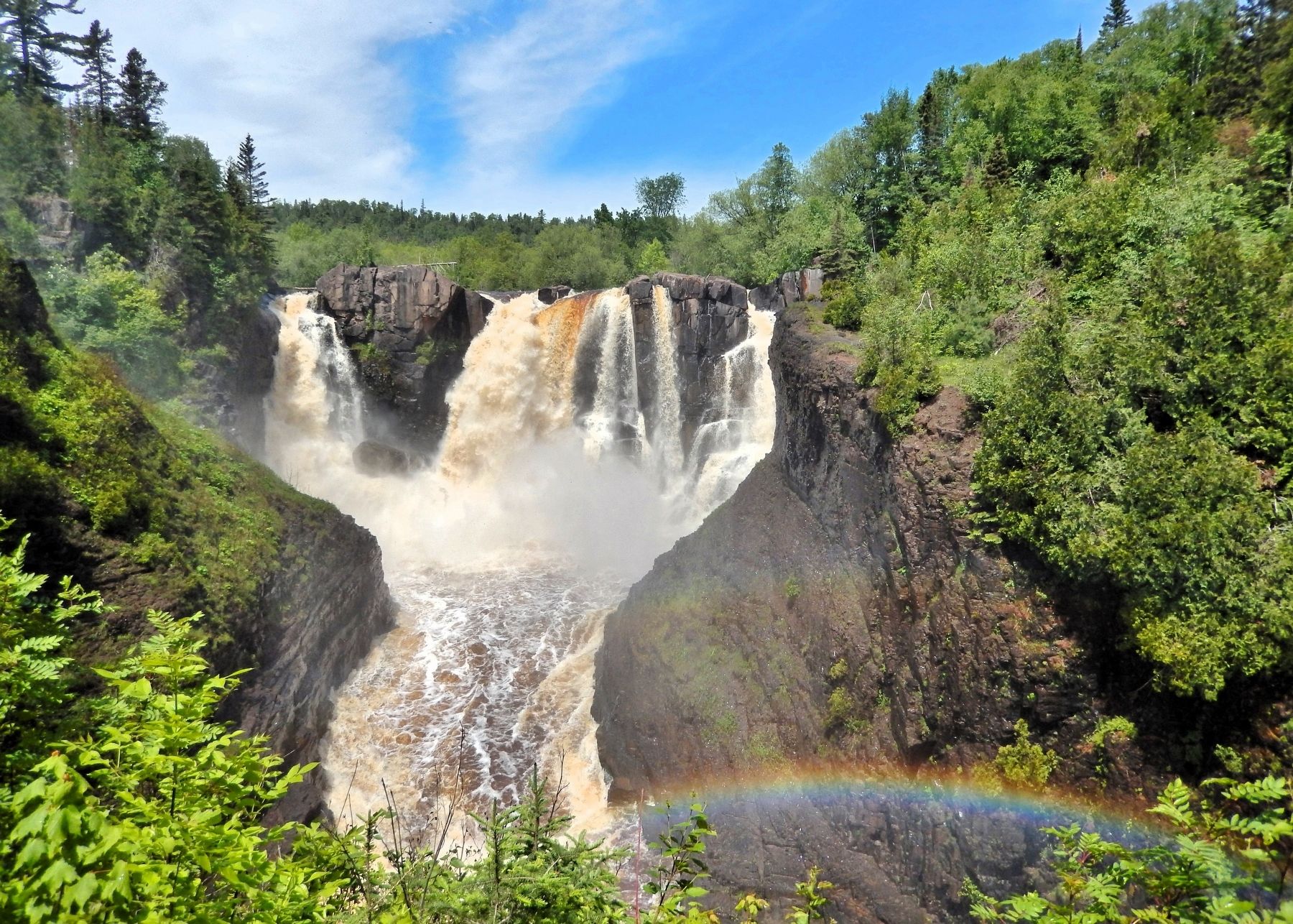
Excerpt: The Grand Portage is an 8.5-mile footpath which bypasses a set of waterfalls and rapids on the last 20 miles of the Pigeon River before it flows into Lake Superior. Composed of the Pigeon River and other strategic interior streams, lakes, and portages, this route was of enormous importance in pre-industrial times. It provided quick water access from Canada's settled areas and Atlantic ports to the fur-rich Rupert's Land and the North-Western Territory. Some 50 miles upstream from Lake Superior, this trade route crosses the Height of Land Portage, on the Northern continental divide, and connects South Lake in the Pigeon River/Great Lakes watershed with North Lake of the Rainy River watershed. Grand Portage was an essential link between the drainage basin of the Nelson River to Hudson Bay and that of the Saint Lawrence(Submitted on March 2, 2025, by Cosmos Mariner of Cape Canaveral, Florida.)River to the Atlantic Ocean.Photographed by Cosmos Mariner, June 21, 20243. High Falls of the Pigeon RiverThe High Falls of the Pigeon River is Minnesota’s highest waterfall, plummeting 120 feet into a narrow rocky gorge.As early as 2,000 years ago, Native American Nations probably used Gichi-onigaming, or "the Great Carrying Place", to travel from summer homes on Lake Superior to winter hunting grounds in the interior of Minnesota and Ontario. In 1729 Cree guide Auchagah drew a map for Pierre Gaultier de Varennes, sieur de La Vérendrye, one of the early French fur traders, showing how to reach the "western sea" of Lake Winnipeg. In time, Grand Portage became the gateway into rich northern fur-bearing country, where it connected remote interior outposts to lucrative international markets.
Credits. This page was last revised on March 2, 2025. It was originally submitted on March 2, 2025, by Cosmos Mariner of Cape Canaveral, Florida. This page has been viewed 130 times since then and 15 times this year. Photos: 1, 2, 3. submitted on March 2, 2025, by Cosmos Mariner of Cape Canaveral, Florida.
