Crystal River in Citrus County, Florida — The American South (South Atlantic)
Crystal River: An Enduring Legacy
| — | Crystal River Archaeological State Park | — |
Photographed by Brandon D Cross
1. Crystal River: An Enduring Legacy Marker
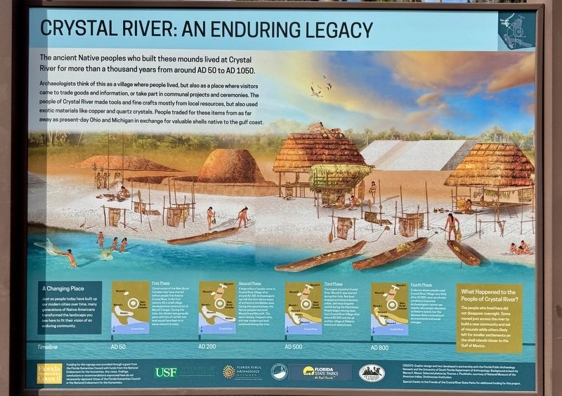
Archaeologists think of this as a village where people lived, but also as a place where visitors came to trade goods and information, or take part in communal projects and ceremonies. The people of Crystal River made tools and fine crafts mostly from local resources, but also used exotic materials like copper and quartz crystals. People traded for these items from as far away as present-day Ohio and Michigan in exchange for valuable shells native to the gulf coast.
A Changing Place
Just as people today have built up our modern cities over time, many generations of Native Americans transformed the landscape you see here to fit their vision of an enduring community.
What Happened to the People of Crystal River?
The people who lived here did not disappear overnight. Some moved just across the river to build a new community and set of mounds while others likely left for smaller settlements on the shell islands closer to the Gulf of Mexico.
Timeline
AD 50
First Phase
this page online
Construction of the Main Burial Complex may have started before people first lived at Crystal River. In the first century AD a small village developed and construction of Mound G began. During this time, the climate was generally warm with lots of rainfall; sea level would have been at or below where it is today.
AD 200
Second Phase
A large influx of people came to Crystal River Village after around AD 200. Archaeologists can tell this from dense layers of artifacts in the Midden area. During this second phase, the Native peoples here built Mound H and Mound K. The warm climate, frequent rains, and near modern sea level continued during this time.
AD 500
Third Phase
The largest mound at Crystal River, Mound A, was started during this time. Sea level dropped and climate became colder, with less frequent rainfall during the third phase. People began moving away from Crystal River Village after around AD 500 and set up another village at Roberts Island just downstream.
AD 800
Fourth Phase
Evidence shows people used Crystal River Village very little after AD 800, even as climate conditions improved.
Photographed by Brandon D Cross
2. Crystal River: An Enduring Legacy Marker
Erected by Florida Humanities Council and the National Endowment for the Humanities.
Topics. This historical marker is listed in these topic lists: Anthropology & Archaeology • Indigenous Peoples and Communities • Notable Places • Parks & Recreational Areas. A significant historical year for this entry is 1903.
Location. 28° 54.583′ N, 82° 37.715′ W. Marker is in Crystal River, Florida, in Citrus County. It can be reached from North Museum Point one mile south of West State Park Street, on the right when traveling north. The marker is located within Crystal River Archaeological State Park. Touch for map. Marker is at or near this postal address: 3400 N Museum Pt, Crystal River FL 34428, United States of America. Touch for directions.

Regionally, this marker is on Florida’s Gulf Coast. It is also in the American South and on the Gulf Coast. Globally, it is in the North Atlantic Region, North America, a Gulf of Mexico state, the Western Hemisphere, the Western
Florida Historical Society
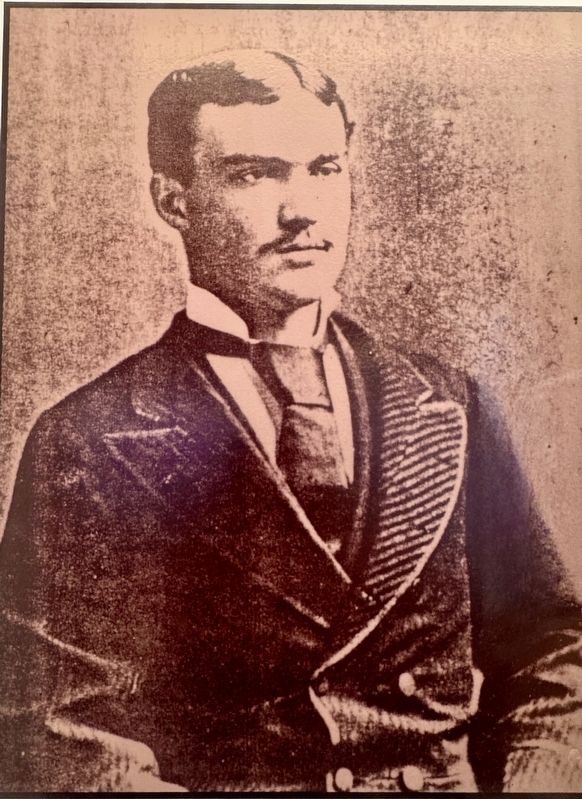
3. Clarence B. Moore Conducts Earliest Excavations
In 1903, he landed at a large shell mound on the bank of the Crystal River. He mapped the entire site and assigned major letter designations to the mounds. His excavation of the conical Burial Mound (C, E, and F) revealed many of the artifacts displayed in the visitor center today.
Moore's record of archaeological recovery and site maps continue to provide modern archaeologists with a foundation on which additional information may be compiled.
Moore's record of archaeological recovery and site maps continue to provide modern archaeologists with a foundation on which additional information may be compiled.
Other nearby markers. At least 8 other markers are within 3 miles of this marker, measured as the crow flies: A Separate Resting Place (within shouting distance of this marker); Temple or Stage? (about 400 feet away, measured in a direct line); A Place to Call Home (about 500 feet away); Remembering the Dead (about 500 feet away); Mystery in Stone (about 700 feet away); A View from the Top (about 800 feet away); Watery World (approx. 0.2 miles away); Kings Bay Park (approx. 2.2 miles away). Touch for a list and map of all markers in Crystal River.
Also see . . .
1. Crystal River Archaeological State Park. (Submitted on March 2, 2025, by Brandon D Cross of Flagler Beach, Florida.)
2. Crystal River Archaeological State Park. (Submitted on March 2, 2025, by Brandon D Cross of Flagler Beach, Florida.)
Photographed by University of Florida
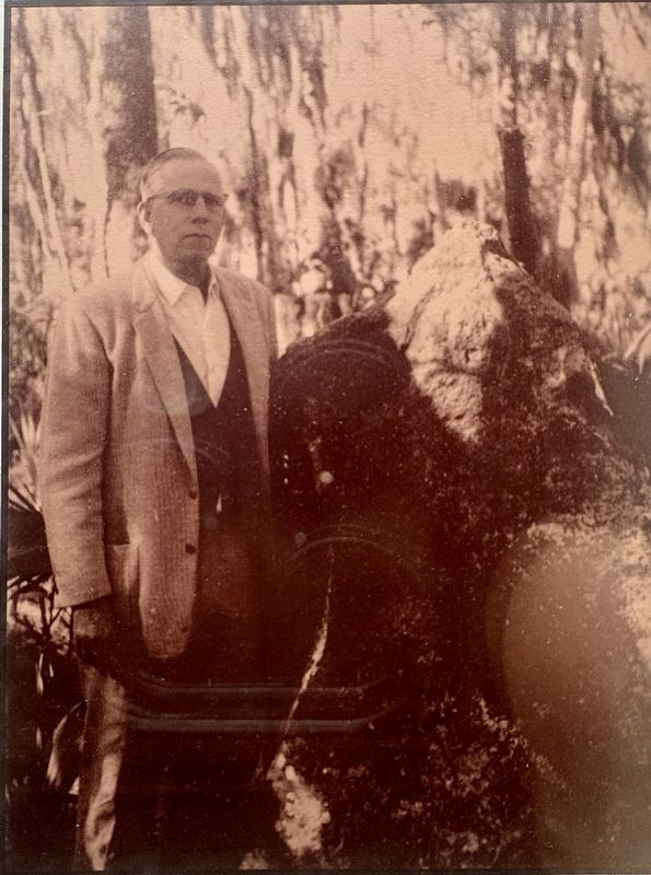
4. Excavations by Ripley P. Bullen
Bullen first visited the Crystal River Site in 1951 while he was an archaeologist for the Florida Park Service.
In 1960, Bullen returned and completed the most comprehensive excavation ever conducted at the site.
Bullen's final work at the site took place in 1964 and 1965. His radiocarbon research in 1964 and final excavation in 1965 is the foundation of the site's interpretation.
In 1960, Bullen returned and completed the most comprehensive excavation ever conducted at the site.
Bullen's final work at the site took place in 1964 and 1965. His radiocarbon research in 1964 and final excavation in 1965 is the foundation of the site's interpretation.

Photographed by Brandon D Cross
5. Crystal River Archaeological State Park entrance
Credits. This page was last revised on March 3, 2025. It was originally submitted on March 2, 2025, by Brandon D Cross of Flagler Beach, Florida. This page has been viewed 192 times since then and 52 times this year. Photos: 1, 2, 3, 4, 5. submitted on March 2, 2025, by Brandon D Cross of Flagler Beach, Florida. • J. J. Prats was the editor who published this page.
