
New Buffalo Township in Berrien County, Michigan — The American Midwest (Great Lakes)
The Importance of Water for Neshnabék
Photographed by Trevor L Whited, March 2, 2025
1. The Importance of Water for Neshnabek Marker
Inscription.
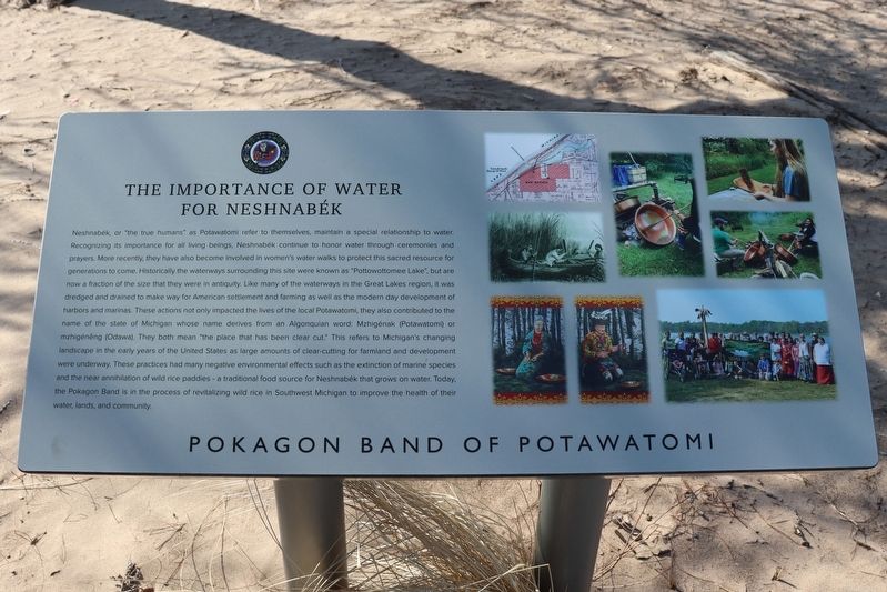
The Importance of Water for Neshnabék. . Neshnabék, or "the true humans" as Potawatomi refer to themselves, maintain a special relationship to water. Recognizing its importance for all living beings, Neshnabék continue to honor water through ceremonies and prayers. More recently, they have also become involved in women's water walks to protect this sacred resource for generations to come. Historically the waterways surrounding this site were known as "Pottowottomee Lake", but are now a fraction of the size that they were in antiquity. Like many of the waterways in the Great Lakes region, it was dredged and drained to make way for American settlement and farming as well as the modern day development of harbors and marinas. These actions not only impacted the lives of the local Potawatomi, they also contributed to the name of the state of Michigan whose name derives from an Algonquian word: Mzhigénak (Potawatomi) or mzhigénęng (Odawa). They both mean "the place that has been clear cut." This refers to Michigan's changing landscape in the early years of the United States as large amounts of clear-cutting for farmland and development were underway. These practices had many negative environmental effects such as the extinction of marine species and the near annihilation of wild rice paddies - a traditional food source for Neshnabék that grows on water. Today. the Pokagon Band is in the process of revitalizing wild rice in Southwest Michigan to improve the health of their water, lands, and community.
Neshnabék, or "the true humans" as Potawatomi refer to themselves, maintain a special relationship to water.
Recognizing its importance for all living beings, Neshnabék continue to honor water through ceremonies and
prayers. More recently, they have also become involved in women's water walks to protect this sacred resource for
generations to come. Historically the waterways surrounding this site were known as "Pottowottomee Lake", but are
now a fraction of the size that they were in antiquity. Like many of the waterways in the Great Lakes region, it was
dredged and drained to make way for American settlement and farming as well as the modern day development of
harbors and marinas. These actions not only impacted the lives of the local Potawatomi, they also contributed to the
name of the state of Michigan whose name derives from an Algonquian word: Mzhigénak (Potawatomi) or
mzhigénęng (Odawa). They both mean "the place that has been clear cut." This refers to Michigan's changing
landscape in the early years of the United States as large amounts of clear-cutting for farmland and development
were underway. These
Click or scan to see this page online
practices had many negative environmental effects such as the extinction of marine species
and the near annihilation of wild rice paddies - a traditional food source for Neshnabék that grows on water. Today.
the Pokagon Band is in the process of revitalizing wild rice in Southwest Michigan to improve the health of their
water, lands, and community.
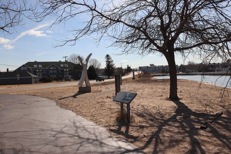
Location. 41° 47.995′ N, 86° 44.888′ W. Marker is in New Buffalo, Michigan, in Berrien County. It is in New Buffalo Township. It can be reached from Marquette Drive. The marker can be reached from the southeast corner of the parking lot of the New Buffalo Beach. Touch for map. Marker is at or near this postal address: 200 Marquette Dr New Buffalo MI 49117, New Buffalo MI 49117, United States of America. Touch for directions.

Regionally, this marker is in Southwest Michigan and specifically in one
Photographed by Trevor L Whited, March 2, 2025
2. The Importance of Water for Neshnabek Marker
of the Lake Michigan Shore counties. It is also in the American Midwest and on the Great Lakes. Globally, it is in North America, the Western Hemisphere, the Western World, and the Anglosphere. Historically, it finds itself in what was once the Viceroyalty of New France and also the Northwest Territory.
Another marker is no longer nearby. West Michigan Pike (was within shouting distance of this marker but has been confirmed missing).
Credits. This page was last revised on July 9, 2025. It was originally submitted on March 2, 2025, by Trevor L Whited of Kokomo, Indiana. This page has been viewed 184 times since then and 15 times this year. Photos:1, 2. submitted on March 2, 2025, by Trevor L Whited of Kokomo, Indiana. • J. Makali Bruton was the editor who published this page.
