Northwest in Williams County, Ohio — The American Midwest (Great Lakes)
The Nettle Lake Mound Group
⎯⎯⎯
The Hopewell Indians
Photographed by Christopher Light, November 4, 2007
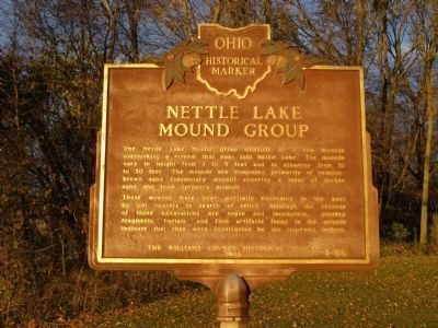
1. Nettle Lake Mound Group side of the marker
The Nettle Lake Mound Group
The Nettle Lake Mound group consists of 4 low mounds overlooking a stream that runs into Nettle Lake. The mounds vary in height from 1 to 3 feet and in diameter from 18 to 3- feet. The mounds are composed primarily of reddish-brown sand (secondary mound) covering a layer of darker sand and loam (primary mound).
These mounds have been partially excavated in the past by pot hunters in search of relics. Although the records of these excavations are vague and incomplete, pottery fragments, burials, and flint artifacts found in the mounds indicate that they were constructed by the Hopewell Indians.
The Hopewell Indians
The prehistoric Hopewell Indians who inhabited Ohio 2000 years ago are famous for their large ceremonial earthworks and burial mounds, and for their artistic abilities. Many of the artifacts they made - - especially those manufactured from 'exotic' materials such as copper, mica, obsidian, and marine shell - - were evidently connected with their social organization and burial rites. They lived in small river valley communities where they hunted, fished, gathered food, and farmed.
this page online
Erected 1968 by The Ohio Historical Society. (Marker Number 1-86.)
Topics and series. This historical marker is listed in these topic lists: Anthropology & Archaeology • Cemeteries & Burial Sites • Indigenous Peoples and Communities. In addition, it is included in the Ohio Historical Society / The Ohio History Connection series list. A significant historical year for this entry is 2000.
Location. 41° 41.194′ N, 84° 43.887′ W. Marker is in Northwest, Ohio, in Williams County. It is on County Road 475 one mile County Road R. North of the Ohio Turnpike on S.R. 49. Turn east (right)onto C.R. R to C.R. 475. North 1 mile. Touch for map. Marker is in this post office area: Montpelier OH 43543, United States of America. Touch for directions.

Regionally, this marker is in the Till Plains. It is also in the American Midwest and in the Corn Belt. Globally, it is in North America, the

Photographed by Christopher Light, November 4, 2007
2. The Hopewell Indians side of the marker
Other nearby markers. At least 8 other markers are within 7 miles of this marker, measured as the crow flies: Copperbelly Water Snake Habitat Restoration (approx. one mile away); Where Indiana, Michigan, and Ohio Meet (approx. 3.9 miles away in Michigan); Chester Park Veterans Memorial (approx. 5 miles away in Michigan); Camden Cemetery Veterans Memorial (approx. 5 miles away in Michigan); First Millstone Used in Mill (approx. 5½ miles away); Indiana's Northern Boundary Line (approx. 6½ miles away in Indiana); Powers Memorial (approx. 6.6 miles away in Indiana); Powers Church (approx. 6.6 miles away in Indiana).
More about this marker. On the left half of the reverse side of this marker is a timeline of Ohio's Indian History. A closeup of this timeline is provided in picture 3.
Also see . . . Hopewell Culture of Native Americans. Legends of America website entry (Submitted on October 14, 2024, by Larry Gertner of New York, New York.)
Photographed by Christopher Light, November 4, 2007
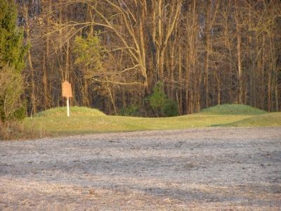
3. Nettle Lake Mounds from CR 475
Note that there is a farm field between the mound area and the road. If a tall crop, such as corn, is planted, the marker and the mounds will not be visible from the road.
Photographed by Christopher Light, November 4, 2007
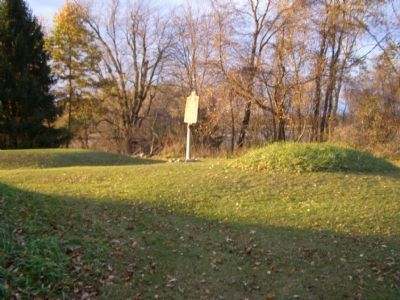
4. Three of the four Mounds and Marker
One mound is the shadow at the left front. A second is fully lite in the right center. The third is center left; lite and shadowed in the left center.
Photographed by Christopher Light, November 4, 2007
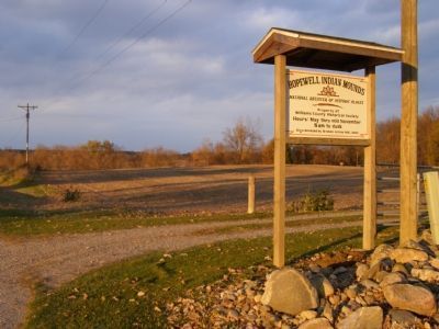
5. Hopewell Indian Mounds
National Register of Historic Places
Property of Williams County Historical Society
Hours: May thru mid November
8 am. to dusk
Sign donated by Broken Arrow M.C. 2004
Note: there is a farm field between the entrance and the park. If planted in corn, the park and marker will not be visible from the road.
Property of Williams County Historical Society
Hours: May thru mid November
8 am. to dusk
Sign donated by Broken Arrow M.C. 2004
Note: there is a farm field between the entrance and the park. If planted in corn, the park and marker will not be visible from the road.
Photographed by Christopher Light, November 4, 2007
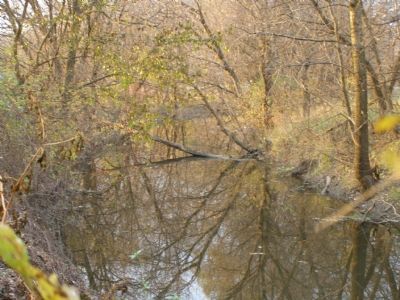
6. The creek leading to Nettle Lake
Credits. This page was last revised on March 15, 2025. It was originally submitted on December 6, 2007, by Christopher Light of Valparaiso, Indiana. This page has been viewed 10,658 times since then and 445 times this year. Last updated on March 13, 2025, by Craig Doda of Napoleon, Ohio. Photos: 1, 2, 3, 4, 5, 6. submitted on December 6, 2007, by Christopher Light of Valparaiso, Indiana. • J. Makali Bruton was the editor who published this page.
