Gateway of the Rio Grande
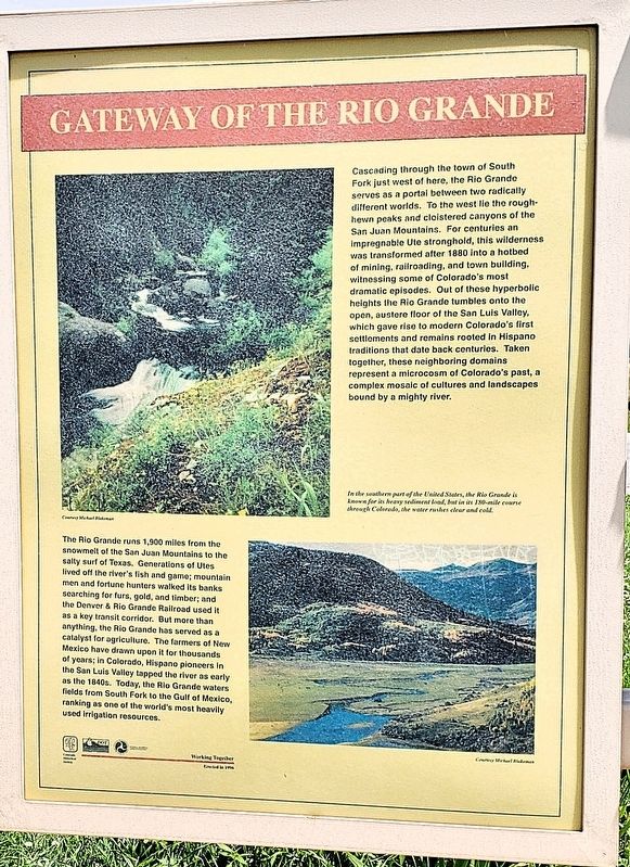
Cascading through the town of South Fork just west of here, the Rio Grande serves as a portal between two radically different worlds. To the west lie the roughhewn peaks and cloistered canyons of the San Juan Mountains. For centuries an impregnable Ute stronghold, this wilderness was transformed after 1880 into a hotbed of mining, railroading, and town building, witnessing some of Colorado’s most dramatic episodes. Out of these hyperbolic heights the Rio Grande tumbles onto the open, austere floor of the San Luis Valley, which gave rise to modern Colorado’s first settlements and remains rooted in Hispano traditions that date back centuries. Taken together, these neighboring domains represent a microcosm of Colorado’s past, a complex mosaic of cultures and landscapes bound by a mighty river.
In the southern part of the United States, the Rio Grande is known for its heavy sediment load, but in its 180-mile course through Colorado, the water rushes clear and cold.
The Rio Grande runs 1,900 miles from the snowmelt of the San Juan Mountains to the salty surf of Texas. Generations of Utes lived off the river’s fish and game; mountain
this page online
Erected 1996 by Colorado Historical Society, Colorado Department of Transportation, and Federal Highway Administration.
Topics. This historical marker is listed in these topic lists: Agriculture • Hispanic Americans • Settlements & Settlers • Waterways & Vessels. A significant historical year for this entry is 1880.
Location. 37° 40.834′ N, 106° 32.725′ W. Marker is in South Fork, Colorado, in Rio Grande County. It can be reached from U.S. 160 at milepost 191.4, 0.1 miles west of County Road 50, on the right when traveling west. The marker is in the Shaw Creek CDOT Rest Area. Touch for map.
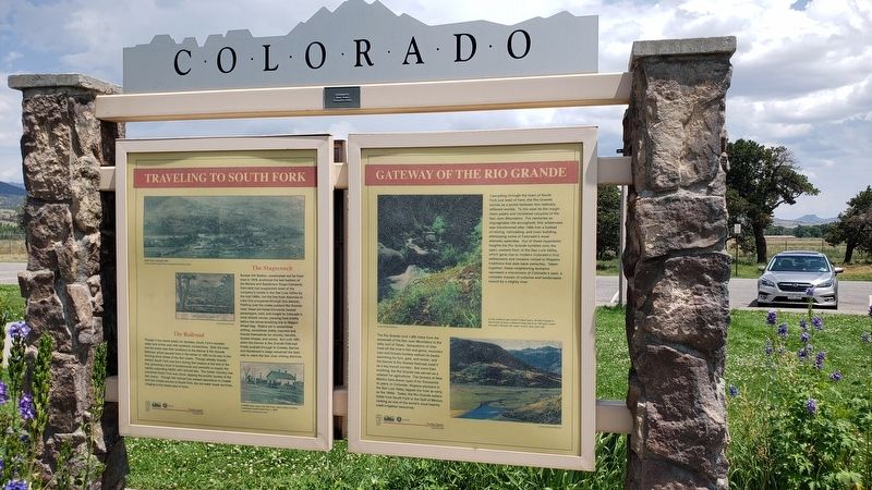

Regionally, this marker is in the Colorado High Rockies, in the San Juan Mountains, and in the San Luis Valley. It is also in the American Mountain West. Globally, it is in North America, the Rocky Mountains, the Western Hemisphere, the Western World, and the Anglosphere. Historically, it finds itself in what was once New Spain and also the Republic of Texas.
Other nearby markers. At least 8 other markers are within 11 miles of this marker, measured as the crow flies: Traveling to South Fork (here, next to this marker); Explorers (here, next to this marker); South Fork Country (here, next to this marker); A Passport Through Time (approx. 5.3 miles away); Living on the Byway (approx. 5.3 miles away); Watchable Wildlife (approx. 5.3 miles away); Rio Grande — A River of Life (approx. 5.3 miles away); Mark M. Jones, AIA (approx. 10½ miles away). Touch for a list and map of all markers in South Fork.
Also see . . . Rio Grande (Wikipedia).
Excerpt: The Rio Grande rises in the(Submitted on March 18, 2025, by Cosmos Mariner of Cape Canaveral, Florida.)western part of Rio Grande National Forest, in the U.S. state of Colorado, and is formed by the joining of several streams at the base of Canby Mountain, in the San Juan Mountains, due east of the Continental Divide. From the Continental Divide, the Rio Grande flows through the San Luis Valley, then south into New Mexico.Photographed by Cosmos Mariner, July 26, 20243. Shaw Creek Rest Area Interpretive KioskLooking northeast; the rest area parking lot is in the background.The Rio Grande with its fertile valley, along with its tributaries, is a vital water source for seven U.S. and Mexican states and flows primarily through arid and semi-arid lands. After traversing the length of New Mexico, the Rio Grande becomes the Mexico–United States border, between the U.S. state of Texas and the northern Mexican states of Chihuahua and Coahuila, Nuevo León and Tamaulipas; a short segment of the Rio Grande is a partial state-boundary between the U.S. states of New Mexico and Texas. Since the mid–twentieth century, only 20 percent of the Rio Grande's water reaches the Gulf of Mexico, because of the voluminous consumption of water required to irrigate farmland (e.g. the Mesilla and Lower Rio Grande Valleys) and to continually hydrate cities (e.g. Albuquerque); such water usages are additional to
the reservoirs of water retained with diversion dams.

Credits. This page was last revised on March 18, 2025. It was originally submitted on March 13, 2025, by Cosmos Mariner of Cape Canaveral, Florida. This page has been viewed 138 times since then and 19 times this year. Photos: 1, 2, 3. submitted on March 17, 2025, by Cosmos Mariner of Cape Canaveral, Florida.
