Crystal River in Citrus County, Florida — The American South (South Atlantic)
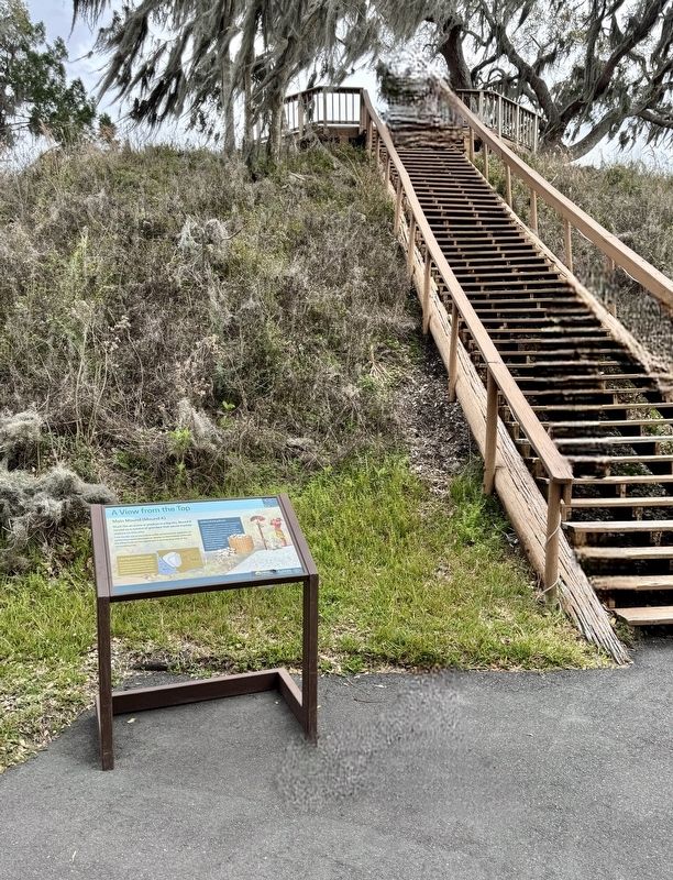
A View from the Top
Crystal River Archaeological State Park

Photographed by Brandon D Cross
1. A View from the Top Marker
A View from the Top
Much like an arena or stadium in a big city, Mound A served as a symbol of grandeur that would impress visitors to this site.
From the flat top of the mound, public performances, speakers, or ceremonies would have been on display to those below, while also providing those on the mound with a commanding view of the surrounding area.
Learning from What’s Left
Mound A stood intact for over 1,000 years until developers bulldozed two-thirds for use as landfill in the late 1950s. The map (right) shows Mound A's current shape overlaid with an outline of its original size.
Unlikely Building Blocks
At around 28 feet tall, Mound A would have been a big construction project no matter when it was built. Scientists estimate that it is made up of about 317,901 cubic feet of shell - that's about 256,372 bushels or baskets full! If a community of 50 to 100 people here at the Crystal River site piled up 36 baskets of shell a day it would have taken 7,202 days, or more than 19 years, to build a mound of this size.
Erected by Florida Humanities Council and the National Endowment for
this page online
Topics. This historical marker is listed in these topic lists: Anthropology & Archaeology • Indigenous Peoples and Communities • Man-Made Features.
Location. 28° 54.458′ N, 82° 37.703′ W. Marker is in Crystal River, Florida, in Citrus County. It is on North Museum Point 0.1 miles south of West State Park Street, on the right when traveling north. The marker is located within Crystal River Archaeological State Park. Touch for map. Marker is at or near this postal address: 3400 North Museum Point, Crystal River FL 34428, United States of America. Touch for directions.

Regionally, this marker is on Florida’s Gulf Coast. It is also in the American South and on the Gulf Coast. Globally, it is in the North Atlantic Region, North America, a Gulf of Mexico state, the Western Hemisphere, the Western World, and the Anglosphere. Historically, it finds itself in what was once New Spain, the territory of the Mississippian Culture, one of the Confederate States of America, and the Antebellum South.
Other nearby markers. At least 8 other markers are
Photographed by Brandon D Cross
2. A View from the Top Marker
Also see . . .
1. Crystal River Archaeological State Park. (Submitted on March 16, 2025, by Brandon D Cross of Flagler Beach, Florida.)
2. Crystal River Archaeological State Park. (Submitted on March 16, 2025, by Brandon D Cross of Flagler Beach, Florida.)
Credits. This page was last revised on March 20, 2025. It was originally submitted on March 16, 2025, by Brandon D Cross of Flagler Beach, Florida. This page has been viewed 136 times since then and 18 times this year. Photos: 1, 2. submitted on March 16, 2025, by Brandon D Cross of Flagler Beach, Florida. • Andrew Ruppenstein was the editor who published this page.
