Defiance in Defiance County, Ohio — The American Midwest (Great Lakes)
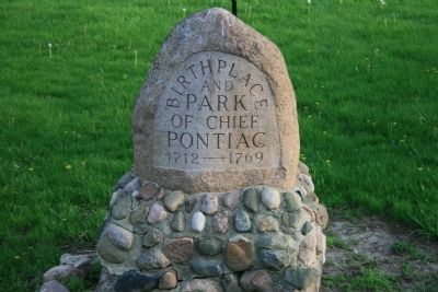
Chief Pontiac
and
Park
of Chief
Pontiac
1712 --- 1769
Topics. This historical marker is listed in these topic lists: Native Americans • Wars, US Indian. A significant historical year for this entry is 1712.
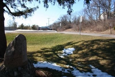
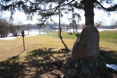
Location. 41° 17.363′ N, 84° 21.291′ W. Marker is in Defiance, Ohio, in Defiance County. Marker is on East River Drive, 0.3 miles east of North Clinton Street (Ohio Route 15). This historic marker is located in Pontiac Park along the west/north side of the Maumee River, directly opposite the confluence of the Auglaize River with the Maumee River. Touch for map. Marker is in this post office area: Defiance OH 43512, United States of America. Touch for directions.
Other nearby markers. At least 8 other markers are within walking distance of this marker. Flood Poles (within shouting distance of this marker); Buckeye Trail (within shouting distance of this marker); Johnny Appleseed (about 400 feet away, measured in a direct line); Pontiac Birthplace (about 600 feet away); French Indian Apple Tree (about 600 feet away); Bark Cabin Home of Coohcoohe (about 600 feet away); Civil War Cannons (approx. 0.2 miles away); Fort Defiance, 1794 (approx. 0.2 miles away). Touch for a list and map of all markers in Defiance.
Also see . . .
1. Pontiac. This link is published and made available by, "Ohio History Central," an online encyclopedia of Ohio History. (Submitted on January 23, 2010, by Dale K. Benington of Toledo, Ohio.)
2. Pontiac's Rebellion. This link is published and made available by, "Ohio History Central," an online encyclopedia of Ohio History. (Submitted on January 23, 2010, by Dale K. Benington of Toledo, Ohio.)

Photographed By Dale K. Benington, March 6, 2010
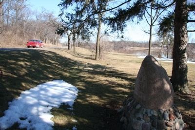
3. Chief Pontiac Marker
View looking west with the historical marker in the left foreground, River Road heading westward over on the right hand side of the picture, and the parking lot for the Pontiac Park river access to the Maumee River in the background of the picture.
Credits. This page was last revised on June 16, 2016. It was originally submitted on January 23, 2010, by Dale K. Benington of Toledo, Ohio. This page has been viewed 2,009 times since then and 29 times this year. Photos: 1. submitted on January 23, 2010, by Dale K. Benington of Toledo, Ohio. 2, 3, 4. submitted on March 8, 2010, by Dale K. Benington of Toledo, Ohio. • Kevin W. was the editor who published this page.


