
Old Port of Montreal in Montréal, Québec — Central Canada (French-Canadian)
Arrondissement Historique
Vieux-Port
⎯⎯⎯
Historic District
Old Port
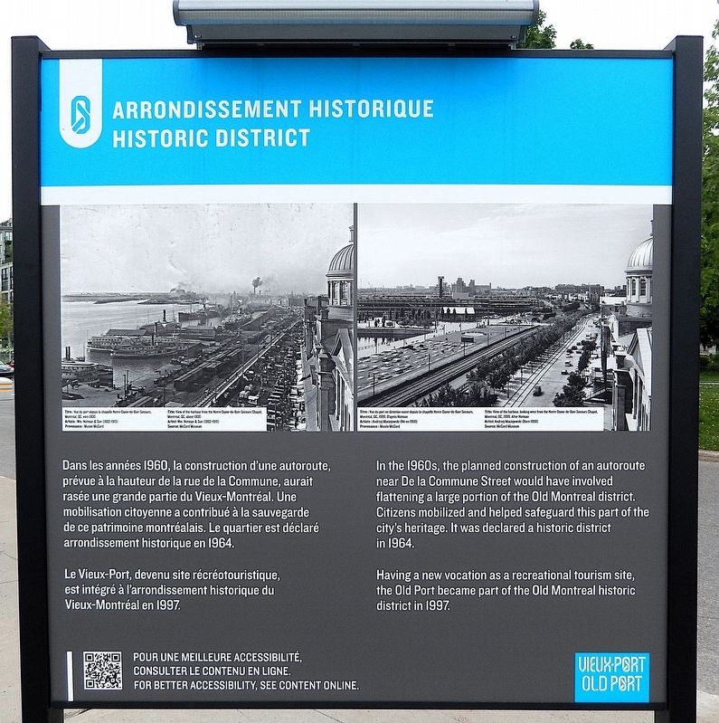
Photographed by Cosmos Mariner, May 21, 2024
1. Arrondissement Historique/Historic District Marker

Le Vieux-Port, devenu site récréotouristique, est intégré à l'arrondissement historique du Vieux-Montréal en 1997.
Having a new vocation as a recreational tourism site, the Old Port became part of the Old Montreal historic district in 1997.
Topics. This historical marker is listed in these topic lists: Architecture • Parks & Recreational Areas • Roads & Vehicles • Waterways & Vessels. A significant historical year for this entry is 1997.
Location. 45° 30.052′ N, 73° 33.154′ W. Marker is in Montréal, Québec. It is in Old
this page online

Regionally, this marker is in Central Canada. Globally, it is in North America, the Western Hemisphere, and the Western World. Historically, it finds itself in what was once a British colony, the Viceroyalty of New France, the Haudenosaunee (Iroquois) Confederacy, and Rupert’s Land.
Other nearby markers. At least 8 other markers are within walking distance of this marker: Transformation Vieux-Port en site récréotouristique / Old Port Transformed into Recreational Tourism (here, next to this marker); Lieu de commémoration / Commemorative Site (here, next to this marker); a different marker also named Transformation Vieux-Port en site récréotouristique / Old Port Transformed into Recreational Tourism (a few steps from this marker); Le plus grand port céréalier du monde / The World's Largest Grain Port

Courtesy Musée McCord Museum
2. Marker detail: View of the harbour from the Notre-Dame-de-Bon-Secours Chapel, Montréal, QC, c. 1900
Vue du port depuis la chapelle Notre-Dame-de-Bon-Secours, Montréal, QC, vers 1900
Artist/Artiste : Wm. Notman & Son (1882-1919)
Artist/Artiste : Wm. Notman & Son (1882-1919)
Related markers. Click here for a list of markers that are related to this marker. Vieux-Port/Old Port
Also see . . . Old Montreal (Wikipedia).
Excerpt: Founded by French settlers in 1642 as Fort Ville-Marie, Old Montreal is home to many structures dating back to the era of New France. The 17th century settlement lends its name to the borough in which the neighbourhood lies, Ville-Marie. In 1964, much of Old Montreal was declared a historic district by the Ministère des Affaires culturelles du Québec.(Submitted on April 1, 2025, by Cosmos Mariner of Cape Canaveral, Florida.)The old town's riverbank is taken up by the Old Port (Vieux-Port), whose maritime facilities are surrounded with recreational space and a variety of museums and attractions. The Iberville terminal on the Alexandra Pier serves as the cruise terminal for about 50,000 passengers annually from large cruise ships plying the Saint Lawrence Seaway.
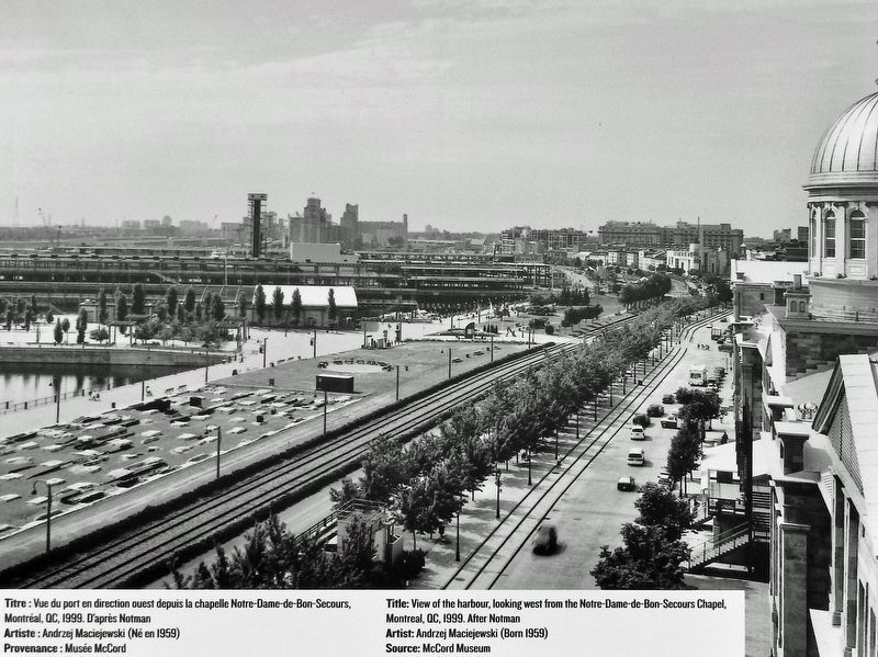
Courtesy Musée McCord Museum
3. Marker detail: View of the harbour from the Notre-Dame-de-Bon-Secours Chapel, Montréal, QC, 1999
Vue du port en direction ouest depuis la chapelle Notre-Dame-de-Bon-Secours, Montréal, QC, 1999.
Artist/Artiste : Andrzej Maciejewski (Born/Né en 1959)
Artist/Artiste : Andrzej Maciejewski (Born/Né en 1959)
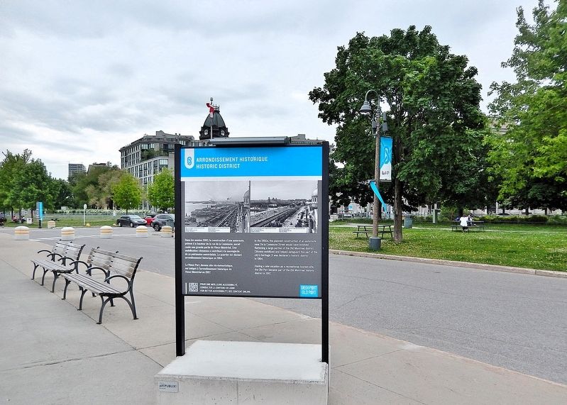
Photographed by Cosmos Mariner, May 21, 2024
4. Arrondissement Historique/Historic District Marker
Looking south along the Promenade du Vieux-Port.
Credits. This page was last revised on April 5, 2025. It was originally submitted on March 30, 2025, by Cosmos Mariner of Cape Canaveral, Florida. This page has been viewed 140 times since then and 34 times this year. Photos: 1, 2, 3, 4. submitted on April 1, 2025, by Cosmos Mariner of Cape Canaveral, Florida.
