
Fremont in Sandusky County, Ohio — The American Midwest (Great Lakes)
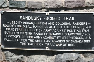
Sandusky-Scioto Trail
Used by Indian, British and Colonial Rangers
Photographed by Dale K. Benington, April 8, 2009
1. Sandusky-Scioto Trail Marker
Topics. This historical marker is listed in these topic lists: Indigenous Peoples and Communities • Roads & Vehicles • War of 1812 • War, French and Indian. A significant historical year for this entry is 1760.
Location. Marker has been reported missing. It was located near 41° 20.203′ N, 83° 7.938′ W. Marker was in Fremont, Ohio, in Sandusky County. It was at the intersection of Buckland Avenue and Cleveland Ave., on the left when traveling north on Buckland Avenue. This historical marker is located on the outer wall that surrounds the Rutherford B. Hayes Presidential Center, just to the left of the south-east gate entrance (the gate doors originally protecting the White House in Washington DC, but were donated to the Hayes Presidential Center). Touch for map. Marker was at or near this postal address: 1491 Buckland Avenue,
this page online

Regionally, this marker was on the Lake Erie Shore and in the Toledo Metropolitan Area. It was also in the American Midwest and in the Corn Belt. Globally, it was in North America, on the Great Lakes, in the Western Hemisphere, in the Western World, and in the Anglosphere. Historically, it found itself in what was once the Viceroyalty of New France, the Haudenosaunee (Iroquois) Confederacy, the territory of the Mississippian Culture, and the Northwest Territory.
Other nearby markers. At least 8 other markers are within walking distance of this location: Harold R. Balsizer (about 500 feet away, measured in a direct line); Soldiers Memorial Parkway Of Sandusky County (about 500 feet away); William E. Allen (about 500 feet away); Robert R. Benner (about 500 feet away); Wayne F. Baumann (about 500 feet away); Arthur N. Berry (about 500 feet away); Irvan A. Bennett (about 600 feet away); Phillip Bowe (about 600 feet away). Touch for a list and map of all markers in Fremont.
More about this marker. The pathway that heads north through the nearby gated
Photographed by Dale K. Benington, April 8, 2009
2. Sandusky-Scioto Trail Marker
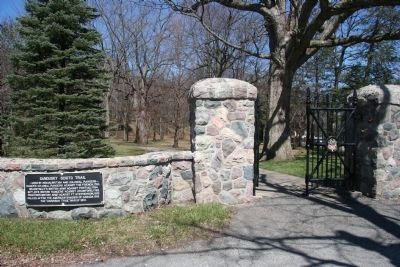
The historical marker is shown on the wall of the Hayes Presidential Center, just to the left of the gated southeast entrance that allows the Scioto-Sandusky Trail to proceed through grounds of the Presidential estate. Immediately seen through and just beyond the gate is the broad leaf tree that Mr. Hayes named after William Henry Harrison.
Regarding Sandusky-Scioto Trail. During the course of the War of 1812 this trail, which runs right through the Hayes Presidential Center, was said to have been used at times by both the British and their Native American allies, as well as by the American military. Tradition has it that at some point, during the course of his Sandusky Valley Campaign, elements of the American army (along with General Harrison) actually camped and slept on what is now the Hayes Presidental Center.
Related markers. Click here for a list of markers that are related to this marker. To better understand the
Photographed by Dale K. Benington, April 8, 2009
3. Sandusky-Scioto Trail Marker
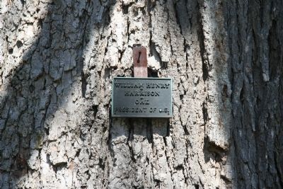
A close up view of the plaque on the tree, that is located just inside the south-east gate of the Hayes Presidental Center. The plaque shows that Mr. Hayes named the tree after William Henry Harrison.
Credits. This page was last revised on March 31, 2025. It was originally submitted on April 24, 2009, by Dale K. Benington of Toledo, Ohio. This page has been viewed 2,517 times since then and 57 times this year. Last updated on March 30, 2025, by Trevor L Whited of Kokomo, Indiana. Photos: 1, 2, 3. submitted on April 24, 2009, by Dale K. Benington of Toledo, Ohio. • Devry Becker Jones was the editor who published this page.
