Dublin's Docklands in County Dublin, Leinster, Ireland — Mid-East (and Dublin)
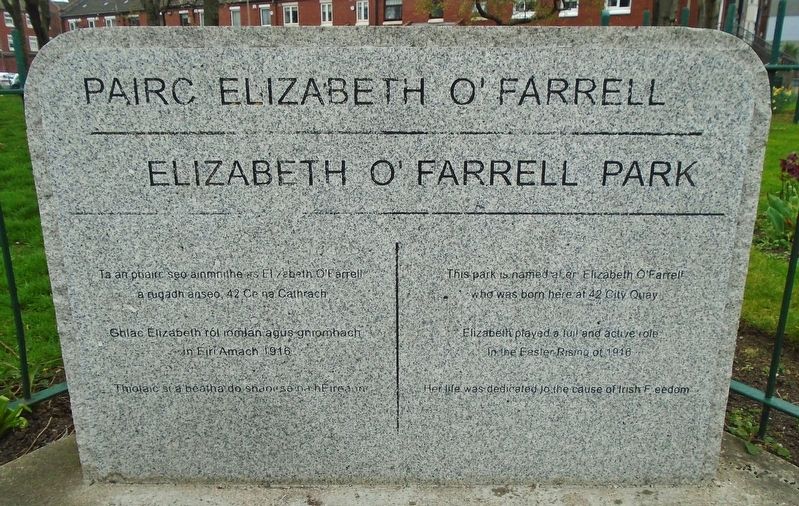
Pairc Elizabeth O'Farrell Park
Photographed by William Fischer, Jr., April 3, 2025
1. Pairc Elizabeth O'Farrell Park Marker

who was born here at 42 City Quay
Elizabeth played a full and active role
in the Easter Rising of 1916
Her life was dedicated to the cause of Irish Freedom
———————————————————
a rugadh anseo, 42 Cé na Cathrach
Ghlac Elizabeth ról iomlán agus gníomhach
in Éirí Amach 1916
Thiolaic si a beatha do shaoirse na hÉireann
Topics. This historical marker is listed in these topic lists: Parks & Recreational Areas • Patriots & Patriotism • Wars, Non-US • Women. A significant historical month for this entry is April 1916.
Location. 53° 20.801′ N, 6° 14.881′ W. Marker is in Dublin, Leinster, in County Dublin. It is in Dublin's Docklands. It is at the intersection of City Quay (Leinster Route 813) and Lombard Street East ( Route 814), on the right when traveling east on City Quay. Touch for map. Marker is in this post office area: Dublin, Leinster D02, Ireland. Touch for directions.

Regionally, this marker is in the Ancient East. Globally, it is on the Atlantic Ocean, in the North Atlantic Region, in Europe, on
this page online
Other nearby markers. At least 8 other markers are within walking distance of this marker: Irish Seaman's National Memorial (a few steps from this marker); Human Rights and Poverty Stone (about 150 meters away, measured in a direct line); a different marker also named Human Rights and Poverty Stone (about 180 meters away); S.S. Adela (about 180 meters away); National Famine Way (about 180 meters away); Great Irish Famine Victims and Their Canadian Descendants (about 180 meters away); Dublin Docklands Landmarks (about 180 meters away); "Famine" (about 210 meters away). Touch for a list and map of all markers in Dublin.
Also see . . .
1. Elizabeth O'Farrell in Dictionary of Irish Biography. (Submitted on April 6, 2025, by William Fischer, Jr. of Reynoldsburg, Ohio.)
2. Elizabeth O'Farrell: The woman airbrushed from history (Irish Independent, 2016). (Submitted on April 6, 2025, by William Fischer, Jr. of Reynoldsburg, Ohio.)
3. Elizabeth O’Farrell, The woman with the white flag -Transcript, Dublin City Libraries Podcast, 2016).
Photographed by William Fischer, Jr., April 3, 2025
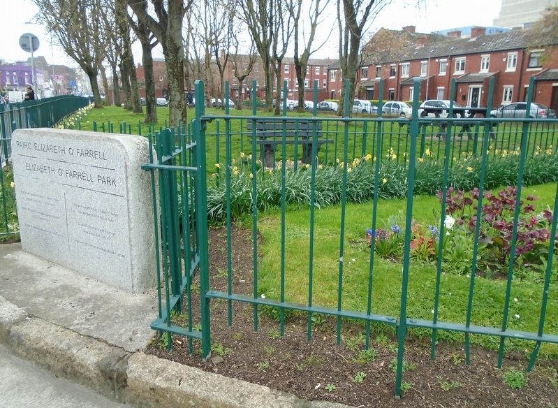
2. Pairc Elizabeth O'Farrell Park and Marker
Credits. This page was last revised on April 9, 2025. It was originally submitted on April 6, 2025, by William Fischer, Jr. of Reynoldsburg, Ohio. This page has been viewed 151 times since then and 42 times this year. Photos: 1, 2. submitted on April 6, 2025, by William Fischer, Jr. of Reynoldsburg, Ohio.
