Shiloh in Hardin County, Tennessee — The American South (East South Central)
Sifting the Evidence
Shiloh Indian Mounds National Historic Park
| — | National Park Service, U.S. Department of the Interior | — |
Photographed by Sandra Hughes, September 1, 2009
1. Sifting the Evidence
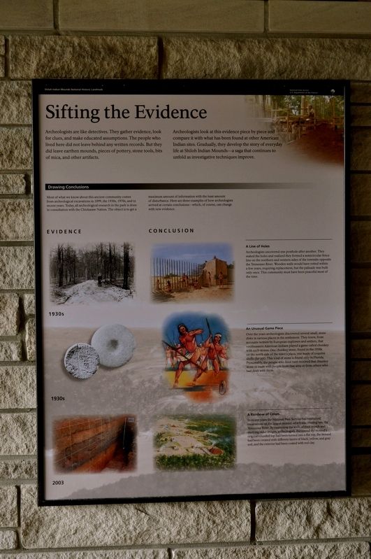
Archeologists are like detectives. They gather evidence, look for clues, and make educated assumptions. The people who lived here did not leave behind any written records. But they did leave earthen mounds, pieces of pottery, stone tools, bits of mica, and other artifacts.
Archeologists look at this evidence piece by piece and compare it with what has been found at other American Indian sites. Gradually, they develop the story of everyday life at Shiloh Indian Mounds-a saga that continues to unfold as investigative techniques improve.
Drawing Conclusions
Most of what we know about this ancient community comes from archeological excavations in 1899, the 1930s, 1970s, and in recent years. Today, all archeological research in the park is done in consultation with the Chickasaw Nation. The object is to get maximum amount of information with the least amount of disturbance. Here are three examples of how archeologists arrived at certain conclusions-which, of course, can change with new evidence.
A Line of Holes
Archeologists uncovered one posthole after another. They staked the holes and realized they formed a semicircular fence line on the northern and western sides of the townsite opposite the Tennessee River. Wooden walls would have rotted within a few years, requiring replacement, but the palisade was built only once. This community must have been peaceful most of the time.
An Unusual Game Piece
Over the years archeologists discovered several small, stone disks in various places in the settlement. They knew, from accounts written by European explorers and settlers, that southeastern American Indians played a game called chunkey with such stones. One chunkey stone, found in the 1930s on the north side of the town's plaza, was made of coquina shell (far left). This kind of stone is found only
this page online
A Rainbow of Colors
In recent years the National Park Service has conducted excavations on the largest mound, which was eroding into the Tennessee River. By examining the walls of their trench and studying radar images, archeologist discovered the mound's original rounded top had been turned into a flat top, the mound had been created with different layers of black, yellow, and gray soil, and the exterior had been coated with red clay.
Erected by National Park Service, U.S. Department of the Interior.
Topics. This historical marker is listed in these topic lists: Environment • Indigenous Peoples and Communities • Man-Made Features. A significant historical year for this entry is 1899.
Location. 35° 8.488′ N, 88° 19.611′ W. Marker is in Shiloh, Tennessee, in Hardin County. It is on Riverside Drive east of Hamburg Savannah Road, on the left when traveling east. The marker hangs at the shelter in Shiloh Park. Touch for map. Marker is at or near this postal address: Riverside Dr, Shiloh TN 38376, United States of America. Touch for directions.

Regionally, this marker is in West Tennessee. It is also in the American South and specifically in the Upper South. Globally, it is in North America, the Western Hemisphere, the Western World, and the Anglosphere. Historically, it finds itself in what was once the territory of the Mississippian Culture, one of the Confederate States of America, and the Antebellum South.
Other nearby markers. At least 8 other markers are within walking distance of this marker: Chickasaw Homeland (here, next to this marker); Mississippian Indians (a few steps from this marker); Camp of 17th Kentucky Infantry (a few steps from this marker); Shiloh Indian Mounds (within shouting distance of this marker); A Temporary Wall (within shouting distance of this marker); Kentucky Regiments at Battle of Shiloh (about 300 feet away, measured in a direct line); Crossing the Palisade (about 400 feet away); Signs of Dwellings (about 500 feet away). Touch for a list and map of all markers in Shiloh.
Credits. This page was last revised on August 13, 2025. It was originally submitted on August 14, 2017, by Sandra Hughes Tidwell of Killen, Alabama, USA. This page has been viewed 430 times since then and 24 times this year. Last updated on April 15, 2025, by David Austin of Scotts Hill, Tennessee. Photo 1. submitted on August 14, 2017, by Sandra Hughes Tidwell of Killen, Alabama, USA. • Devry Becker Jones was the editor who published this page.
