Near Nageezi in San Juan County, New Mexico — The American Mountains (Southwest)
Chacoan Stairway
Chaco Culture National Historical Park
| — | National Park Service, U.S.Department of the Interior | — |
Photographed by James Hulse, March 26, 2025
1. Chacoan Stairway Marker
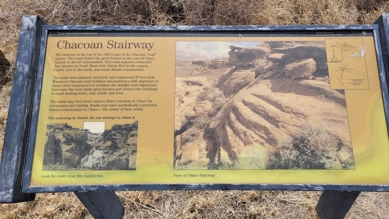
The stairway at the top of the cliff is part of the Chacoan "road" system. The roads linked the great houses in the core of Chaco Canyon to far-off communities. This road segment connected Tsin Kletzin on South Mesa with Chetro Ketl in the canyon, Pueblo Alto to the north, and many distant communities.
The roads were planned, surveyed, and engineered 30 feet wide. Whenever Chacoan road builders encountered a cliff, stairways or ramps were constructed to continue the straight road alignments. Stairways rise near many great houses and connect the buildings to roads leading north, east, south, and west.
The roads may have been used to direct travelers to Chaco for ceremonies and trading. Roads may have symbolically connected distant communities to Chaco the center of their world.
The stairway is closed. Do not attempt to climb it.
Captions
(Photo #1) Look for stairs near the canyon rim.
(Photo #2) View of Chaco Stairway
Erected by National Park Service, U.S. Department of the Interior.
Topics. This historical marker is listed in these topic lists: Anthropology & Archaeology • Indigenous Peoples and Communities
this page online
Location. 36° 3.31′ N, 107° 57.277′ W. Marker is near Nageezi, New Mexico, in San Juan County. It is on Navajo Service Route 14 0.2 miles east of Indian Service Route, on the right when traveling east. The marker is located along the highway. Touch for map. Marker is in this post office area: Nageezi NM 87037, United States of America. Touch for directions.

Regionally, this marker is in the Navajo Nation and in the San Juan Basin. It is also in the American Southwest, in the Mountain West, on the Colorado Plateau, and at the Four Corners. Globally, it is in North America, the Rocky Mountains, the Western Hemisphere, the Western World, and the Anglosphere. Historically, it finds itself in what was once New Spain and also the territory of the Ancestral Puebloans.
Other nearby markers. At least 8 other markers are within 3 miles of this marker, measured as the crow flies: Casa Rinconada Community (approx. ¼ mile away); Chetro Ketl (approx. 0.4 miles away); Pueblo Bonito (approx. 0.4 miles away); Chaco Culture (approx. half
Photographed by James Hulse, March 26, 2025
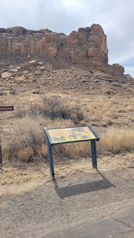
2. Chacoan Stairway and Marker
Also see . . . The Center of an Ancient World. National Park Service, U.S. Department of the Interior
Explore the monumental structures and breathtaking landscape at Chaco, a thriving regional center for the ancestral Pueblo people from 850 to 1250 CE (Common Era), through guided tours, hiking & biking trails, evening campfire talks, night sky programs, and more. Chaco Canyon is a sacred and deeply personal place for many Indigenous peoples throughout the Southwest. Please visit with respect.(Submitted on April 17, 2025, by James Hulse of Medina, Texas.)
Photographed by James Hulse, March 26, 2025
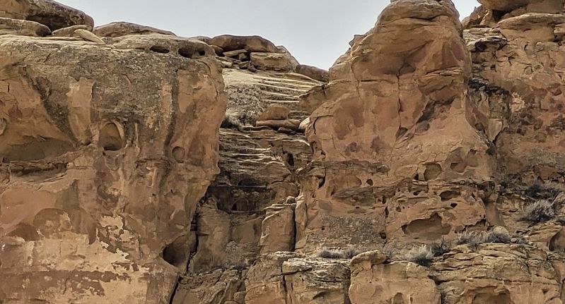
3. Closeup of the Chacoan Stairway
Credits. This page was last revised on July 14, 2025. It was originally submitted on April 16, 2025, by James Hulse of Medina, Texas. This page has been viewed 439 times since then and 77 times this year. Photos: 1, 2, 3. submitted on April 17, 2025, by James Hulse of Medina, Texas.
