USCG Training Center Yorktown in York County, Virginia — The American South (Mid-Atlantic)
Yorke Village
Photographed by Evan Dwyer, March 8, 2025
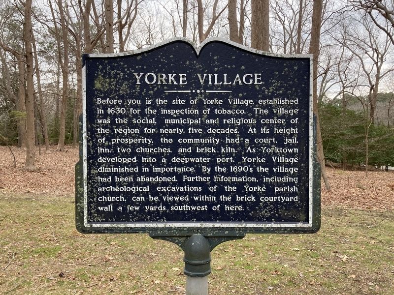
1. Yorke Village Marker
Before you is the site of Yorke Village, established in 1630 for the inspection of tobacco. The village was the social, municipal and religious center of the region for nearly five decades. At its height of prosperity, the community had a court, jail, inn, two churches, and brick kiln. As Yorktown developed into a deepwater port, Yorke Village diminished in importance. By the 1690's the village had been abandoned. Further information, including archeological excavations of the Yorke parish church, can be viewed within the brick courtyard wall a few yards, southwest of here.
Topics. This historical marker is listed in these topic lists: Anthropology & Archaeology • Colonial Era • Settlements & Settlers. A significant historical year for this entry is 1630.
Location. 37° 12.946′ N, 76° 28.718′ W. Marker is in Yorktown, Virginia, in York County. It is in USCG Training Center Yorktown. It is on Perimeter Road 0.4 miles east of Nelson Street & Hamilton/Perimeter Road, on the right. The marker is on post at USCG Training Center Yorktown, across from the Perimeter Road Baseball Field backstop. This is a secured
this page online

Regionally, this marker is on Virginia’s Peninsula, in Coastal Virginia, and in the Hampton Roads Metropolitan Area. It is also in the American South, specifically in the Upper South, in the Tidewater, and on the Eastern Seaboard. Globally, it is in the North Atlantic Region, North America, the Western Hemisphere, the Western World, and the Anglosphere. Historically, it finds itself in what was once the territory of the Mississippian Culture, one of the original Thirteen Colonies, one of the Confederate States of America, and the Antebellum South.
Other nearby markers. At least 8 other markers are within walking distance of this marker: Early Settlement Along Wormley's Creek (within shouting distance of this marker); Major William Gooch Of This Parish (within shouting distance of this marker); Archaeological Excavations (within shouting distance of this marker); The Seventeenth-Century Churches of York Parish

Photographed by Evan Dwyer, March 8, 2025
2. Yorke Village Marker
The village was in the wooded area at right.
Regarding Yorke Village. The village was in the woods beyond the marker and out of the frame to the right. A 20th century brick wall marks the foundation of the Second York Parish Church along with the 1655 grave of William Gooch and multiple other markers. The site is archaeologically recognized as a Virginia Historic Landmark.

Photographed by Evan Dwyer, March 8, 2025
3. Second Parish Church Outline
The 20th Century brick wall outlines the foundation shape of the Second Parish Church, built in York Village in 1667 on the site of the First Parish Church. The marker is at distant left next to the road.

Photographed by Evan Dwyer, March 8, 2025
4. Virginia Historic Landmark Sign
On the 20th Century brick foundation outline.
Credits. This page was last revised on April 19, 2025. It was originally submitted on April 17, 2025, by Evan Dwyer of Richmond, Virginia. This page has been viewed 193 times since then and 56 times this year. Photos: 1, 2, 3, 4. submitted on April 17, 2025, by Evan Dwyer of Richmond, Virginia. • Andrew Ruppenstein was the editor who published this page.
